
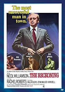
Reckoning, The
Date: 1970
Director: Jack Gold
Production Company: Columbia Pictures
Stars: Nicol Williamson, Ann Bell, Rachel Roberts
Location(s): Berkshire, Buckinghamshire, Cheshire, Lancashire, London, Surrey
Region(s): London R-S, North, South East R-Z
Storyline:
Michael Marler, a successful business man in London, is about to make his way to the top. The death of his father brings him – after 37 years – back to his hometown Liverpool, where he is confronted with his lost Irish roots. He finds out that his father died because of a fight with some anglo-saxon teddy boys. It becomes “a matter of honour” for him, to take his revenge without involving the British police.
Additional Information:
John Owens provided the stills and nows.
John remarks “The film gives the impression that the Virginia Water area of Surrey was used. I am fairly sure that some scenes in the early part of the film were shot around the junction of Christchurch Road and Gorse Hill Lane.”

As an Amazon Associate, we earn from qualifying purchases.
Can you help:
If you have any information regarding this production, the locations or, even better, some comparison shots please contact us. Images submitted must be in Landscape orientation, as would be seen on the cinema screen, not Portrait.
We are aware that there are films on the site that were added when the criteria for the inclusion of locations was very different from today and, as a result, there may be scenes missing from some productions. Please do not forward additional screen captures to us but bring the detail to our attention, for we do, and are, 're-addressing' these older entries as time allows.
- Capture 1
- 09 Aug 2010

Number 7 Rolls Building in New Fetter Lane, London.

The Rolls building now - under redevelopment. Photo copyright Google Street View.
- Capture 2
- 09 Aug 2010

Close up of the Rolls Building.

Close up of Rolls Building today - photo from Google Street View.
- Capture 3
- 09 Aug 2010

This is Wheatland Lane in the Seacombe area of the Wirral. The 'parents house' was shot in Daisy Grove - now demolished.

The houses in Wheatland Lane have been demolished but the pub - Mona Castle - in the background to the right is still there - the drainpipe running down the side and the window help to identify. John Owens.
- Capture 4
- 09 Aug 2010

Wheatland Lane again - the wall alongside Hector Jackson's scrapyard - information courtesy of local WikiWirral forum.

Part of the wall in Wheatland Lane survives. John Owens.
- Capture 5
- 02 Jun 2013

Nicol Williamson walking alongside a wall in the docks area of Birkenhead in Cheshire. Martin Owens says that Williamson is walking along Beaufort Road, Birkenhead towards the corner of Buccleuch Street, most of the wall has been demolished now, the only remaining piece is at the junction of Beaufort Road and Buccleuch Street.

And here's the part of the wall that still stands. Taken from the corner of Buccleuch Street on Beaufort Road in Birkenhead now in Merseyside. (PW)
- Capture 6
- 09 Aug 2010

One of the 'Four Bridges' connecting Birkenhead and Wallasey.

The bridge in Tower Road is unchanged. John Owens.
- Capture 7
- 'Now' required

A doctors surgery in the film - looks like a church building possibly. Could be the Wirral or Liverpool - the film switches between them in seemingly continuous shots.
- Capture 8
- 04 Apr 2012

Other shots in the film suggest that this is the Virginia Water area of Surrey. Mark Pearce says; Pinewood Road in Virginia Water at the point where the road crosses the 18th fairway on Wentworth's West course.

The house in the background (which is still there, behind the trees) belonged at the time of filming to the crime writer David Williams. Mark Pearce
- Capture 9
- 04 Apr 2012

Again possibly Virginia Water - tree lined leafy road with a distinctive sloping roof on the building.

Mark Pearce states; This is Christchurch Road in Virginia Water. Nearly all the houses along the road have since been demolished and rebuilt, including the one in the original shot, though the trees remain.
- Capture 10
- 'Now' required

Nicol Williamson's house in the film - looks like 60s building possibly the same location as tr008 and tr009.
- Capture 11
- 04 Apr 2012

Is this a real butchers shop - possibly Barker Bros / Parker Bros? Again could be in Virginia Water. Or could be a set?

Real says Mark Pearce; This was a butcher's shop, Clarke Bros., in Station Approach, Virginia Water. The butchers closed in around 1995 but the hairdressers which took over the premises is still partly owned by the same family.
- Capture 12
- 20 Jan 2012

Conveniently identified by the sign as 'King Street Service Station'. This is King Street Wallasey in Cheshire. The garage is very close to the pub pic 016 as King St.,is at the bottom of Union St., where the pub is. Martin Owens.

The service staion in King Street is still in the same location. John Owens.
- Capture 13
- 09 Aug 2010

Nicol Williamson driving off from a road alongside the 'Shaggy Calf' pub - supposedly in Liverpool - but in fact it's Carlton Road in Slough, Buckinghamshire. Thanks to local 'YoLiverpool' forum for help in identifying this.

Carlton Road Slough today - photo copyright Google Street View.
- Capture 14
- 09 Aug 2010

The 'Shaggy Calf' pub in Mirador Crescent in Slough. Thanks to 'Slough Information' internet forum for help in identifying the location.

The 'Shaggy Calf' pub at the corner of Mirador Crescent/Carlton Road Slough has been replaced by housing. Photo copyright Google Street View.
- Capture 15
- 09 Aug 2010

Carlton Road, Slough again, outside a fish and chip shop.

There is still a fish and chip shop at the end of the row of shops in Mirador Crescent Slough. Photo courtesy of Google.
- Capture 16
- 28 Oct 2020

The Firefly public house, identified by Anthony O'Leary as standing on Welbeck Road on the Barnhill Estate in Hayes, Greater London. The pub has since been demolished.
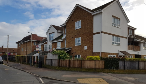
Antony Blair captured the site of the pub adding that the licenced premises were knocked down in about 2000.
- Capture 17
- 09 Aug 2010

St George's church in Heyworth Street in the Everton district of Liverpool. The 'pointed tower' to the left is the roof of the Everton library on St Domingo Road.

St George's church is still there - supposedly one of the highest points in Liverpool. The pointed library tower to the left is just visible through the trees - though the library is no longer in use. John Owens.
- Capture 18
- 09 Aug 2010

Nicol Williamson looking from the churchyard in reck017. This is identified in the next still from the Liverpool Echo as Havelock Street and Seacombe Towers in Everton looking down towards the docks and river Mersey.

Havelock Street and Seacombe Towers have been demolished. This photo is taken from the same spot as the original. The area has been landscaped but the docks and river are visible in the distance. John Owens.
- Capture 19
- 'Now' required

Picture courtesy of the Liverpool Echo.