
London Can Take It (aka Britain Can Take It)
Date: 1940
Director: Humphrey Jennings, Harry Watt
Production Company: GPO (General Post Office) Film Unit, Ministry of Information
Stars: Quentin Reynolds, King George Vl, Queen Elizabeth the Queen Mother
Location(s): London
Region(s): London H-L
Storyline:
Reporter Quentin Reynolds narrates and comments on the fortitude, courage, and perseverance of London civilians during the months of bombing by German air forces in the Second World War. Documentary footage of air-raid shelters, fire brigades, and decimated structures illustrate the plight and the strength of the citizens of London.
Additional Information:
The grabs for this film were the last that Brian Tunstill made before he died in February 2011. Location information, together with “now”shots of additional screen captures from contributors focused the need to revisit this film. Additional screen captures and uncredited “now” shots uploaded by Richard Lovejoy.
Further photographs and a recounting of events at the ‘Dutch Boy Laundry’ from Richard Hudd can be seen by clicking here.

As an Amazon Associate, we earn from qualifying purchases.
Can you help:
If you have any information regarding this production, the locations or, even better, some comparison shots please contact us. Images submitted must be in Landscape orientation, as would be seen on the cinema screen, not Portrait.
We are aware that there are films on the site that were added when the criteria for the inclusion of locations was very different from today and, as a result, there may be scenes missing from some productions. Please do not forward additional screen captures to us but bring the detail to our attention, for we do, and are, 're-addressing' these older entries as time allows.
- Capture 1
- 'Now' required
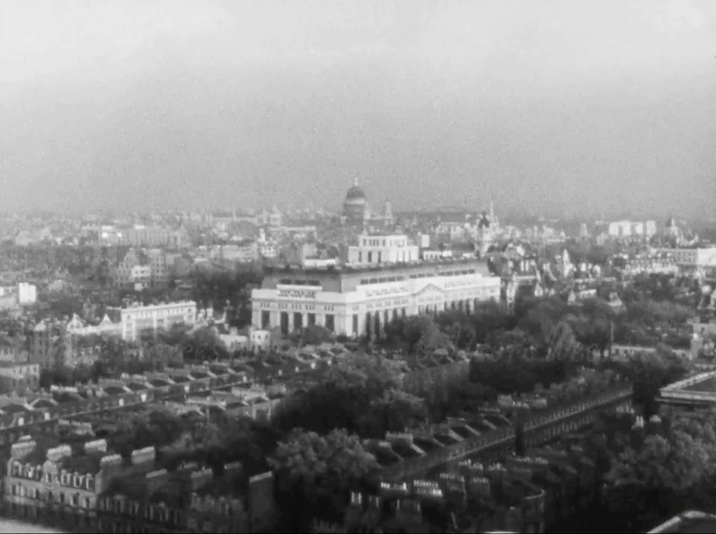
An overview of London with the dome of St. Paul’s Cathedral centre distance and Victoria House, Bloomsbury Square, London WC1 centre. Dave W makes the point that this, together with Captures 11 and 17 were taken from Senate House WC1, wartime home of the Ministry of Information who commissioned the film.
- Capture 2
- 05 Aug 2024
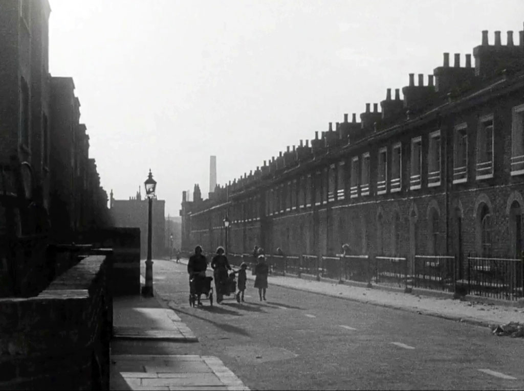
“It is late afternoon and the people of London are preparing for the night”. Some interesting features here that might help with the location. It has even taken Dave W some considerable time to assemble, dismiss and interpret all the features and facts to arrive at Kenley Street, W10, now sadly lost. However, a 1970's comparative shot can, by chance, be seen at LPA 83438. John Henwood of northkensington histories.wordpress.com confirms that this is indeed Kenley Street and recalls that "Kenley street was well known locally for the clinic there, usually referred to by us as youngsters as 'Nitty Nora's'' as it's where we taken to have disinfectant -or something similar - combed through our hair ostensibly to eliminate lice. I was also 'treated' there for a dislocated finger sustained playing football for my school Oxford Gardens at nearby Avondale Park. They didn't know what to do with it there so I was taken to St Charles where it was reset." (RL)
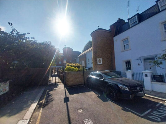
Despite the sun shining directly at his camera, Nick Booth couldnt resist caputuring the location as it is now having spent so much time trying to establish it himself. (RL)
- Capture 3
- 12 Jun 2019
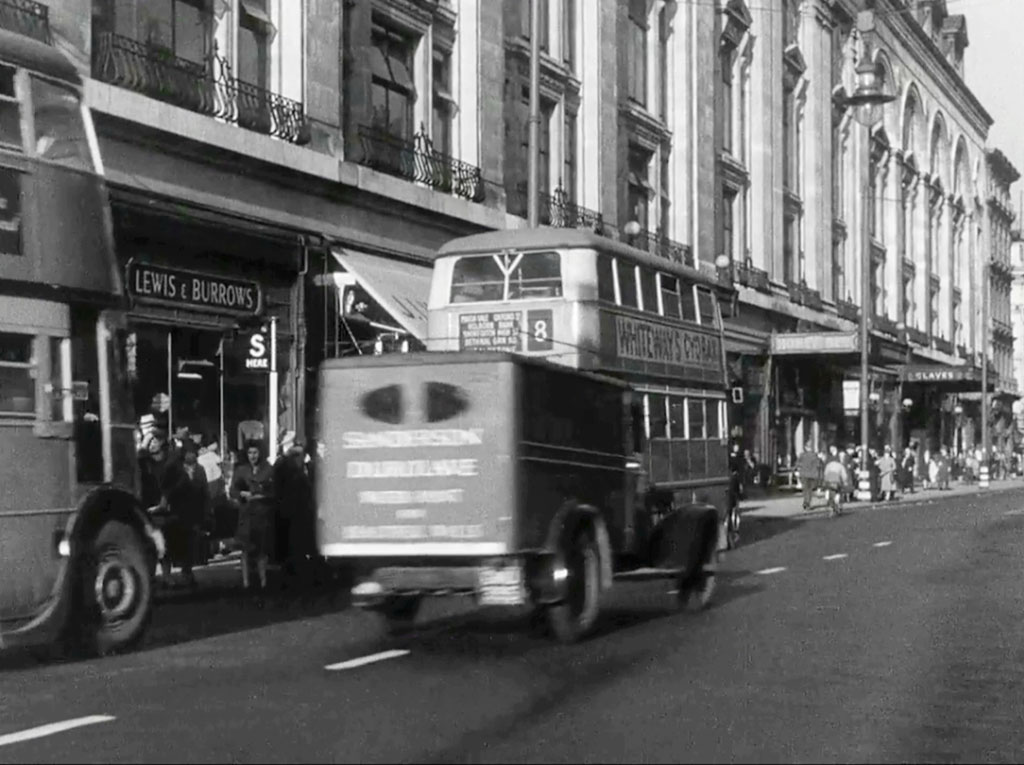
“Everyone is anxious to get home before darkness falls”. New Oxford Street, London WC1

The architecture remains.
- Capture 4
- 12 Jun 2019
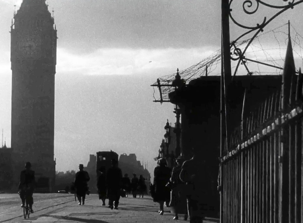
“These men and women that have worked all day…..”. Westminster Bridge looking towards Parliament Square and Great George Street, London SW1
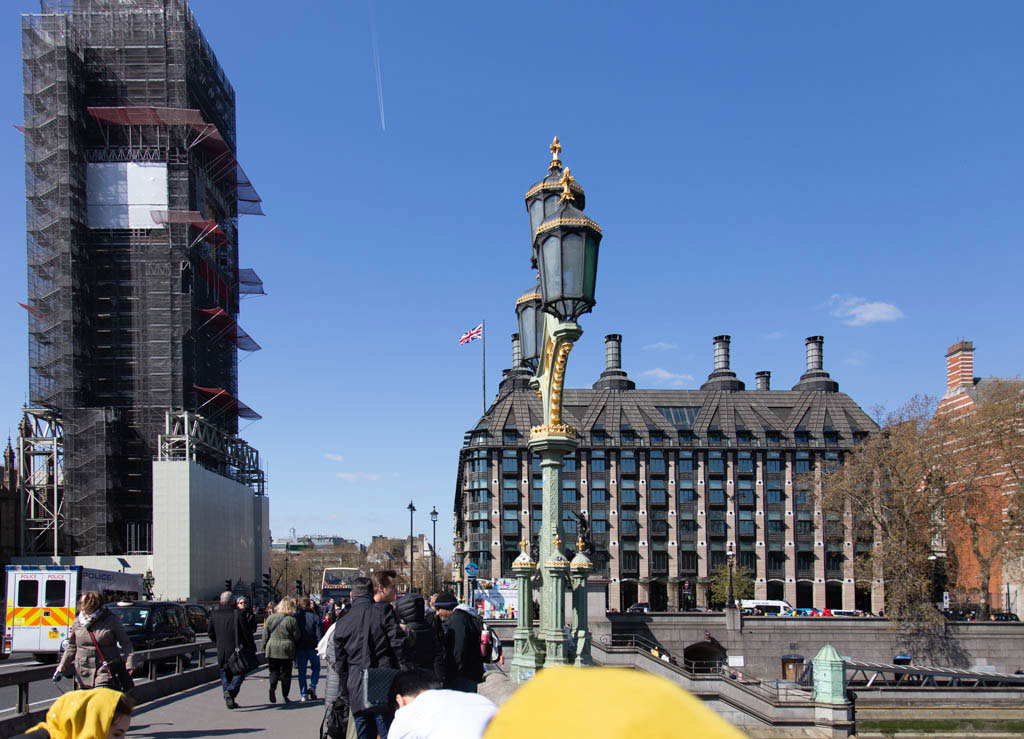
Elizabeth Tower survived the War but not the passage of years.
- Capture 5
- 12 Jun 2019
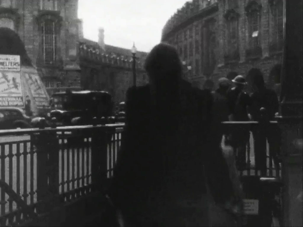
“…in offices or markets are now hurrying home….”. Piccadilly Circus looking up Regent Street.
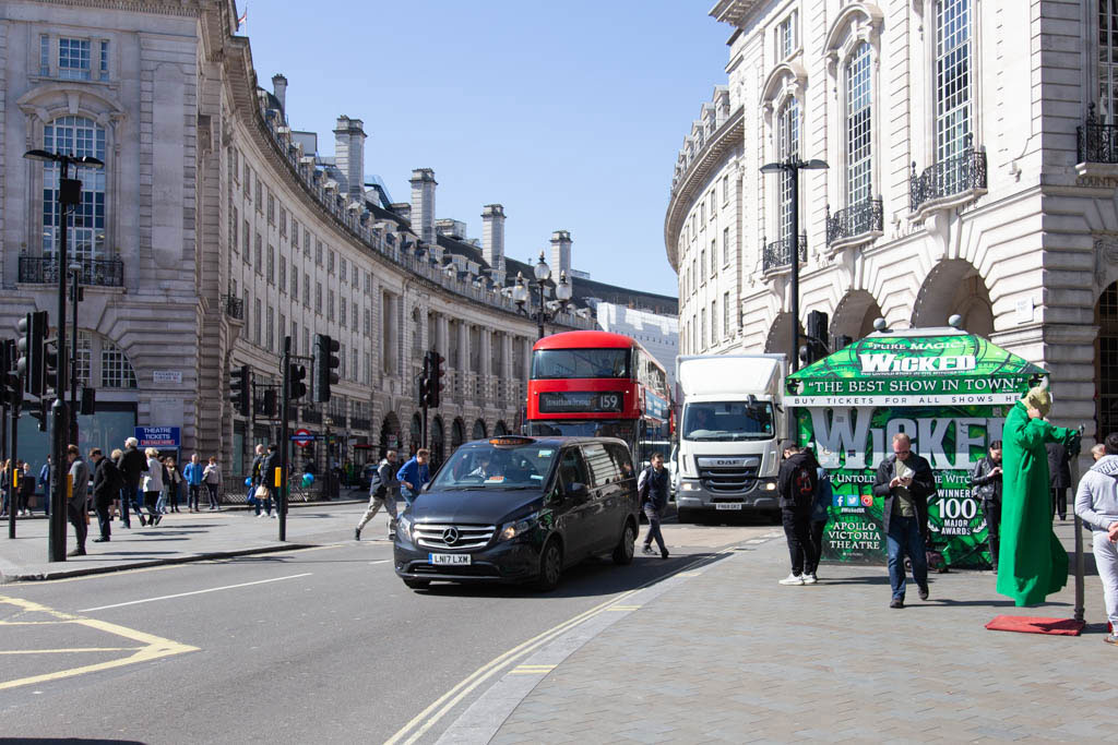
Piccadilly Circus, as we know, has been remodelled.
- Capture 6
- 12 Jun 2019
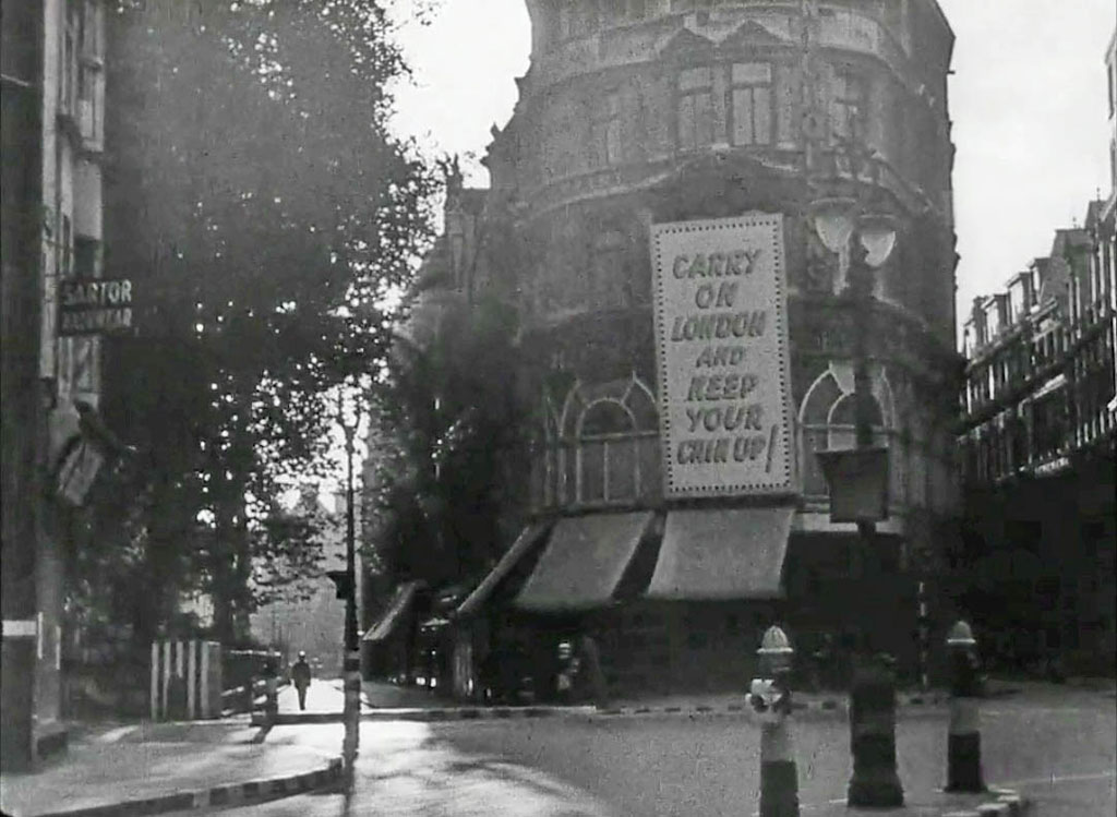
“…to change into the uniform of their particular service.” Dave W establishes this as Cheapside, London EC2 at the junction with New Change.
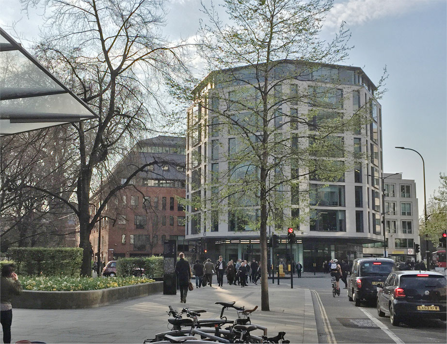
And Dave provides the now, reassuring us that the existence of trees has been continued.
- Capture 7
- 04 Mar 2019
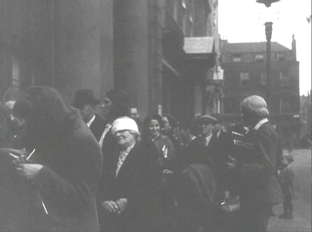
“The dusk is deepening”. Nick Booth provides the location as Soho Square, London W1 looking towards Greek Street. The queue is outside 20 Soho Square as per Capture 8.
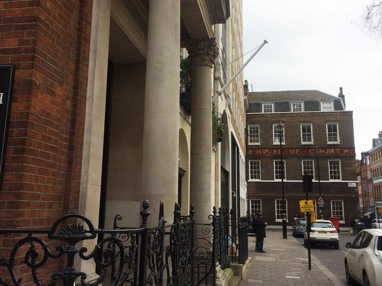
Nick also provides this comparison shot of the location now. St. Patrick's Catholic Church to the immediate left.
- Capture 8
- 04 Jan 2020
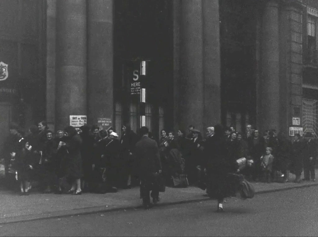
“Soon the nightly battle of London will be on”. Queuing for the Public Shelter. 20 Soho Square, London W1.
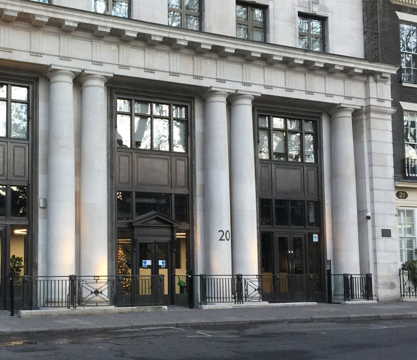
Dave W provides a replacement shot to mine of June 2019 that was overwhelmed by temporary street furniture. Dave tells us that 20 Soho Square was the Headquarters of 'Cross and Blackwell' at the time of filming and questions whether in fact their basement was in fact the air raid shelter.
- Capture 9
- 12 Jun 2019
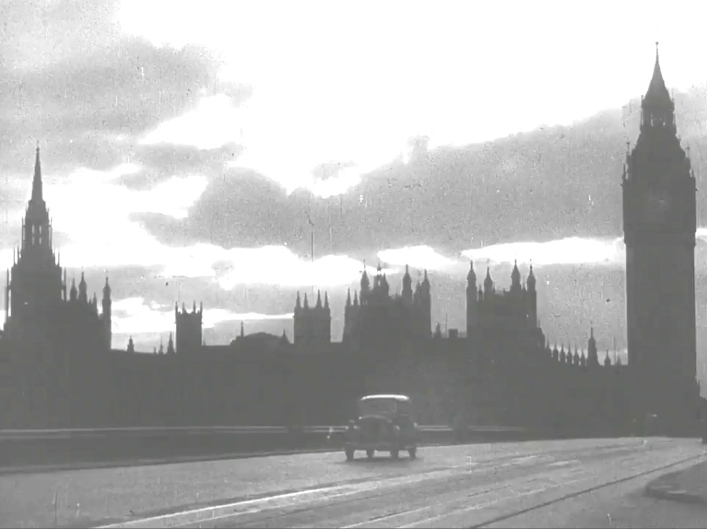
“It is now 8 o’clock…Gerry is a little late this evening”. Westminster Bridge and the `Houses of Parliament'.
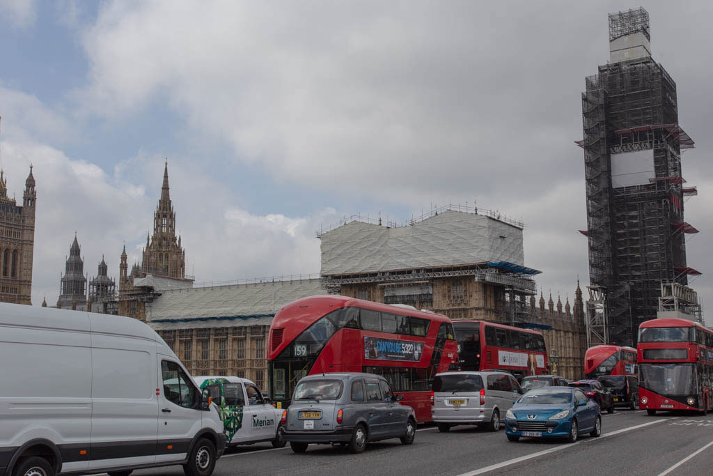
Westminster Bridge is considerably busier these days.
- Capture 10
- 20 Mar 2019
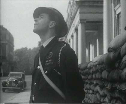
“The ones who are really fighting this war…The Air Raid Warden”. Jules Ballantyne found the street to be Upper Belgrave Street, London SW1.
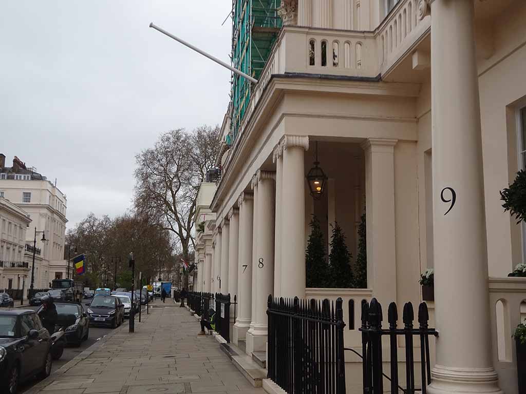
Google Earth Image of May 2016 now replaced by SJ
- Capture 11
- 'Now' required
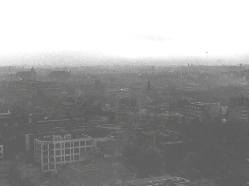
“There is the wail of the Banshee”. Looking SE across London from circa Tottenham Court Road/Chenies Street. The whiter building towards the left hand bottom corner stands in Ridgmount Place, London WC1. Dave W makes the point that this, together with Captures 1 and 17 were taken from Senate House WC1, wartime home of the Ministry of Information who commissioned the film.
- Capture 12
- 03 Apr 2019
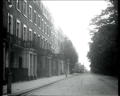
“The nightly siege of London has begun.” Ray Glenister tells us that this is Ladbroke Square Gardens, Notting Hill. He adds that the gardens stand on the site of a racecourse built in 1837 and is one of the largest private gardens in London.
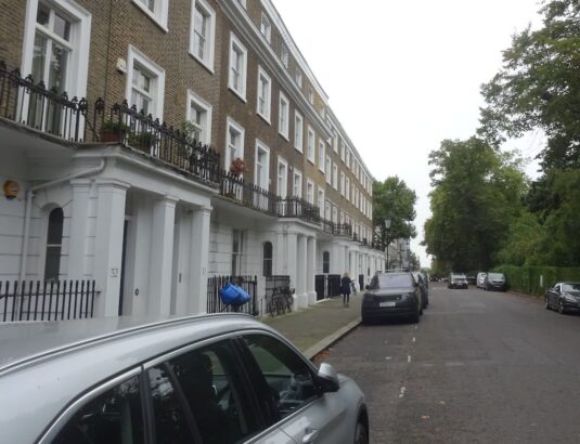
Replacing Ray's GEV from April '19. This is looking west south-west towards Ladbroke Grove. SJ
- Capture 13
- 20 Mar 2019
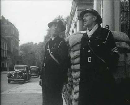
“The City is dressed for battle”. Jules Ballantyne found the street to be Upper Belgrave Street, London SW1.
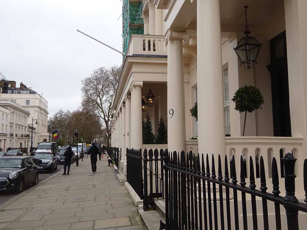
Looking up Upper Belgrave Street. SJ
- Capture 14
- 12 Jun 2019
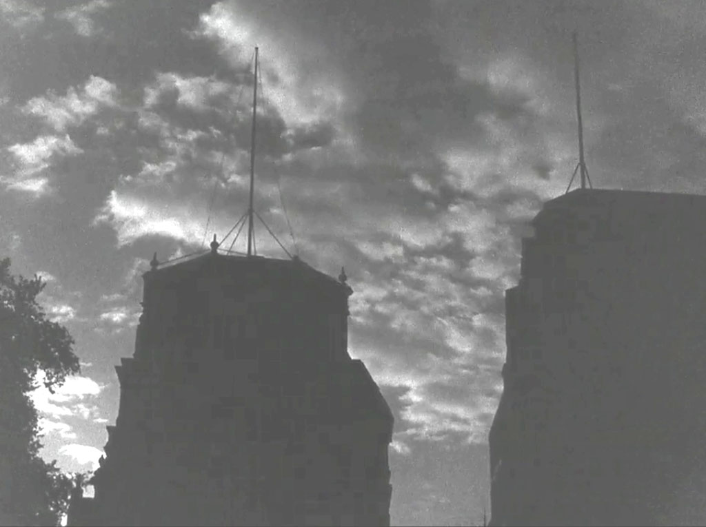
“Here they come”. The top of Capture 6, Cheapside, London EC2 at the junction with New Change as established by Dave W Capture 6.
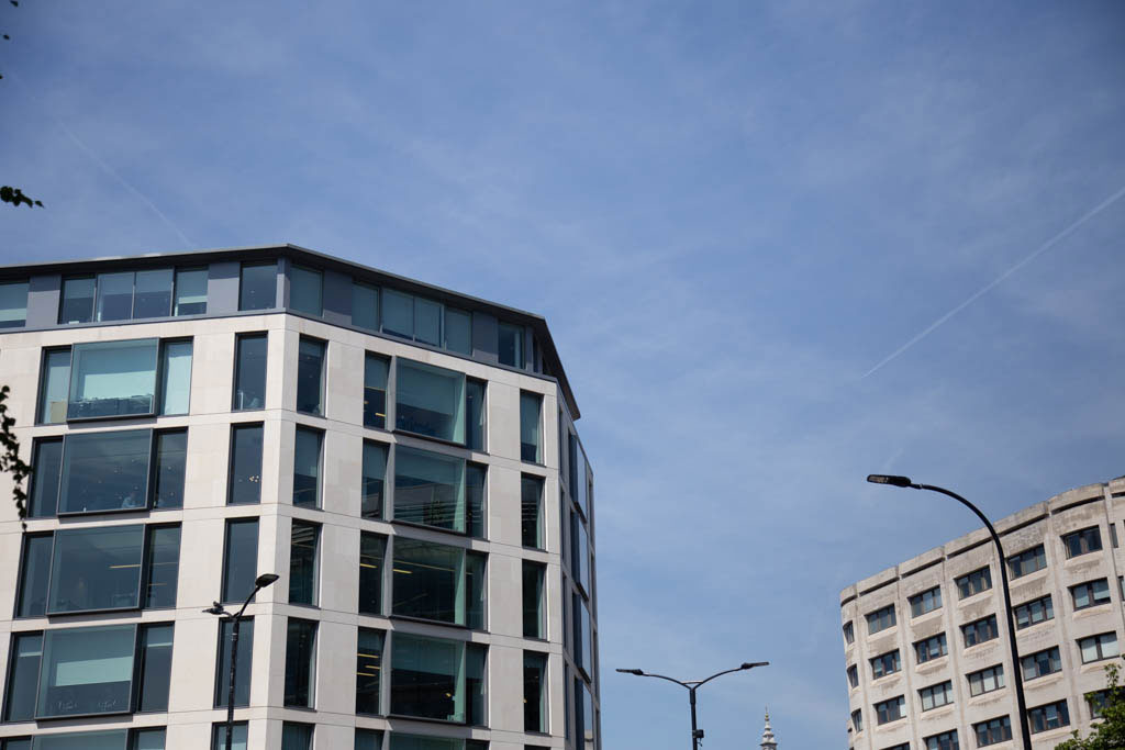
Things have changed so much, a general skywards shot.
- Capture 15
- 12 Jun 2019
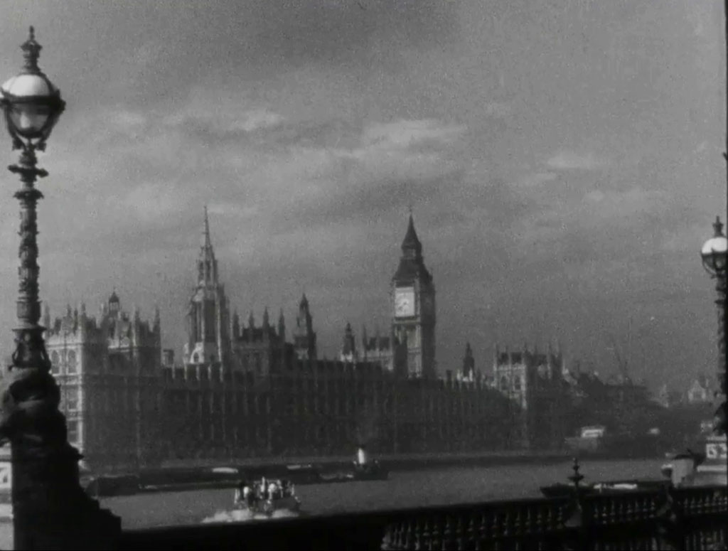
“Dawn..” Houses of Parliament as seen from Albert Embankment.
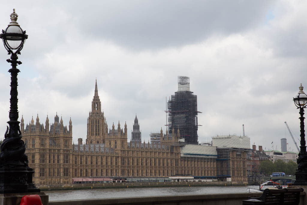
It must be equally disappointing for the tourists photo's as well.
- Capture 16
- 12 Jun 2019
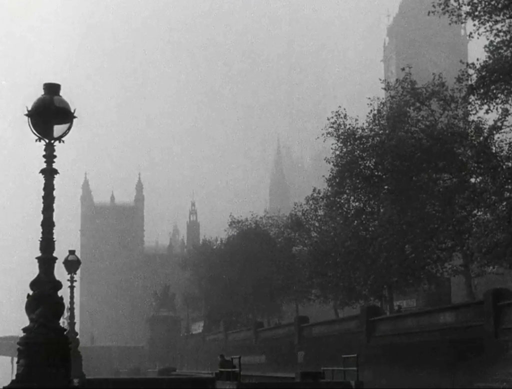
“It’s just 6am”. Houses of Parliament as seen from Westminster Pier
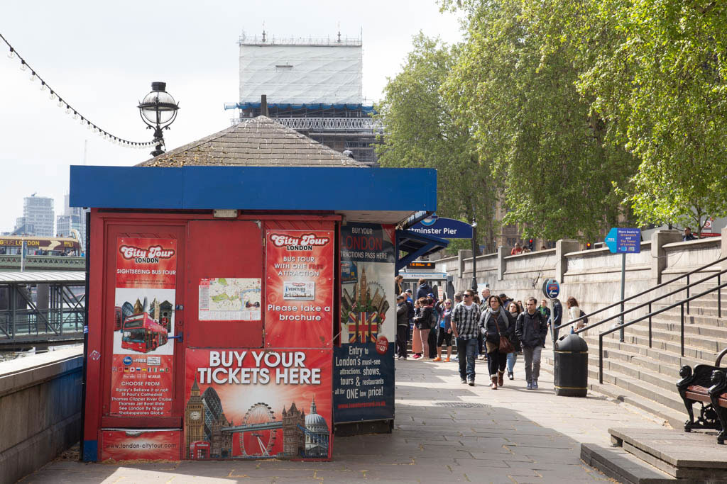
It is clearly evident as to why I could not get anywhere near the correct location.
- Capture 17
- 'Now' required
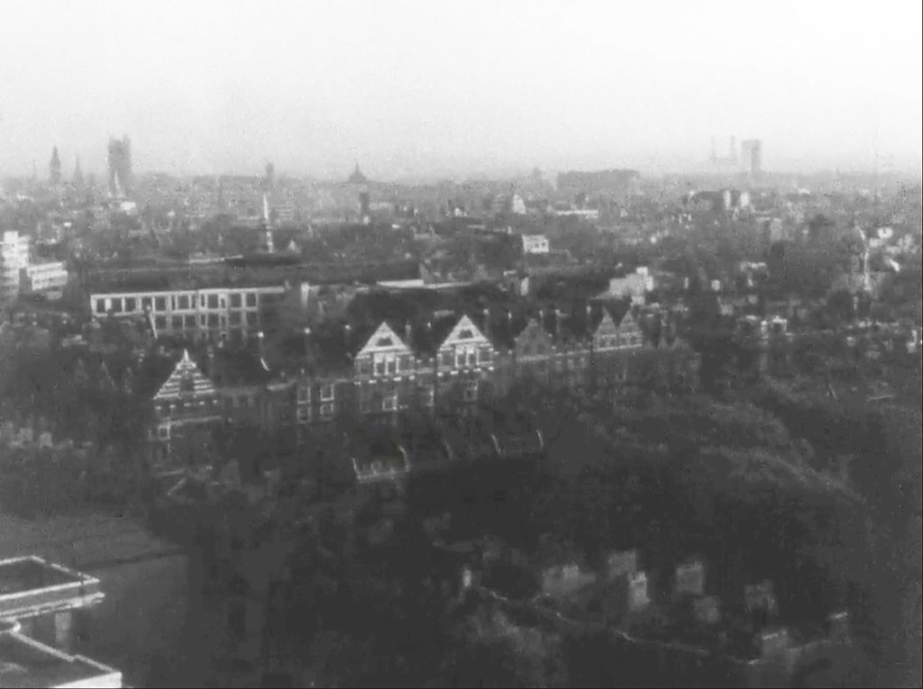
“London Raises her Head”. Dave W makes the point that this, together with Captures 1 and 11 were taken from Senate House WC1, wartime home of the Ministry of Information who commissioned the film.
- Capture 18
- 03 Sep 2024
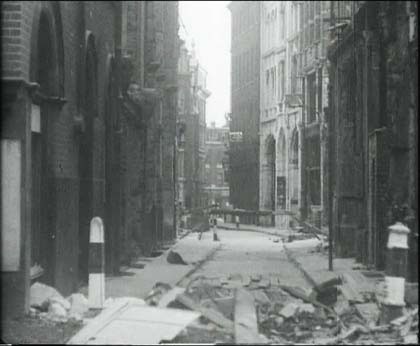
“Shakes the debris of the night from her hair”. Just how many hours have been spent on this one? Well, Dave W, admitting that he was researching another topic, came across LMA Collage 35376 telling us that it is Bread Street, London EC4 as viewed from Cheapside towards Queen Victoria Street. Like Dave, many of us have considered the location but dismissed it through lack of evidence or 'the wrong shape to the route'. I still find the perspective difficult to visualise but Dave has even found that last building on the left in https://www.mediastorehouse.com/fine-art-finder/schools/english-photographer/queen-victoria-street-london-c1891-b-w-photo-12788865.html
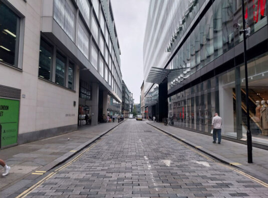
Whilst in the City, Nick captured this shot of Bread Street as it is today, which tends to support why we all dismissed it as a likely candidate for so long.
- Capture 19
- 18 Jul 2024
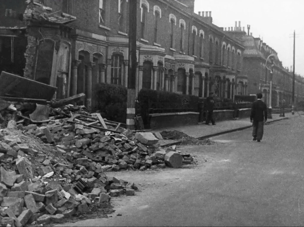
“London has been hurt during the night”. Steve Randall has done an excellent job in establishing the location as Rattray Road, London SW2. The three bombed houses Nos: 15, 17 and 1, on the corner with Bankton Road were replaced with a pair of semi-detached. Probert Road can be seen going off left.
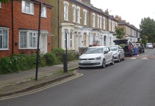
Looking south with the semi-detached replacements on the left. SJ
- Capture 20
- 12 Jun 2019
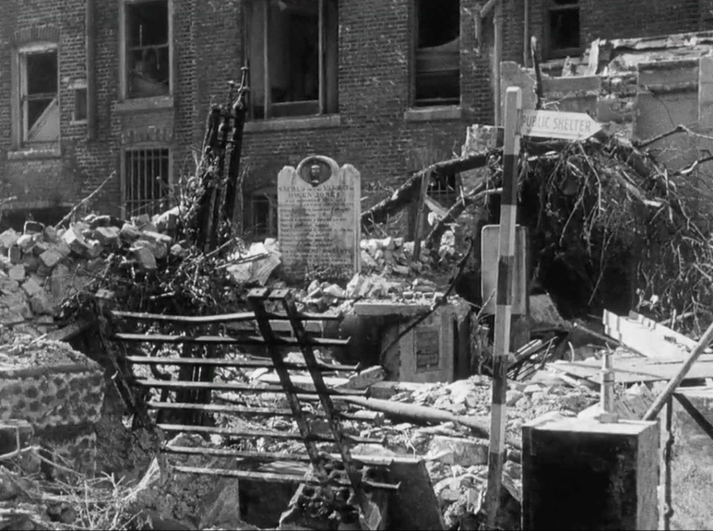
“London does not look down upon…the remains of churches…". Dave W found the vital clue to resolving this one. The graveyard of All Hallows the Great. Before that function it was the site of All Hallows the Less, destroyed in the Great Fire and not replaced, the parishioners of AH the Less were transferred to the AH the Great which was two blocks away alongside Allhalllows Lane. The City of London blue plaque, just right of centre says: SITE OF ALL HALLOWS THE LESS DESTROYED IN THE GREAT FIRE OF 1666
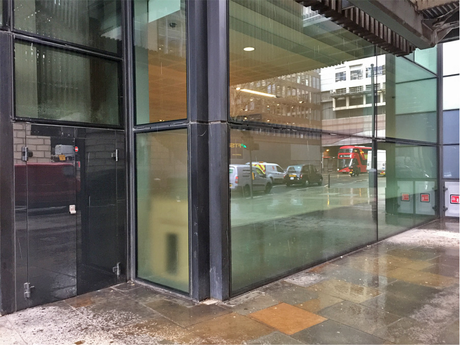
And Dave shows that there is now not a hint of the past.
- Capture 21
- 13 May 2011
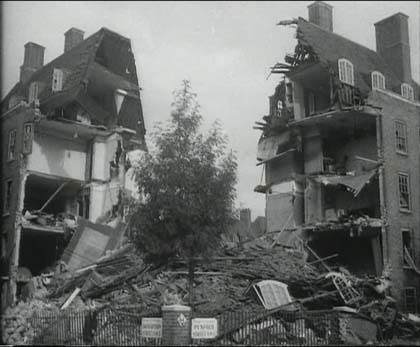
“...hospitals, workers flats…..”. Corner of Penfold and Orchardson Streets, London NW1.

The repaired brickwork has a different, lighter, colour.
- Capture 22
- 08 May 2022
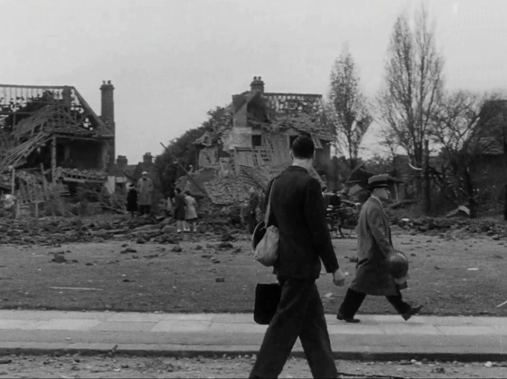
“looks upwards towards the dawn…”. Nick Booth's hard work and dedication in resolving Capture 34 set him on a course to resolving this one too. Willifield Green, Willifield Way, Hampstead Garden Suburb, NW11. He adds that a landmine bomb was dropped on Willifield Green, as the area is known locally, on the 25th September 1940, the houses were not demolished, but repaired as can be seen in Nick's supporting shot.
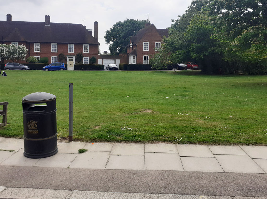
And here is Nick's comparative shot supporting the location. We presume that is an unexploded litter bin.
- Capture 23
- 20 Jun 2016
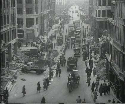
“…the people's army goes to work as they did in their comfortable world…”. King William Street, with London Bridge in the background.

Peter took this shot from ground level noticing the rebuilding south of the bridge.
- Capture 24
- 12 Jun 2019
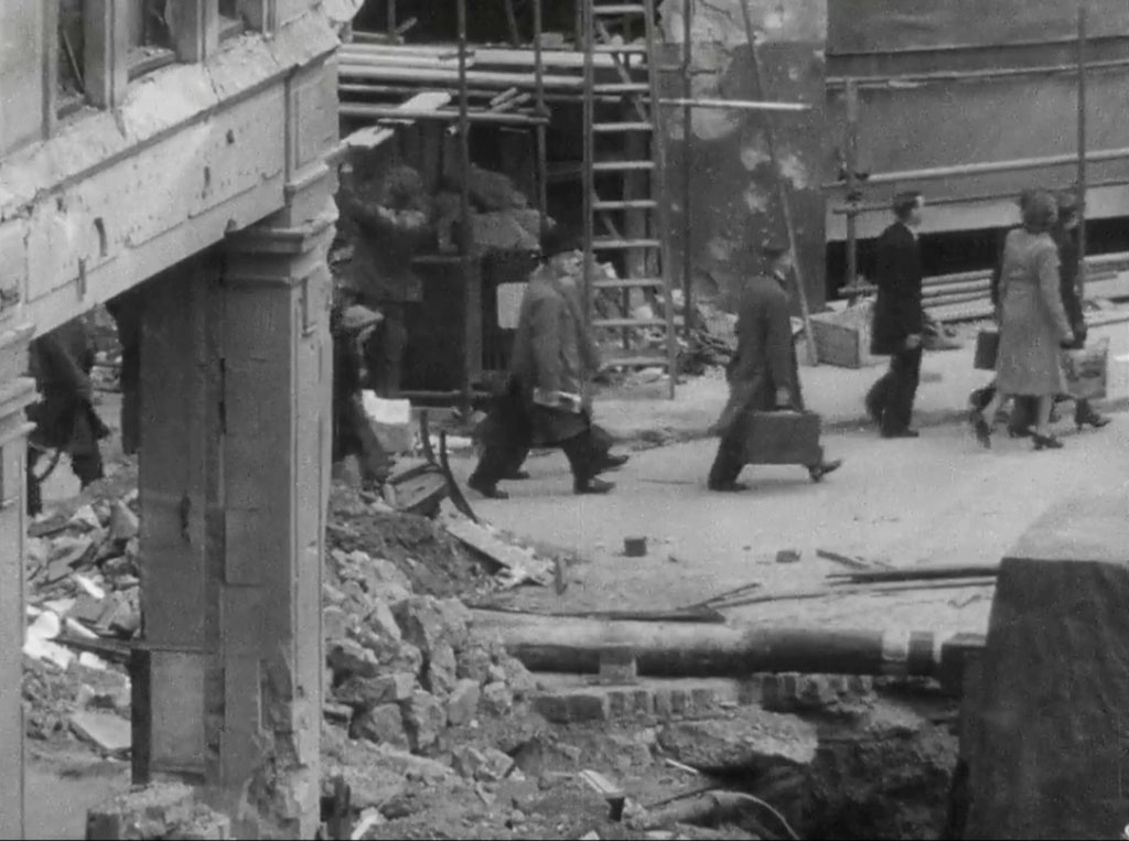
“..which came to an end when the invader started to attack the last stronghold of freedom….”. Monument Street as it meets King William Street.
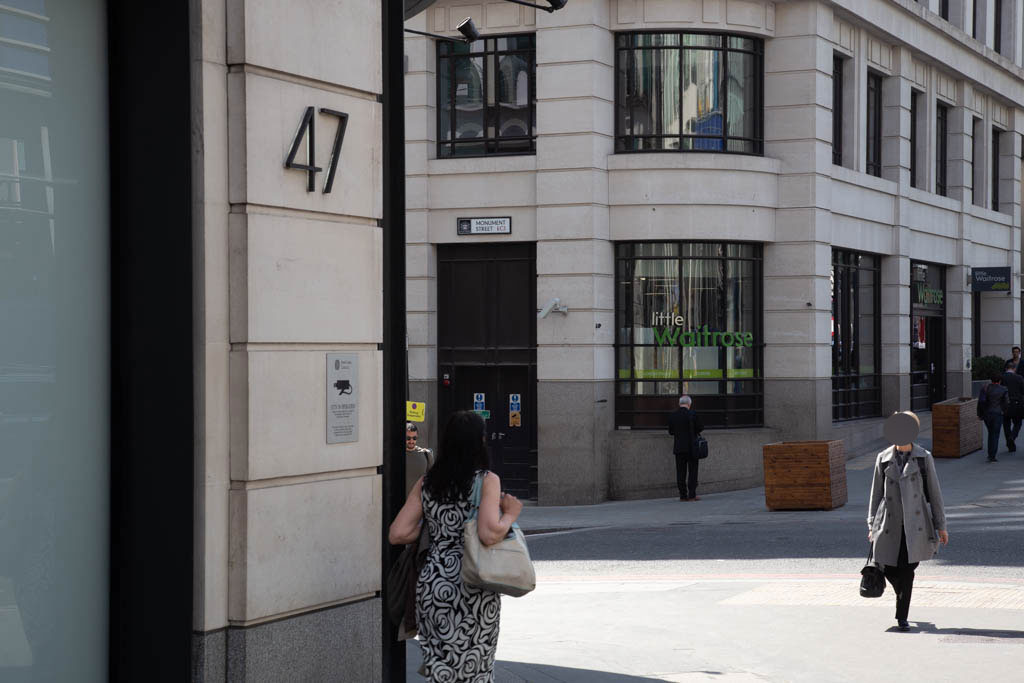
From ground level and a rather tidier street.
- Capture 25
- 08 Aug 2018
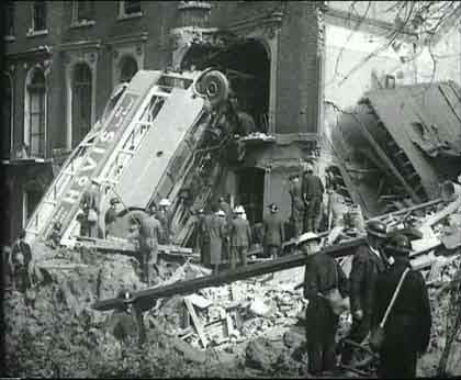
“Not all the services ran as they did yesterday”. After all the years Denis Hoare was able to set our records right. That side of Harrington Square, London NW1 had 38 houses. According to the LCC Bomb Damage Maps Nos: 33 and 34 were totally destructed. The bus is therefore against No 35. When the war was over Nos: 25 to 38 were demolished and Hurdwick House (an apartment block) was built.

Denis provides this Google extract. The bus would have been circa the street light.
- Capture 26
- 31 Dec 2025
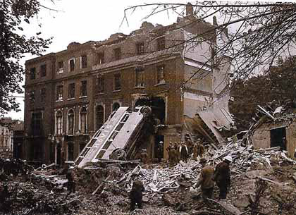
Roy Barnacle sent in this excellent pic and was the first to identify Harrington Square, Mornington Crescent, NW1.
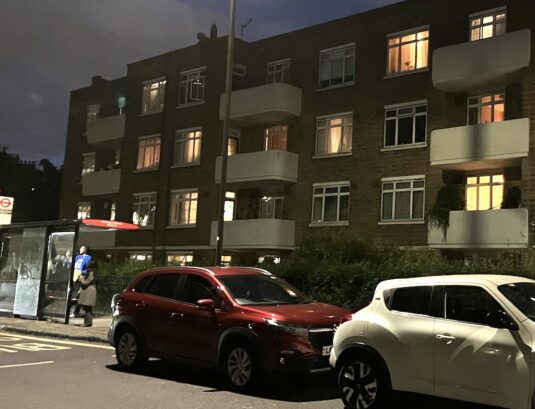
Hurdwick House on the north-east side of the triangular- shaped Harrington Square. SJ
- Capture 27
- 26 Mar 2019
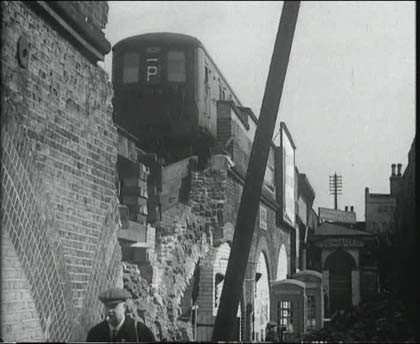
The train on the bombed viaduct is a Southern Railway Electric Multiple Unit that looks like type 2NOL and it is carrying a ‘Bar P’ stencil code on the front. (PW) Facts in the capture suggest that this is Lewisham, east of the Station where the line crosses Lewisham Road/Lewisham High Street. The location is on the south side of the track. The building to the right out of shot sustained serious bomb damage.
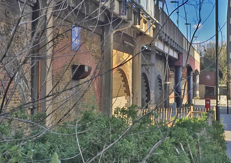
Before the ink is dry Dave W is on the spot and provides the last piece of confirmatory jigsaw, that wall tie top left corner is indeed there.
- Capture 28
- 20 Jul 2011
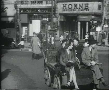
“London manages to get to work on time, one way or the other”. No 6 Oxford Street, with Horne Brothers next door. So Tottenham Court Road end.

Confirmed and pic from Adrian Grepnold.
- Capture 29
- 20 Jul 2011
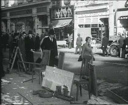
“In the centre of the City the shops are open as usual”. This is just a few doors further west from Capture 28 along Oxford Street (north side). The larger building on the far left with classical detailing was in more recent times the Virgin Megatore and the last time I checked a fashion retailer called 'Hyper Hyper'. Andrew Fisher. In 2019 it is 'Primark'

Confirmation and pic from Adrian Grepnold.
- Capture 30
- 12 Jun 2019
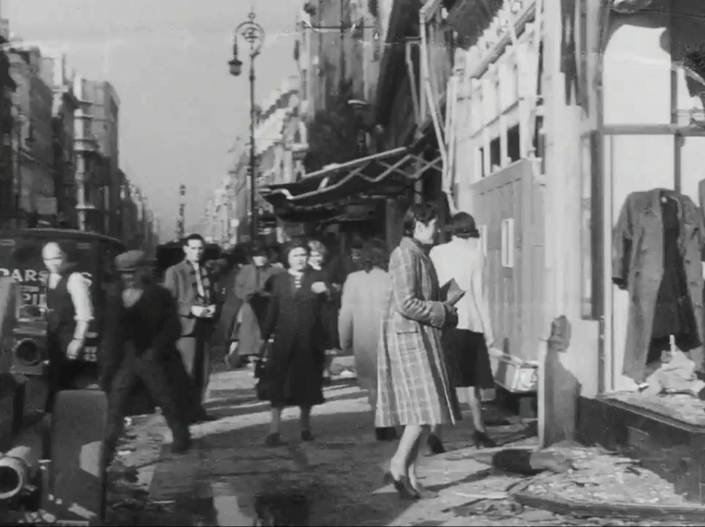
“In fact many of them are more open than usual” . Looking west along Oxford Street, with No 8 immediately to the right.
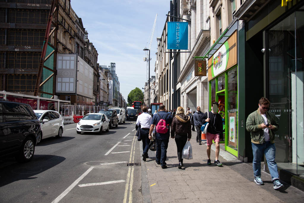
The damage appears to be on the other side of the road now.
- Capture 31
- 'Now' required
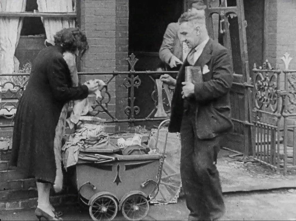
“The morale of the people is higher than ever before” . It is number 32, but where?
- Capture 32
- 'Now' required
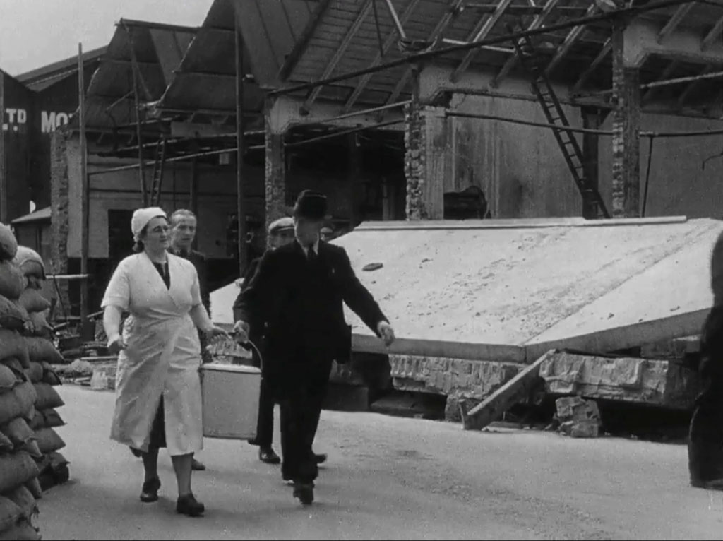
“they are fused together with a spirit of courage ..”.
- Capture 33
- 03 Sep 2024
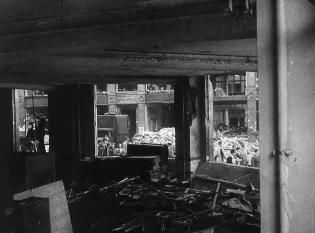
“They know that 1000’s of them will die..”. '******E HOUSE', should be a gift. Nick Booth's persistance has paid off once again, he has found this to be the ground floor office of Regis House (the exterior can be seen in Capture 24) on the corner of King William Street and Monument Street looking across King William Street to 'Imrie House' at the time of filming covering Nos: 33 to 36. (RL)
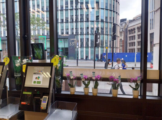
Nick was soon 'out of the blocks' to capture the same scene in peace time and a few re-devolopments later. (RL)
- Capture 34
- 08 May 2022
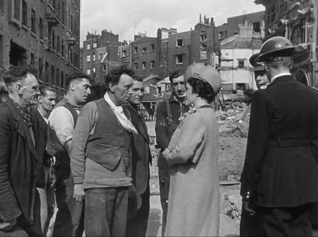
–“…but they would rather stand up and face death….” Queen Elizabeth the Queen Mother and King George Vl behind the Warden. Nick's further identification is Allsop Place, NW1 looking from Marylebone Road, as he says, "right next to Madame Tussauds". In fact Tussauds Cinema that stood next to the wax museum from 1925 until it was hit by a bomb on September 8, 1940. The royal visit took place ten days later. The former Planetarium now stands on the site of the old cinema.
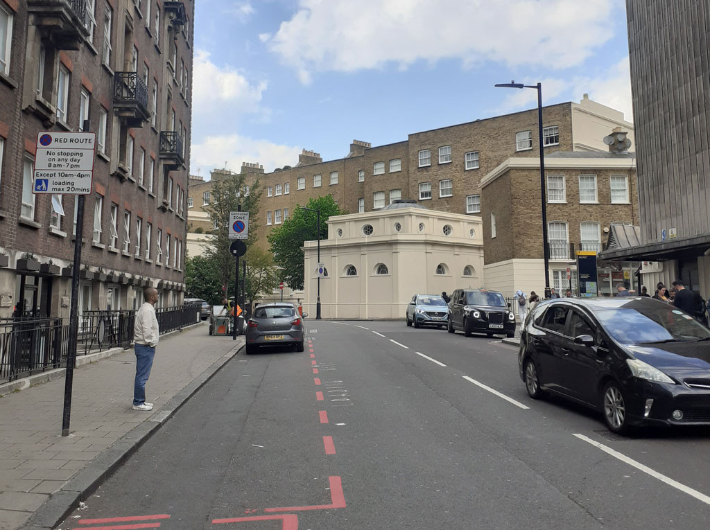
Nick's comparative shot shows the location as it is now, the building on the left supporting the identification.
- Capture 35
- 13 May 2011
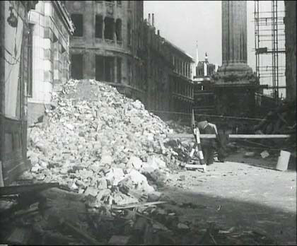
“than kneel down and face the existence the conqueror would impose on them” . The Monument to the Fire of London, Monument Street, Pudding Lane, near London Bridge.

Same rounded corner, repaired, on the left.
- Capture 36
- 20 Jul 2011
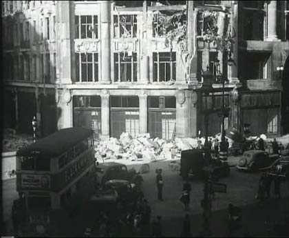
“…England is not taking its beating lying down….". This view is looking towards the north-east corner of Oxford Circus. The bus is turning east out of Regent Street. The large angled building was then the Peter Robinson department store, now occupied by Niketown on the corner and Top Shop in the right hand section with the distinctive large, deep windows at the upper floors. Andrew Fisher.

Confirmation and pic by Adrian Grepnold.
- Capture 37
- 13 May 2011
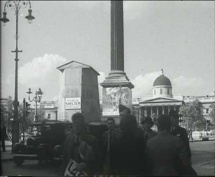
“..they are guarding the frontiers of freedom...". Trafalgar Square from Whitehall.

And the equestrian statue of King Charles was saved by sand-bagging in the "shed".
- Capture 38
- 13 May 2011
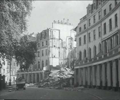
“..it is hard to see five centuries of labour destroyed….”. Park Crescent, top of Portland Place near the Regent’s Park.

Confirmed.
- Capture 39
- 18 Mar 2012
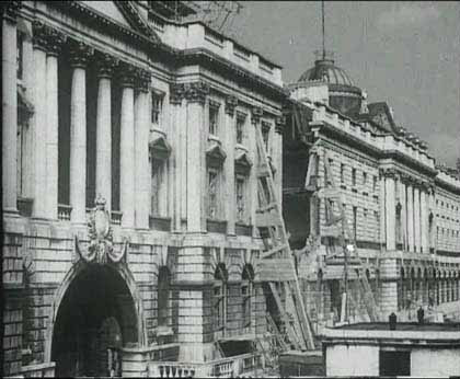
“..in five seconds…” . Somerset House.

Yes, and with the hole fixed.
- Capture 40
- 12 Jun 2019
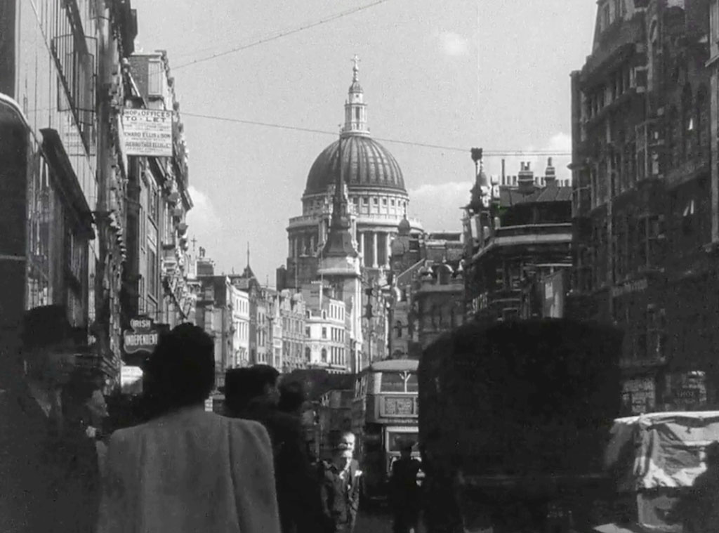
“..but London is fighting back…” . Fleet Street looking towards St. Paul's Cathedral.
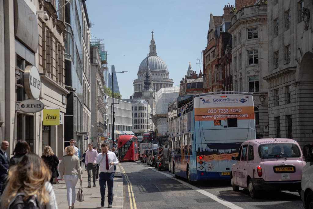
It is reassuring that Fleet Street remains just as busy today.
- Capture 41
- 06 Mar 2022
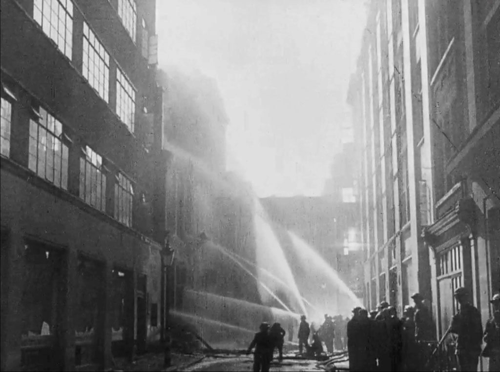
“..I have watched the people of London live and die…” . After much research Nick Booth as solved the enigmatic mystery of this capture and provides us with Little Portland Street, London W1 viewed from Great Titchfield Street.
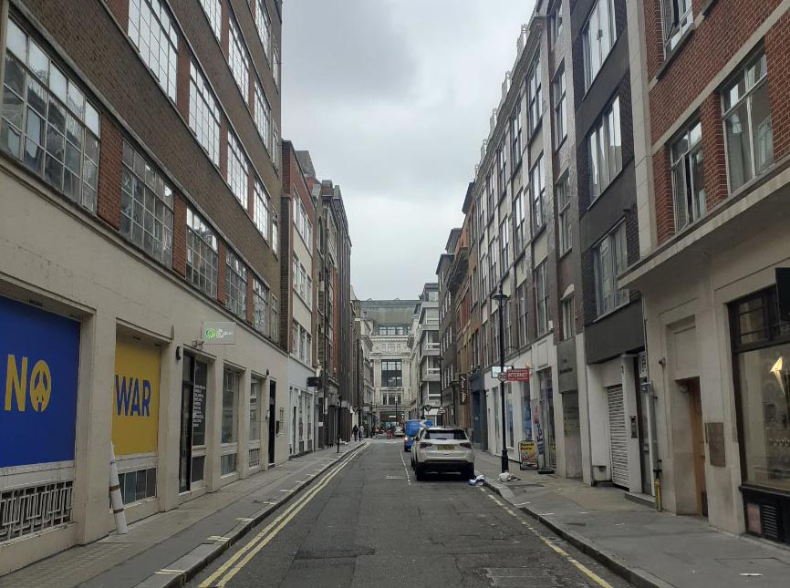
Nick provides his own shot to support, revealing little substantial change to the street although particularly poignant are the windows to the left.
- Capture 42
- 'Now' required
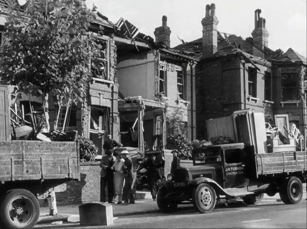
“I have seen them made homeless..” . Dave W tells us that Joseph H Turner, was a cartage contractor of 100 Harlesden Road, Willesden NW10, so presumably these houses could have been somewhere in that vicinity.
- Capture 43
- 05 Jan 2020
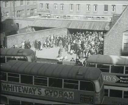
“..I have seen them moved to new homes…” After diligent research Dave W has finally found the location and share his relief and pleasure that it still remains. Welwyn Street in Bethnal Green E2, and the terrace of Gawber Street beyond the playground of Globe Primary School.
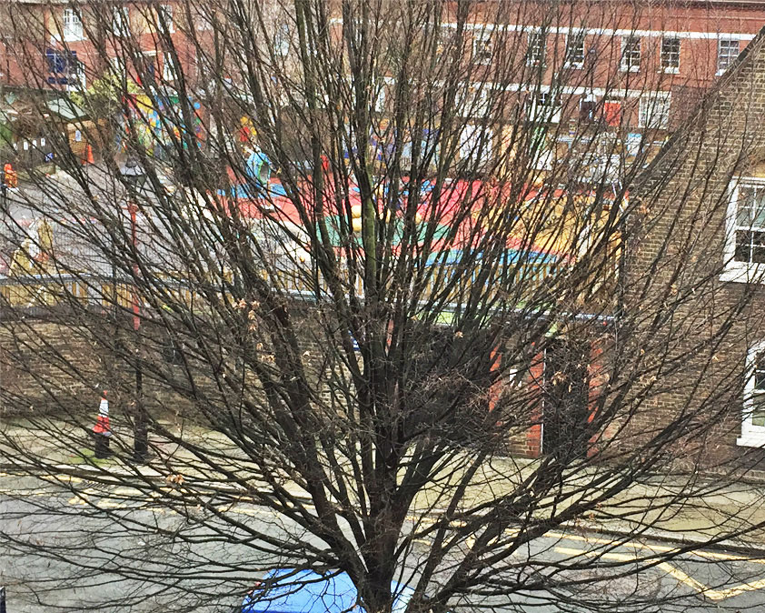
Hot foot from finding the location Dave went off to capture the "now" in September last but has returned to the scene for a re-take without foliage. This is about right for the elevation but he still won't tell us if it was achieved with a drone or a very long selfie stick.
- Capture 44
- 25 Sep 2019
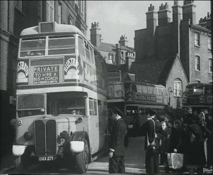
“…no panic, no fear in London Town, there is nothing but determination...” . The exit of Welwyn Street into Globe Road, with the block of flats known as Shepton Houses constructed in 1900. The nearest bus has been identified as part of Dalston Garage's stock, enabling Dave to focus on likely locations for the scene.
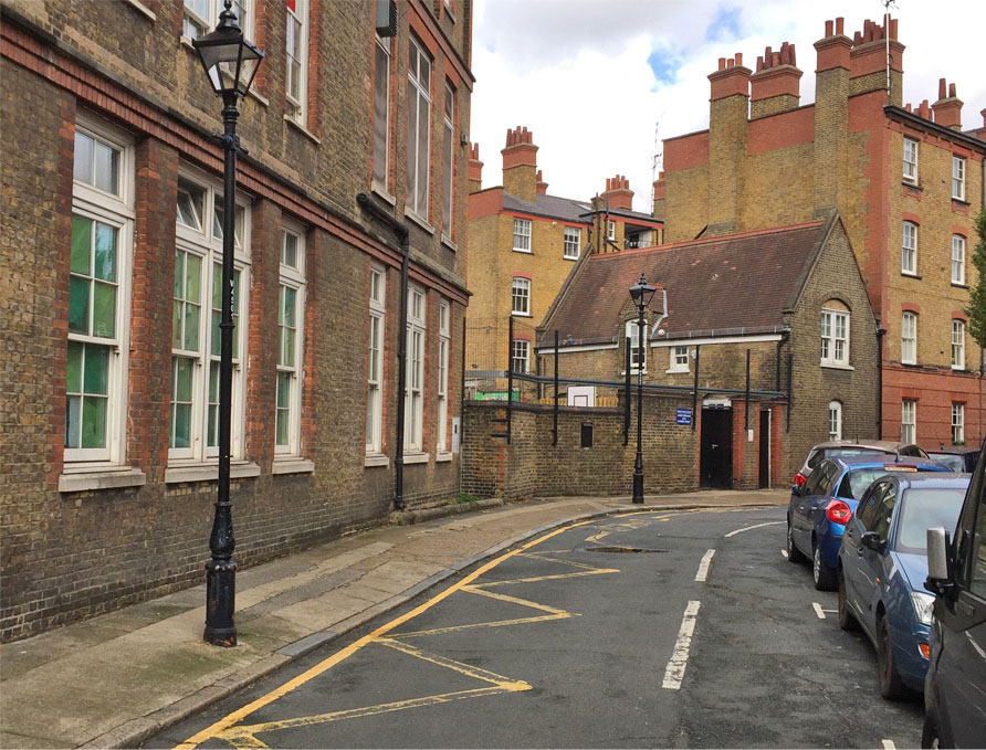
Dave provides an excellent comparative shot and wonders if any of today's local residents were evacuees on that day.
- Capture 45
- 12 Jun 2019
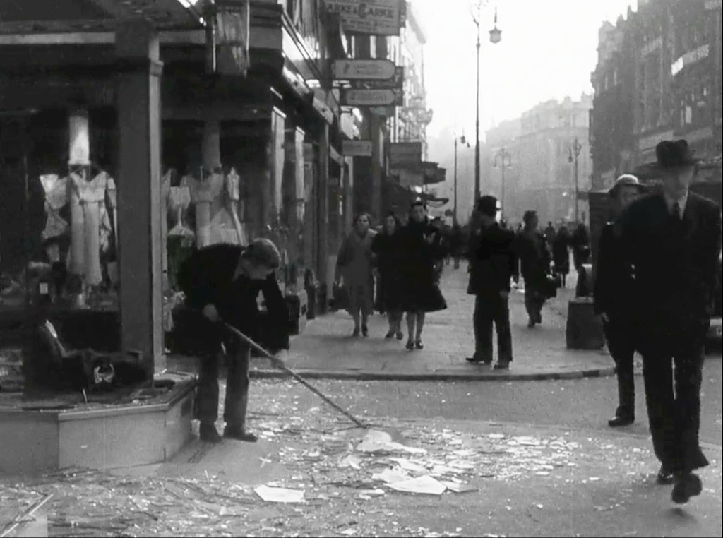
“…it is true that the Nazi’s will be over again tomorrow night…”. Oxford Street, London W1 looking east at the junction with Hanway Street as established by Dave W.
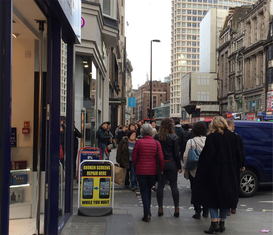
Dave provides a shot of the scene now with all the inherent changes.
- Capture 46
- 'Now' required
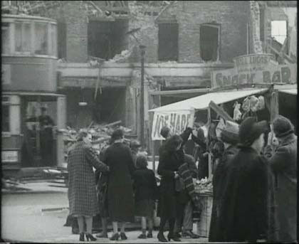
“…they will drop thousand’s of bombs….”. A tram passing left, Joe Hare has a stall and Bill Lucas, Lewisham Market, Snack Bar behind. Lewisham Market has undergone substantial changes in recent years.
- Capture 47
- 'Now' required
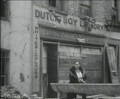
“…they will destroy hundreds of buildings…”. The Dutch Boy Laundry, the lower sign seems to say 71a General - Gonnie Lane -Drapers, or is it - Sophie Lane -? Christopher Matheson writes; The 1941 Kelly's Street Directory lists 'Lane, S (Mrs), laundry' at 71a Ethelred Street, SE11. That building was on the east side of the street and probably close to Lambeth Walk. The whole area has been rebuilt and the street no longer exists. We are fortunate in being able to follow events courtesy of Richard Hudd who was born at the premises in 1948. His story can be read via a link in the Header Section.
- Capture 48
- 29 Mar 2019
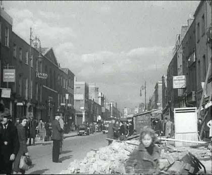
“….they will kill thousand’s of people…” . Hovis (bread) advert, long straight street, with a pitched roof on the left and distinctive curled street lamps. Dave W has identified this as Church Street, London NW8 circa Hardington Street looking north. (RL)
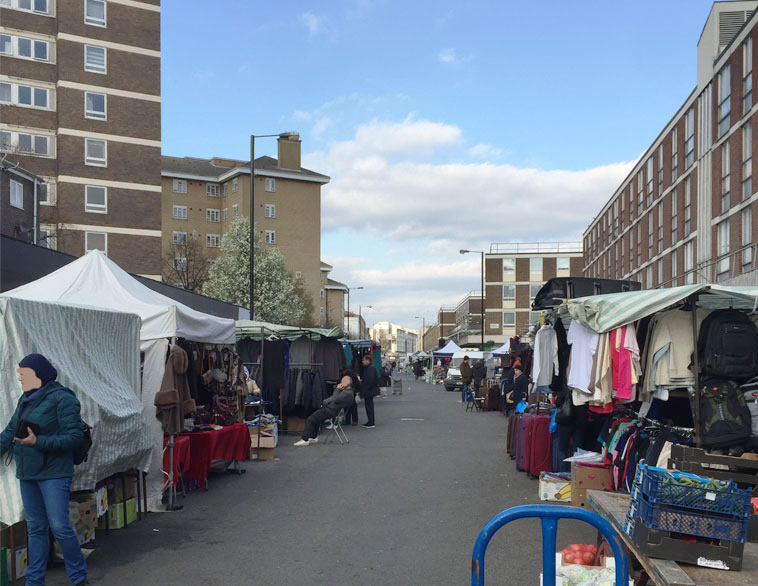
Dave provides the "now" that reveals all the buildings have had a complete change. (RL)
- Capture 49
- 08 Aug 2018
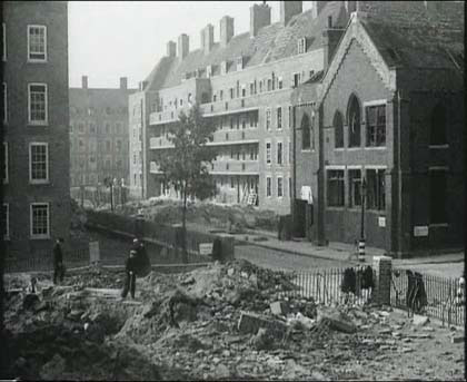
“...the bomb can only destroy buildings and kill people…” 1930’s style council flats, and a church. Denis Hoare adds to his "now" shot: "The rubble in the foreground is of the Phoenix pub, hit by the second of 3 bombs dropped the previous night. The rubble from the 3rd bomb can be seen in the background in Orchardson St. The first of the 3 bombs dropped behind where the camera is, hit a shelter killing 31 people inside. (This was NOT shown in the documentary.). The "church" was actually a school and it too was bombed a short time after the film was made.". (RL)

Denis Hoare tells us that the filming was done from the balcony outside No. 19 Stanfield House, Frampton St. NW8 on 25th October 1940. His family lived there (He was born there later) and his father stood next to Quentin as co-Director Humphrey Jennings filmed the scene. This shot taken by Denis in 2017 looks onto the courtyard, with Orchardson St. on the right leading to Edgware Road. (RL)
- Capture 50
- 26 Mar 2019
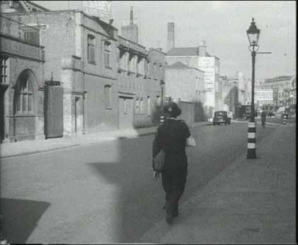
“….it cannot kill the unconquerable spirit and courage of the people of London…”. Variety of styles on the left, a sign above which says SABEY, a chimney stack and a good lamp-post. What more do you want? Not much more really, perhaps eight years for Dave W to come up with South Wharf Road, London W2. SABEY were at No 8 (RL)
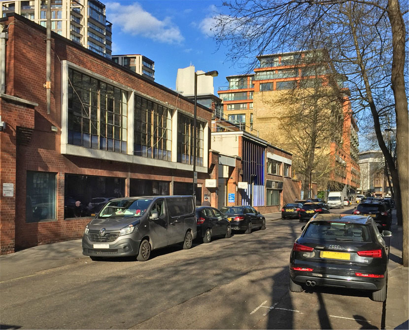
No sooner located than visited and captured by Dave. (RL)
- Capture 51
- 12 Jun 2019
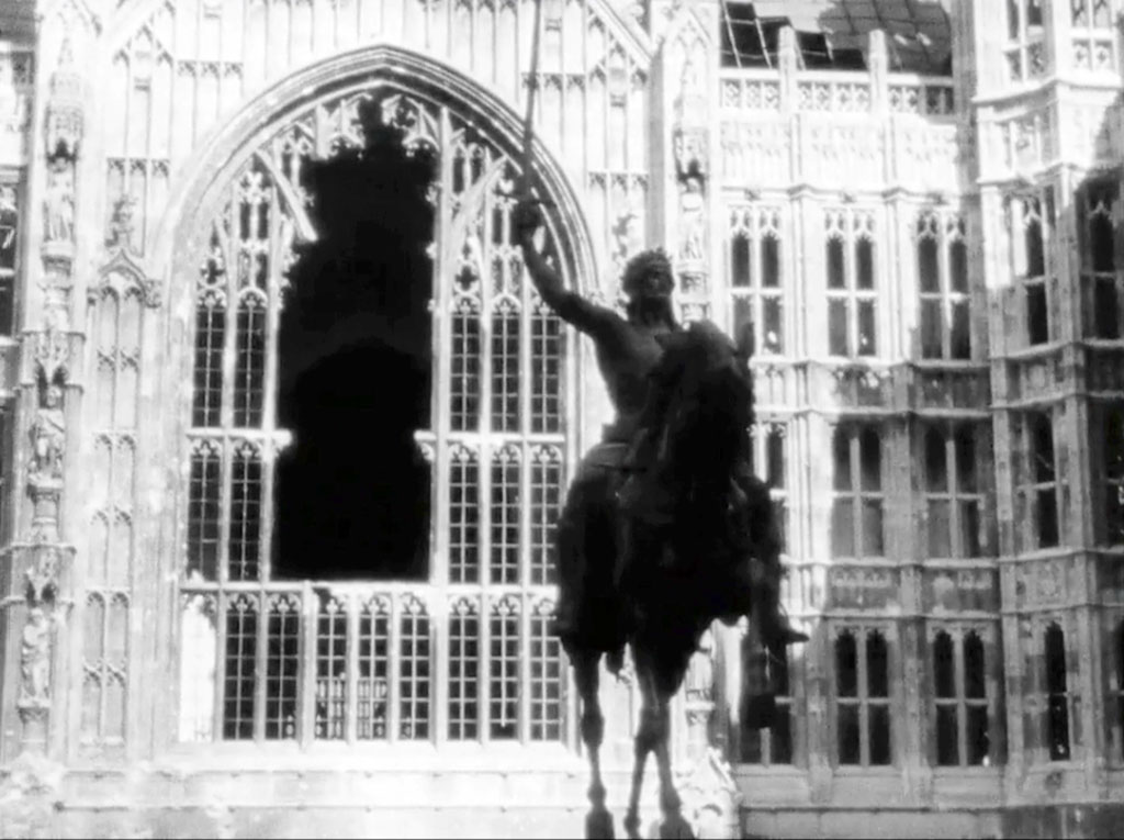
“….London Can Take It!” The Statue of King Richard l against the background of the Houses of Parliament.
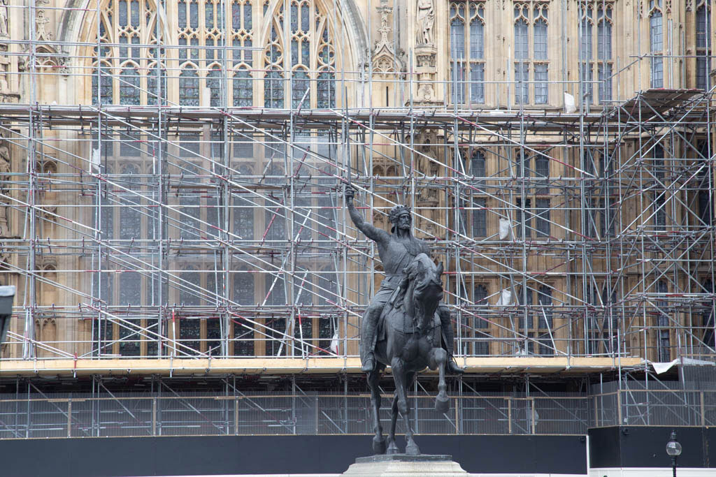
Strict security decides from where shots can be taken these days.