
London Blitz Scenes Revisited – 1946
Date: 1946
Director: George Eaves
Production Company: George Eaves
Stars: Possibly George Eves
Location(s): London
Region(s): London H-L
Storyline:
London Blitz Scenes Revisited – 1946 – George Eves (Imperial War Museums) London
This is an amateur film of some 16 minutes, shot by former Auxiliary Fire Service (AFS) fireman, George Eves, documenting life in London in the years immediately following the end of the Second World War.
Additional Information:
Screen captures have been uploaded by Richard Lovejoy.
With thanks to Bruce Fleming for bringing this film to our attention and for the location and research facts he established, it has been a truly joint collaboration.
The film is available to view, free, on the Website of the Imperial War Museums at https://www.iwm.org.uk/collections/item/object/1060010173 who have kindly agreed to our exhibiting captures from the film. We thank them for their agreement, co-operation and assistance that is much appreciated.
Capture 11: The link to the Mail Online article covering the re-building of London after the Blitz, including this ruin, can be viewed here.
The Royal Institute of British Architects also has a picture of this building in their ‘pix’ accessible here.
Capture 12: Photographs of Fore Street Warehouse ‘before and after’ can be viewed here.
Capture 29: The link to the Mail Online article covering the re-building of London after the Blitz, including this ruin, can be viewed here.
The Royal Institute of British Architects also has a picture of this building in their ‘pix’ accessible here.
Capture 44: The link to Historic England website can be viewed here.
Can you help:
If you have any information regarding this production, the locations or, even better, some comparison shots please contact us. Images submitted must be in Landscape orientation, as would be seen on the cinema screen, not Portrait.
We are aware that there are films on the site that were added when the criteria for the inclusion of locations was very different from today and, as a result, there may be scenes missing from some productions. Please do not forward additional screen captures to us but bring the detail to our attention, for we do, and are, 're-addressing' these older entries as time allows.
- Capture 1
- 'Now' required
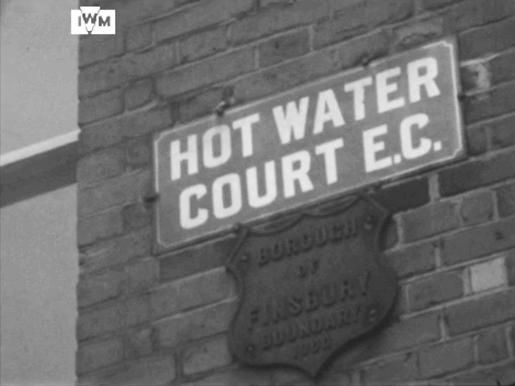
Panning down from the roof to the street sign(s). The building is that of Maurice Rosenberg – Skirt Manufacturer on the corner of Hot Water Court, London EC1 and Fann Street. The lower sign marks the 'Borough of Finsbury Boundary 1900'. The building and the same corner features in ‘No Place for Jennifer’. 'Bowater House' apartment block now occupies the site but set back from the placement of these signs.
- Capture 2
- 17 Aug 2025

A cut to a location with foreground Pre-fab houses, forward facing terrace houses all in Park Crescent Mews West, London W1 and in the background, the rear of Harley Street properties. Development has obliterated Park Crescent Mews West. Location identified by Jane Hearn of www.prefabmuseum.uk.
- Capture 3
- 17 Aug 2025

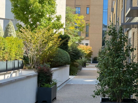
Panning to Pre-fab No. 35g, one of the seven located here.
Aided with a map of the time, a zoomlens and a fortunate gap in the gates to this community Richard Bennett managed this comparative view to the late Pre-Fab 35g.
- Capture 4
- 17 Aug 2025

Here we are ‘introduced’ to our guide, possibly George Eves who is tending his garden. Looking towards 11 and 12 Park Crescent Mews West.
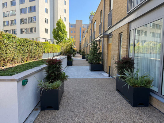
Richard took the opportunity to re-visit old familiar territory for him and managed this shot through the gates of what is now a gated community.
- Capture 5
- 17 Aug 2025

Having tended to his garden we see him leave home, waiving goodbye. Here, once again, showing the frontage of the small terraced houses in Park Crescent Mews West and the rear of the properties in Harley Street.
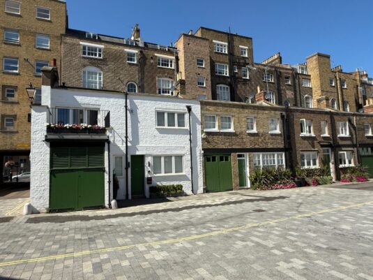
Here Richard is standing further forward than the original capture because the gated community seen in Captures 3 and 4 is right behind him. Long since the prefab was there, but all the period buildings on Harley Street and the news behind remain, with some alterations.
- Capture 6
- 17 Aug 2025

We watch him, followed by school boys, walk the Crescent towards Marylebone Road. The remaining houses in Park Crescent top right.
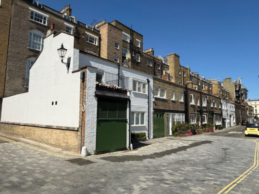
Once again, Richard couldn't get far enough back because the entry to the gated community is restricted, but this is the same terrace of houses at the back of Harley Street.
- Capture 7
- 26 Nov 2022

We catch up with George as he turns the corner from Fann Street, EC1 into Golden Lane as he passes the piles of rubble from clearance of surrounding bomb damed area. The first building to the left of his left shoulder is the top of what was the Baltic Street School, here looking at was at the time the Hatfield Street elevation. The building is today that of the University of the Arts, London College of Fashion. See BfA EAW011202 and www.londoninheritance.com He is shortly to cross what was Great Arthur Street but obliterated by rubble beyond its mouth.

There is nothing to say!
- Capture 8
- 26 Nov 2022

As he continues along Golden Lane, the edge of the rubble pile first brings the top left hand corner of 24 and 26 Baltic Street into view. Now a block of offices known as 24 to 26 Baltic Street West.

Obviously, it is no longer possible to replicate the view from a distance so a closer shot of 24 to 26 Baltic Street West reveals the building as it is now.
- Capture 9
- 'Now' required

As the pile of rubble diminishes further a pan to the left reveals the ruins on the north side of Hatfield Street in the background and more immediately he passes the remnant cul-de-sac of Bayer Street. It can be fully appreciated in context in Britain from Above EAW011215.
- Capture 10
- 26 Nov 2022
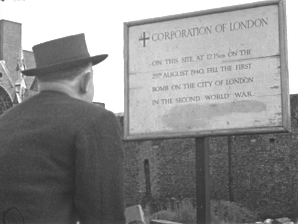
We next find George in Fore Street, EC2 at its junction with Wood Street, reading the sign: "CORPORATION OF LONDON On This Site At 12.15am On The 25th August 1940, Fell The First Bomb On The City Of London In The Second World War". The London Wall (re-routed in 1957) elevation of the ruin of St. Alphage Church can be seen to the left although the majority of the church was situated in Aldermanbury. The wall behind the sign is the ancient London Wall itself that now forms the northern boundary of St. Alphage Gardens.
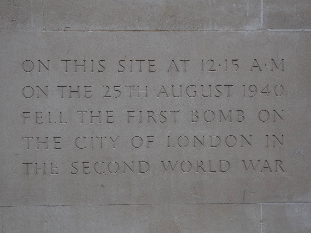
The temporary sign has been replaced by a stone plaque on the building that stands at the end of Fore Street where it turns into Wood Street.
- Capture 11
- 26 Nov 2022

The film then cuts to Lilypot Lane, a now vanished side street running east off Noble Street and looking to an isolated ruin on the junction of Oat Lane and Noble Street. The exposed City Wall along the west side of Noble Street, between the two properties, separates the Oat Lane ruin from Falcon House. This ruin features, fronted with a London Gardens Society noticeboard, in the 'Mail OnLine' article of 2019 on the re-building of London after the Blitz. A link to that article can be found in the Header Section.

The remains of the City Wall, together with the remnants of 18th and 19th century buildings left following the WW2 bombing, now form the backdrop to the Noble Street Garden, a wild flower meadow sown to encourage biodiversity of plants and wildlife.
- Capture 12
- 26 Nov 2022

A cut, and the camera looks up towards the razed site of 'Fore Street Textile Warehouse', marked by a makeshift sign. The warehouse, with a frontage on 104 to 107 Fore Street occupied an area of nearly an acre between Milton Street to the east and Elephant Yard to the west and Green Yard to Fore Street, north to south. A photograph of the premises, before and after, can be viewed via the link in the Header Section.
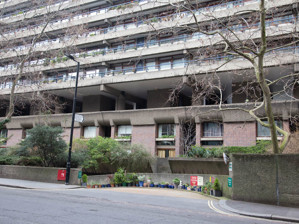
Apartments of the 'Barbican' now occupy the scene.
- Capture 13
- 'Now' required
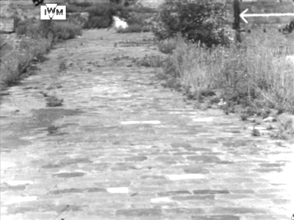
Panning left we are taken to a view along the track of Elephant Yard (looking north from Fore Street).
- Capture 14
- 'Now' required
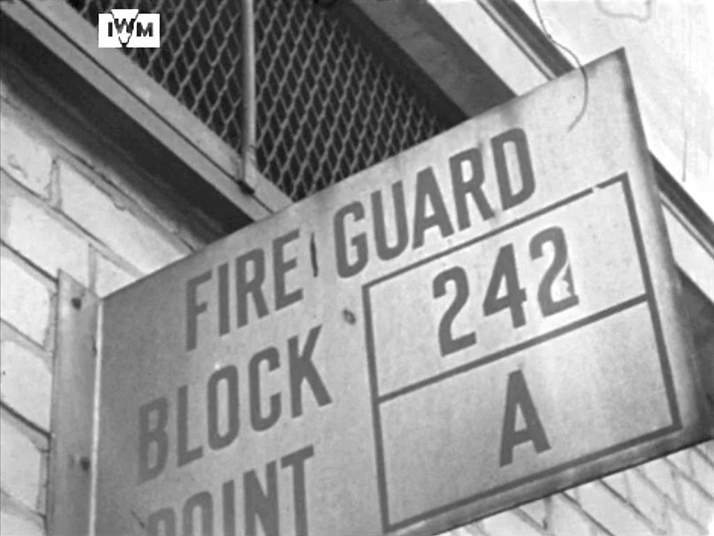
Fire Guard Block 242, Point A. Location so far unidentified.
- Capture 15
- 'Now' required

An interesting cellar, unusually clear of debris, clearly worthy of filming. Ray Glenister has quickly resolved the location for us, the corner of Wood Street and Gresham Street looking north to 47 Gresham Street, (Leith House, akat 22 Wood Street - top right). The cleared basement is that of I & R Morley Ltd., Hosiery Manufacturers at 18 Wood Street, EC2. Ray has now added as to why it is unusually free from debris, clean, sealed and black, it is a Static Water Tank ( or Static Water Supply) adding further interest to the site and to the historical record. As Ray says, George Eaves certainly appreciated what it was.
- Capture 16
- 26 Nov 2022

Cutting once again the camera settles on the ruined premises of 'City Sale & Exchange' (Photographic Stores), neighboured by those of 'David Samuels & Sons' (Show Card Manufacturers). These businesses were at 84 and 83 Aldersgate Street, EC1 respectively almost opposite 'Aldersgate [Street] Underground Station', now known as 'Barbican'.

A wider view of the location now to put the captures within context.
- Capture 17
- 'Now' required

A fuller view of the premises for historic purposes.
- Capture 18
- 'Now' required

We follow George's footsteps as he walks along Hamsell Street (now lost in the Barbican development) towards the only surviving building left standing in Jewin Crescent. See also Capture 22.
- Capture 19
- 26 Nov 2022

We cut to Monkwell Street first looking west across cellars towards Bastion 12 of the City Wall before swinging the camera clockwise, through Bastion 11A .............

The best possible comparative view available to me.
- Capture 20
- 26 Nov 2022

...........into the walled path running northwards through past St Giles Church to the right and the gateway to the Churchyard, seen here at the end.

The City of London School for Girls.
- Capture 21
- 26 Nov 2022

The camera is raised to establish the location. The tower of St Giles-without-Cripplegate, Fore Street, London EC2. Also to be seen in ‘The Key Man’.

Now best taken before the leaves appear.
- Capture 22
- 26 Nov 2022

Returning to the Churchyard path, it may have an official title, with the ruins of the remaining property in Jewin Crescent that can be seen in ‘The Weapon’, ‘It Happened Here’, 'The Glass Cage' and ‘The Key Man’, off to the left. The gateway to the original graveyard is also seen in Capture 19. John Milton the poet was buried in the churchyard that is now all contained within the Barbican development. To the extreme left is the right hand pillar to an opening in the wall with steps.............

At least a comparative shot is possible.
- Capture 23
- 'Now' required

.........from here the camera's view turns anticlockwise and south, towards St Paul’s Cathedral across Bastion 12 of the City Wall. The 'square' building in the center is the eastern end (Aldersgate Street) of the General Post Office building in Angel Street.
- Capture 24
- 'Now' required

As the camera pans further to the left St. Paul's Cathedral comes into view.
- Capture 25
- 'Now' required

Whilst in the area George cuts to another angle of St. Paul's to show the ruins of St. Vedast-Alias-Foster, Foster Lane here in the foreground.
- Capture 26
- 'Now' required

Among ruins at the southwest intersection of Wood Street and Gresham Street, with the curvature of Leith House, Gresham Street, in the background. (See Britain from Above EAW011114). As the camera gradually turns clockwise and south, a few frames on, the spire of St Mary-le-Bow becomes visible in the distance.
- Capture 27
- 26 Nov 2022
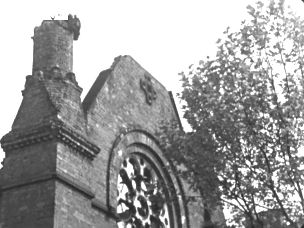
We see George licking his lips before turning to look at the shell of St. Mary's Church, Fortune Street, EC1
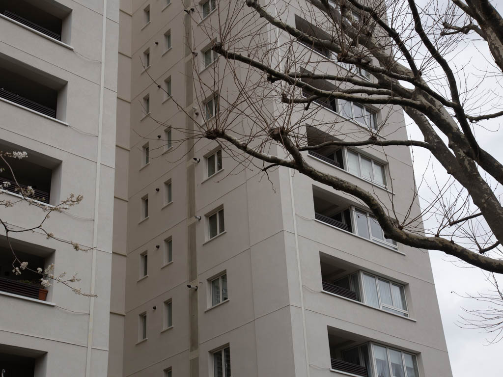
Now St. Mary's Tower, a residential tower block named after the demolished church.
- Capture 28
- 26 Nov 2022

The camera pans down to the main doorway of the church.
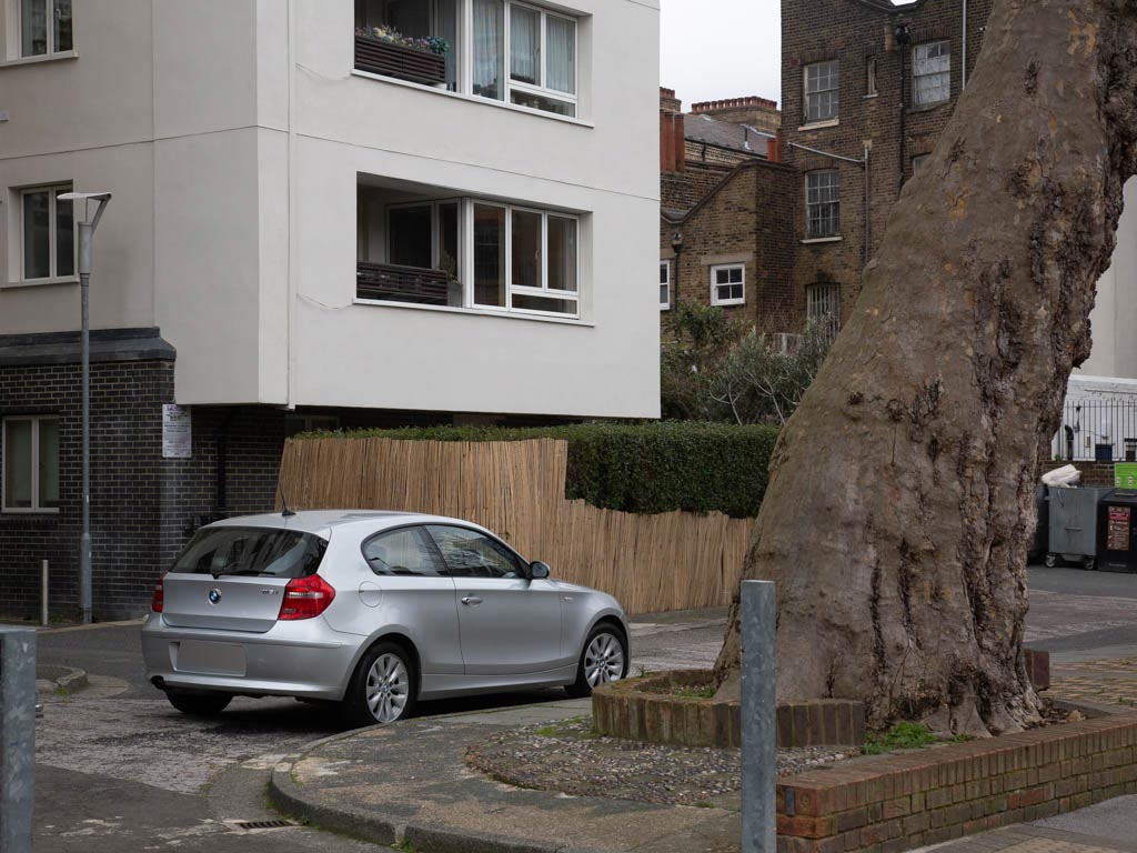
Interesting to see that the tree was allowed to stay and has grown whilst retaining its original shape.
- Capture 29
- 'Now' required

The film cuts to the ruined interior of St. Alban's church, Wood Street, EC2. The tower was left standing, now designated Grade II* and remains as a private dwelling on a traffic island. This ruin features, in the 'Mail OnLine' article of 2019 on the re-building of London after the Blitz. A link to that article can be found in the Header Section.
- Capture 30
- 'Now' required
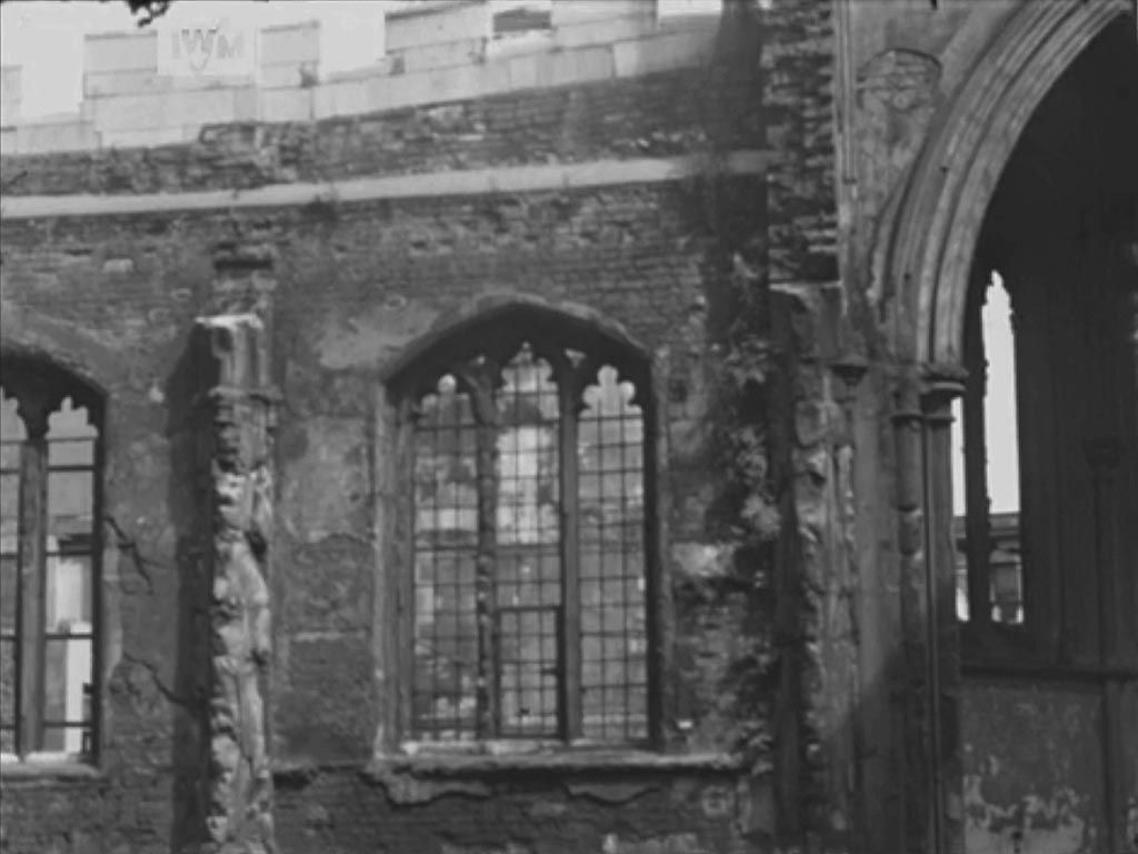
A further view of the interior of St. Alban's church. The windows of the North Aisle and the North Chapel off to the right.
- Capture 31
- 'Now' required
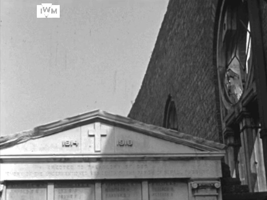
We return to one side of St. Mary's Church, Fortune Street and a First World War Memorial that looks to have sustained little damage. Given the purpose of the memorial it is difficult to imagine that it was ultimately destroyed but I can find no information with regard to its fate. The derelict church with this memorial in place can be seen in Britain from Above EAW011215.
- Capture 32
- 'Now' required
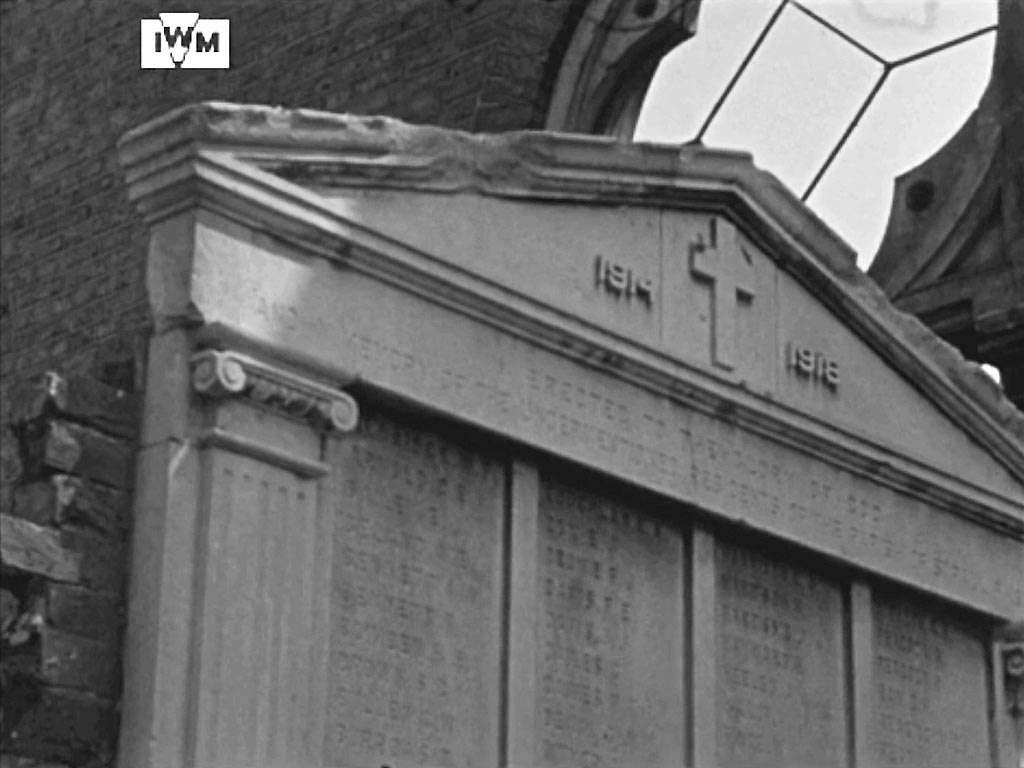
Regrettably, it is difficult to achieve sufficient clarity to read the names engraved but work continues. The header, however, reads: 'To The Glory Of God And The Memory Of The Undermentioned Residents Of The Parish of St Paul Finsbury'.
- Capture 33
- 'Now' required

The footer reads: These Men Fought And Died For...................Justice and Liberty............
- Capture 34
- 'Now' required

A further capture in case an element of clarity can be established.
- Capture 35
- 'Now' required

An as yet unidentified basement with white tiled walls.
- Capture 36
- 04 Dec 2022

Having walked along Albert Embankment Path George goes up the steps to Lambeth Bridge. The Houses of Parliament and Westminster Bridge in the background.

The steps today. SJ
- Capture 37
- 04 Dec 2022

At the top of the stairs he stops to appreciate the view across the Thames to the Houses of Parliament.

More halfway up the steps to be precise. SJ
- Capture 38
- 04 Dec 2022

A short walk to 8 Albert Embankment, SE1 and London Fire Brigade Headquarters.

Looking north towards Lambeth Bridge with the fire hydrant sign and the remnants of the letter box in situ. SJ
- Capture 39
- 04 Dec 2022

The crowd look down at the display from above whilst we see what was the clock tower of Bridge House, demolished in the late 1990's. The Station Commander at Lambeth has very kindly given his agreement and support to providing access for accurate comparison shots to be taken but unfortunately, to date, it has not been possible to establish a date that all those associated with this visit can make......we will keep trying!

A temporary shot until the visit is finalised. Taken from just outside the HQ. SJ
- Capture 40
- 04 Dec 2022

Our guide attends an occasion at Lambeth Fire Brigade Headquarters that includes demonstrations on how various fires are addressed. Headquarters ‘Parade Ground’ with Lambeth High Street premises in the background. Many features of the ‘Parade Ground’ also appear in ‘I Was a Fireman’ as well as 'The Bells Go Down'.

A less busy, as it often is, Lambeth HIgh Street. SJ
- Capture 41
- 'Now' required

A demonstration as to scaling a tall building without an extending ladder. Off the the right is Whitgift Street and 'Whitgift House' that remains to this day.
- Capture 42
- 04 Dec 2022

An extending ladder is brought to the scene. Looking down Lambeth High Street. To the left of the parked fire engine is 'The Windmill' public house that survives today.
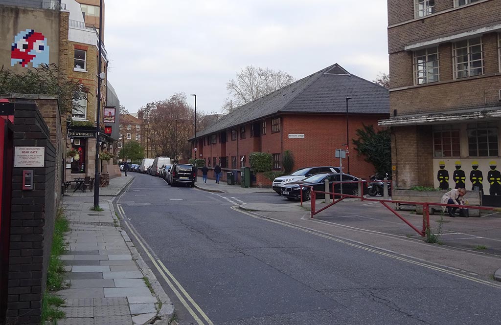
Again a temporary shot taken from the wrong side of the wall showing the WIndmill pub, one of the few survivors in the street. SJ
- Capture 43
- 04 Dec 2022
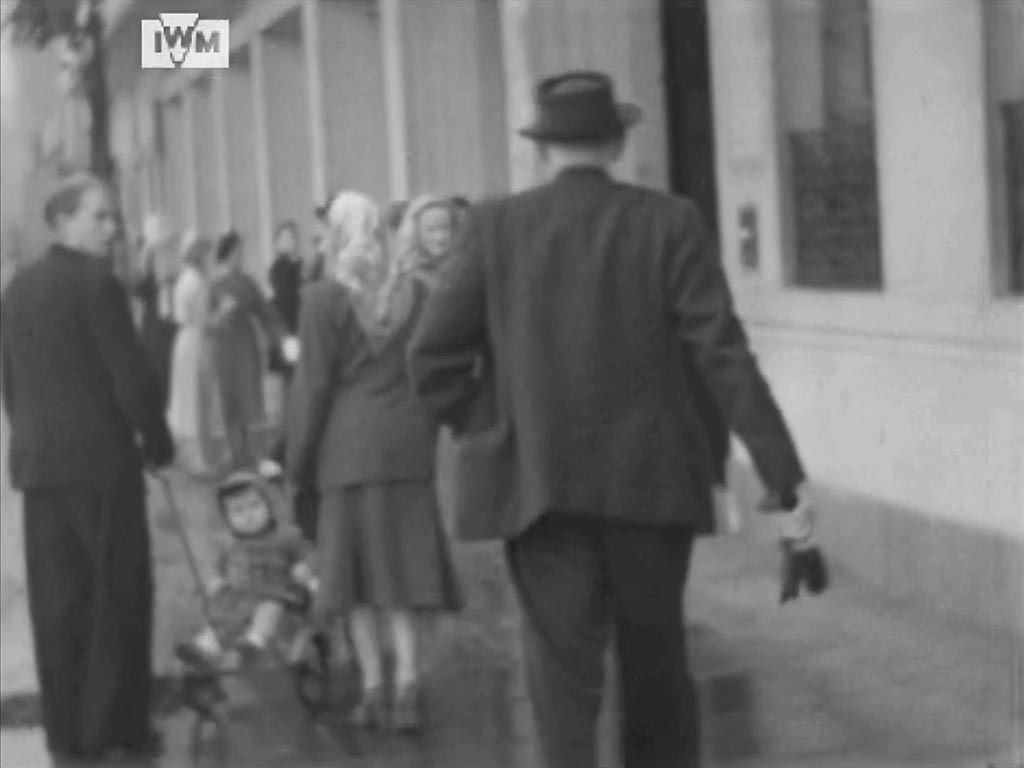
At the end of the display George starts his journey home. Looking north along Albert Embankment outside the Brigade Headquarters.

Some scaffolding as usual. SJ
- Capture 44
- 26 Nov 2022

Next George breaks new territory and visits Temple, EC4 and specifically finds himself looking up at the devastated window of 'Inner Temple Hall'. A not dissimilar but wider view can be see on the Historic England website that can be accessed via the link in the Header Section.
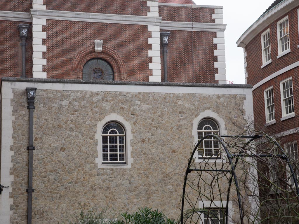
Inner Temple Hall rebuilt.
- Capture 45
- 26 Nov 2022

The camera pans down to the northern elevation of 'Inner Temple Hall' viewed from Tanfield Court.

Once again a view cleared of the product of strife.
- Capture 46
- 26 Nov 2022

Then further pans left to reveal No 1 Tanfield Court and the archway through to Kings Bench Walk.

Besides re-building No 1 Tanfield Court appears to have exchanged a door for a new window.
- Capture 47
- 26 Nov 2022

The camera continues to pan left to settle on the southern elevation of Temple Church.

It is re-assuring to see that this product of history shows little of no evidence of the ravages of time.
- Capture 48
- 26 Nov 2022

The camera cuts to Temple Court Colonnade looking north, as the outer arch ruins come into view to the right a few frames later.
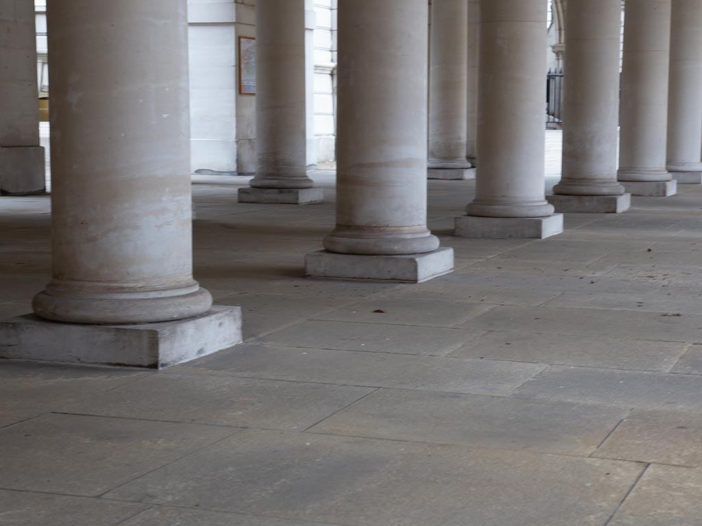
The rebuilt colonnade.
- Capture 49
- 26 Nov 2022

After apparently visiting the premises seen in Captures 16 and 17 a second time we are brought back to Temple, here in Pump Court, looking across the foundations of the colonnade to the corner of 'Farrar's Building' (top left) and the western end of Temple Church (top right).

The rebuilt colonnade limits the view of Temple Church.
- Capture 50
- 26 Nov 2022

Attention moves to a pathway approaching the western end of Inner Temple Hall below the window seen in Capture 44. Nos: 1 and 2 Tanfield Court can be seen behind the 'IWM' logo.
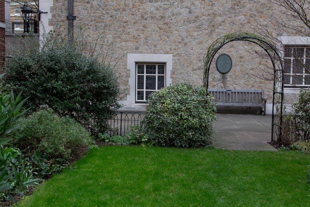
The plaque records the loss of Fig Tree Court, to the right as viewed, first in the Great Fire of London (1666), rebuilt 1679, and then destroyed again in 1940.
- Capture 51
- 07 Dec 2022

Ray Glenister establishes the location as Viscount Street EC1 (previously known as Charles Street) opposite Brackley Street, the wave-like pavement still exists. Not only finding the location Ray also found BfA EAW041393 (1951) revealing an aerial shot of the exact spot.

Bruce captures the location as it is today, including the retained wave-like pavement.
- Capture 52
- 26 Nov 2022
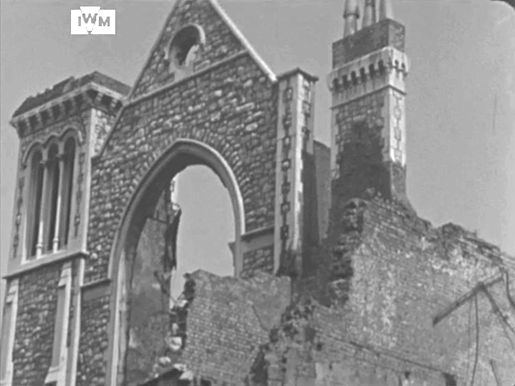
The Jewin Welsh Chapel, Fann Street, EC2 on the corner with Viscount Street. This is the front of the Chapel on Viscount Street.
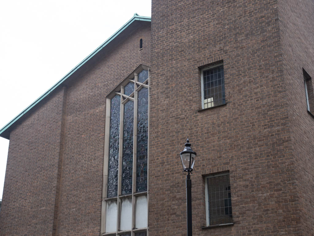
The replacement Chapel that was opened in 1960.
- Capture 53
- 26 Nov 2022

The camera pans down to view the Chapel at pavement level. The premises of Maurice Rosenberg in Hot Water Court, EC1 as seen in Capture 1 can be seen on the extreme left.

'Bowater House' referred to in Capture 1 can be seen on the extreme left.
- Capture 54
- 26 Nov 2022
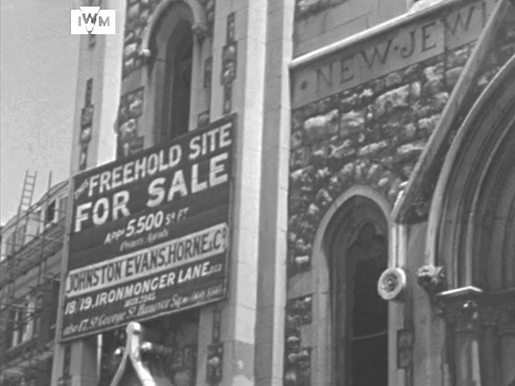
A further view of the Jewin Wesh Chapel and the premies of Maurice Rosenberg , Hot Water Court to the left. The Jewin Welsh Chapel is the oldest Welsh church in London, the chapel here, moved from Jewin Crescent (referred to in Capture 21) in 1879.

Once again 'Bowater House' referred to in Capture 1 can be seen to the left.
- Capture 55
- 'Now' required

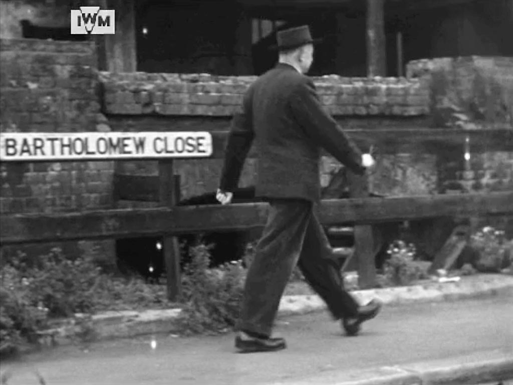
George walks into the memorial square of Bartholomew Close. Looking south down King Edward Street towards St. Paul’s Cathedral. St Bartholomew’s Hospital to the right, a range of buildings to the left are on the western side of Little Britain behind which can be seen the roof of General Post Office building top left.
- Capture 56
- 26 Nov 2022

Walking south east in the north eastern segment of memorial square Bartholomew Close, George first passes 61a before turning left at a ruin.........

At least the facade of 61 Bartholomew Close remains to be recognised.
- Capture 57
- 26 Nov 2022
.....his location is confirmed........
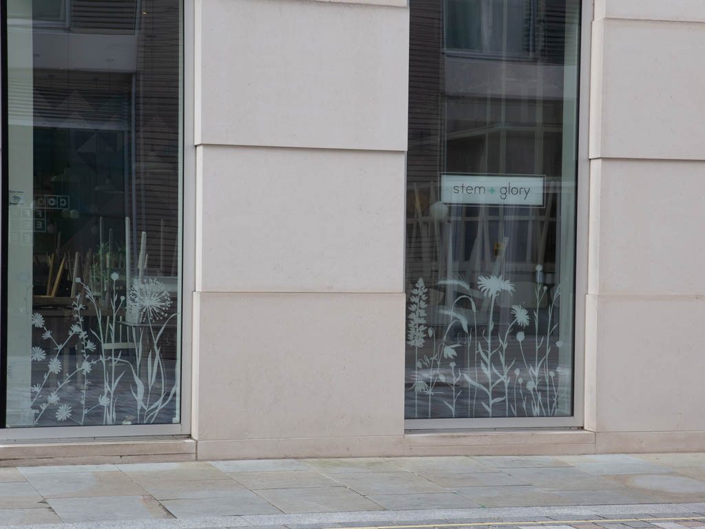
It is doubtful that the window engravings were done to represent the post war wild flowers.
- Capture 58
- 'Now' required

........but soon to stop, raise his hat and read a notice attached to the ruins.
- Capture 59
- 'Now' required
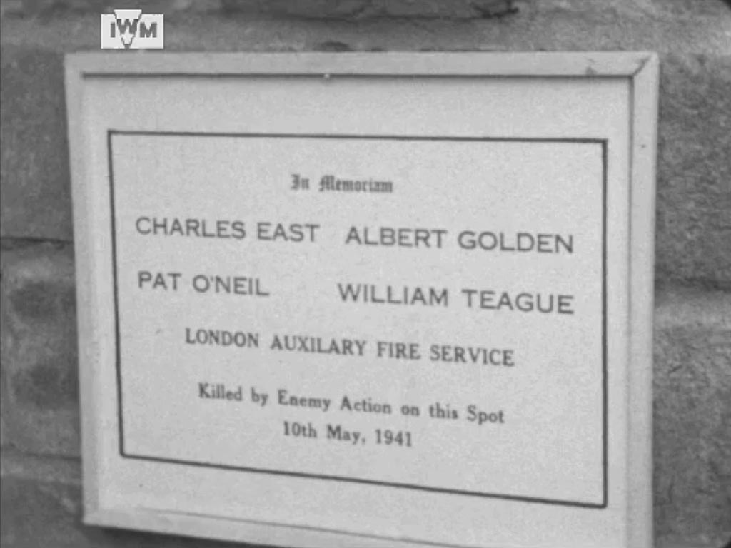
"In Memorium Charles East Albert Golden Pat O'Neil William Teague London Auxilary Fire Service Killed by Enemy Action on this Spot 10th May, 1941"
- Capture 60
- 26 Nov 2022

George walks on past Dominion House on his left, the offices of many businesses. The properties ahead to his right are 29a and 29b Bartholomew Close. The arched ruins are on Aldersgate Street.
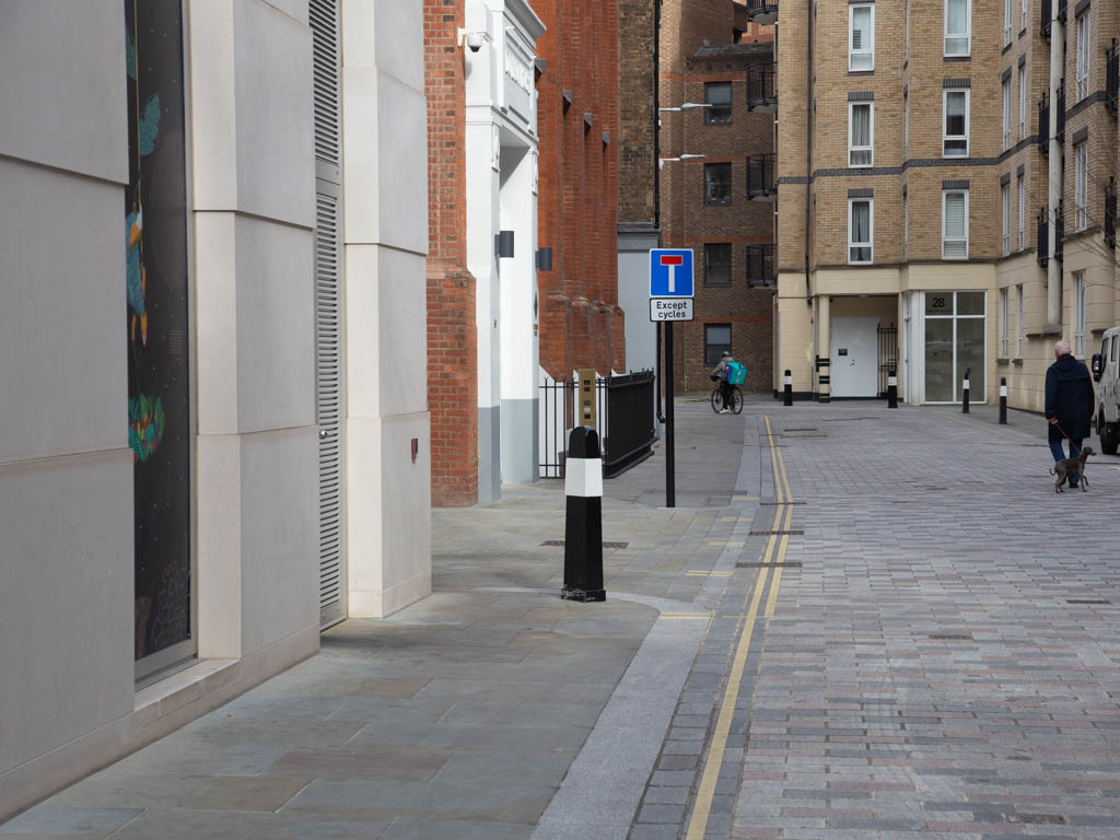
'Dominion House' remains amongst all that is new.
- Capture 61
- 26 Nov 2022
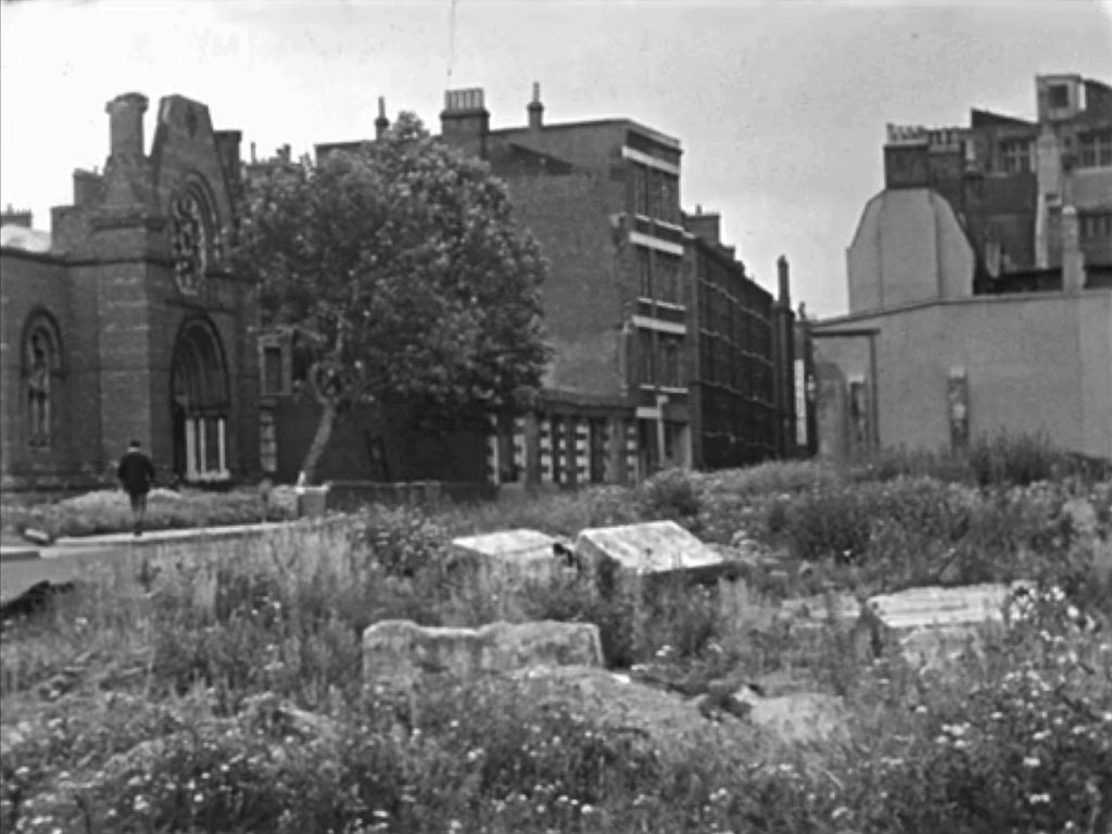
Finally we see George walking along Fortune Street, EC1

It was gratifying to see that the area of ruin is now an open grass area and a children's playground. Known as Fortune Street Park, this 'pocket park' was created to provide outdoor facilities in what had previously been a heavily built-up area and was in danger of being absorbed into post war re-development.