
Kind of Loving, A
Date: 1962
Director: John Schlesinger
Production Company: Vic Films Productions Limited
Stars: Alan Bates, June Ritchie, Thora Hird
Location(s): Lancashire, Middlesex
Region(s): North
Storyline:
A young man, inching his way up from working-class traditions via a white-collar job, finds himself trapped by the frightening reality of his girlfriend’s pregnancy and is forced into marrying her and moving in with his mother-in-law due to a housing shortage in their Northern England town.
Additional Information:
My name is Simon Hopes residing in Manchester about 3 miles from where a lot of the film A Taste of Honey was shot. Mostly filmed in Manchester are all predominately taken in the Miles Platting which is right on the edge of the city centre hemmed in by the city and the areas of Clayton and Beswick. I’ve discovered quite a few that are still there and I hope to take some “now” stills very soon. Just to start the ball rolling the shot toho11c was filmed on Cambrian Street off Ashton new road and is [at the moment], untouched from the days of filming. A lot of the canal scenes attributed to the ship canal on the stills aren’t the ship canal at all. They were filmed on the canal that runs through the above districts. Most were filled in during the 60’s, but incredibly have been re-opened in the last few years and are [of course] on the same route. If you look closely you can see the difference on some shots because the canal is only so wide and not capable of fitting a ship on. The gasometers on the stills were located on Bradford Road in Miles Platting on land very close to where Manchester City’s new City of Manchester stadium is now. Only one survives, the others [the taller ones] were demolished in the mid 90’s. This area was also used to film scenes in “A Kind of Loving” – the scene wear Vic runs away from his sister’s new house to be with Ingrid [I think], the 60’s maisonette where it was filmed is still there, minus it’s top floor and the mill in the background with a castellated tower is the only one of originally 4 that was not burned to the ground,[I should know, I’m a fireman]. Like I say, soon when I have leave, I’ll take some shots and send them in. One last thing, so little has changed in parts of the area that “Life on Mars”, the 1970’s themed drama, was filmed in certain locations that were also used on “A Taste of Honey”. Thanks Simon. This information was provided by Cliff Bray: The Football Match was at Burnden Park Bolton, and featured Bolton Wanderers Vs Sheffield Utd. Burnden Park was demolished and is now a retail park. I worked in Radcliffe at East Lancashire Paper Mill and watched some of the scenes being shot espescialy the ones in Coronation Park Radcliffe. They employed the fire brigade to simulate the rain when Vic meets Ingrid at the Park Gates. The Capture 52 is on the Bank of the River Irwell at Radcliffe. The Cotton mill in the left background was on Church st East as was the other factory which is the East Lancashire Paper Mill, both now demolished. Pioneer Mill which is the smaller of the two chimneys just by Vics head is still standing so the now photo sent in by Brian Kl019n is correct the jury on this one can now rest, I suspect that Brian took this photo from Radcliffe New Road. By way of a coincidence Coronation Park was used in a T.V production of A Kind of Loving starring Joanne Whalley and Clive Wood. Thanks Cliff. Have a look at the “youtube.com” site where you will find some interesting information regarding some of these locations. Alex. Paul Hibbert has provided the following information and detail regarding his location identification of kl029an. The large rectangular mill in the right foreground of the still is now a Travelodge. Buxton Road climbs out of Waters Green to the top right of the picture. The smoke from the steam engine is obscuring what would be the famous Arighi Bianchi furniture store that was established in 1854 and still run by the Bianchi family. Paul goes on to qualify the still location as from the top of Step Hill to one side of Sparrow Park looking down on Gas Road. In addition he advises that the railway line shown is between the former Macclesfield Hibel Road Station (now demolished) and the former Macclesfield Central Station, now Macclesfield Railway Station. Paul has a “close” association with this film as he and his family were rehoused in February 1957 from the Beswick district of Manchester where some of the film was shot to this area in Macclesfield.


As an Amazon Associate, we earn from qualifying purchases.
Can you help:
If you have any information regarding this production, the locations or, even better, some comparison shots please contact us. Images submitted must be in Landscape orientation, as would be seen on the cinema screen, not Portrait.
We are aware that there are films on the site that were added when the criteria for the inclusion of locations was very different from today and, as a result, there may be scenes missing from some productions. Please do not forward additional screen captures to us but bring the detail to our attention, for we do, and are, 're-addressing' these older entries as time allows.
- Capture 1
- 29 Jan 2022

Tony Hughes recognised Waugh Street in Beswick, Lancashire adding "I lived in the 4th house down, Hillkirk Street runs parallel, and is at the top of the picture."
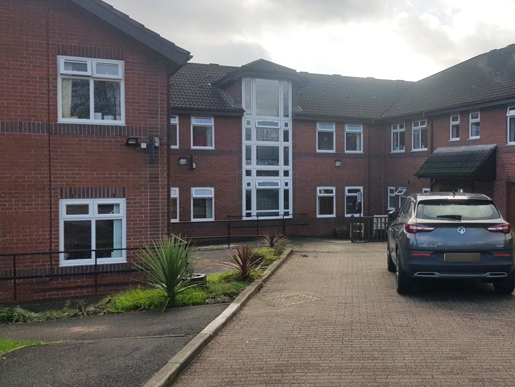
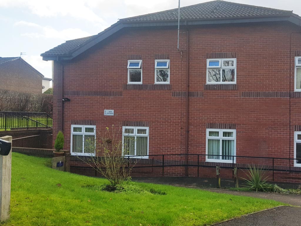
Peter Brown (1) continues touring to secure further comparative shots for this film, finding himself in a very different Waugh St with the waste ground having been absorbed into the 'Mary & Joseph House' residential care home. (RL)
- Capture 2
- 29 Jan 2022
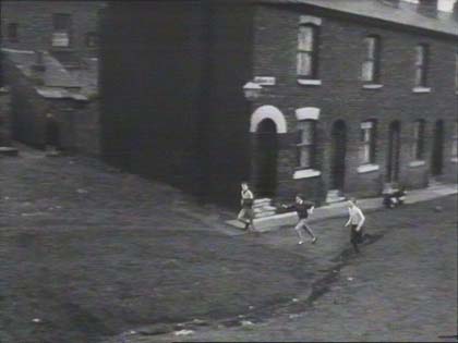
Waugh Street again, Alasdair MacLean tells us. Old maps show that this street ends with waste ground and across the road from St Marys church which was on the corner of Hillkirk and Palmerston Streets. Tony Hughes advises that the area was demolished years ago.
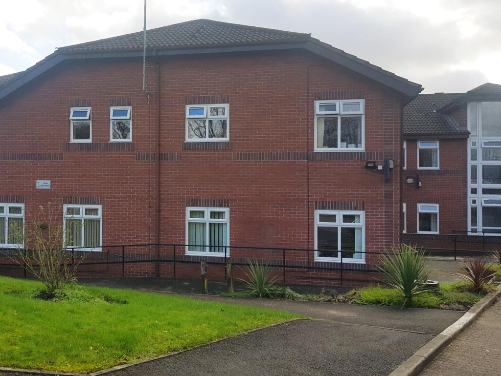
The location of the care home meant that obtaining the correct viewpoint was difficult for Peter (1). (RL)
- Capture 3
- 29 Jan 2022
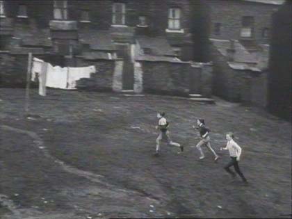
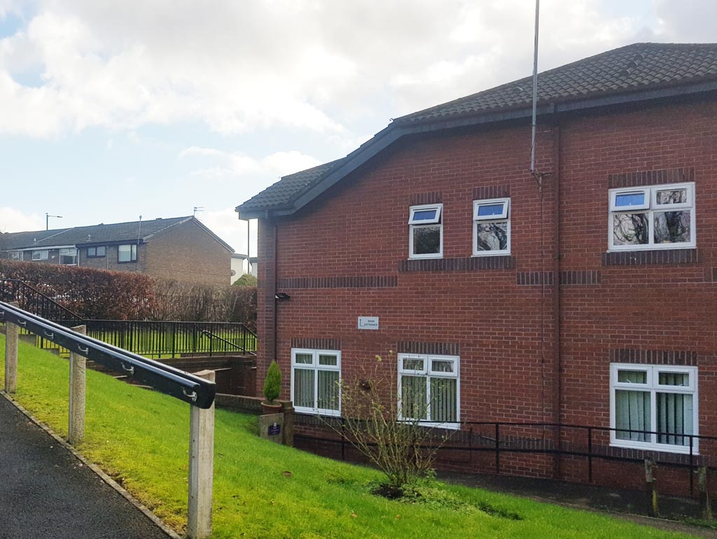
The shot continues to pan.
Peter (1) can only re-iterate what has been said elsewhere, Waugh St ran parallel to the back of Palmerston St, and today is located in the middle of the care home complex. (RL)
- Capture 4
- 29 Jan 2022
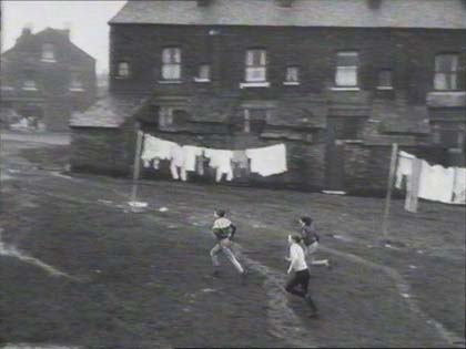
This is Hillkirk Street Market in Beswick, Lancashire with properties on Palmerston Street creating the right background.
Peter (1) points out that the white building peaking out in the background is in the same position as the gable end in the original capture. (RL)
- Capture 5
- 29 Jan 2022
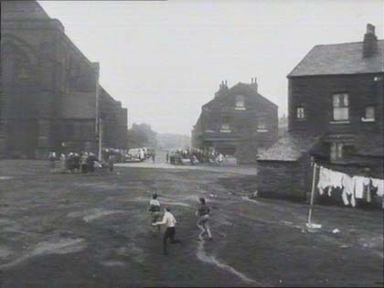
To the left stands St. Mary church at the junction of Palmerston Street and Hillkirk Street in Beswick. Andrew Nickeas grew up in Beswick and lived at 238 Palmerston Street, near where the church stood, and recalls that "The crew asked my mother to be an extra in the production, which she refused, but did allow them to come into our house to ‘brew up’ during the filming!"
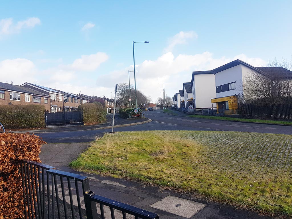
Changing position to obtain a better view, Peter (1) found that Palmerston St comes up from the right and then disappears into the middle distance. Hillkirk St crossed it at this point from left to right. (RL)
- Capture 6
- 29 Jan 2022
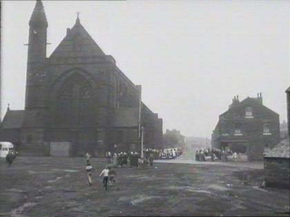
The "Lowry" church, St. Mary's on Hillkirk Road with Palmerston Street heading away in the distance. Andrew Nickeas continues "The 'rec’, as it used to be called, stood opposite St. Mary’s and was used by our gang for football matches, riding bikes, driving hand made bogies."
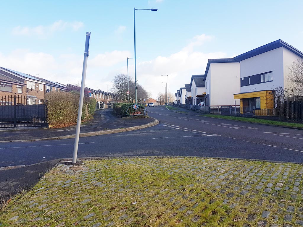
The 'Lowry church' on the left was replaced by housing in the 1960s, and the terrace on Palmerston St on the right was replaced by modern housing more recently. Peter (1) found no 'matchstalk men or matchstalk cats and dogs' whilst he was there. (RL)
- Capture 7
- 29 Jan 2022
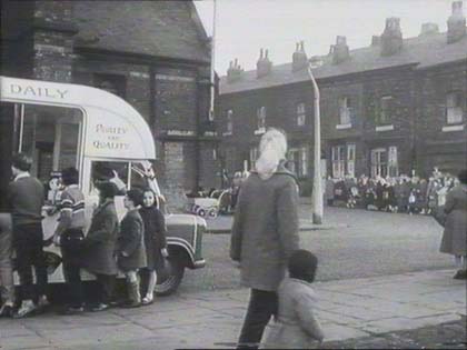
Pete also suggests kindly that the icecream van would have been owned by Conniola or Granelli, local hokey-pokey men.
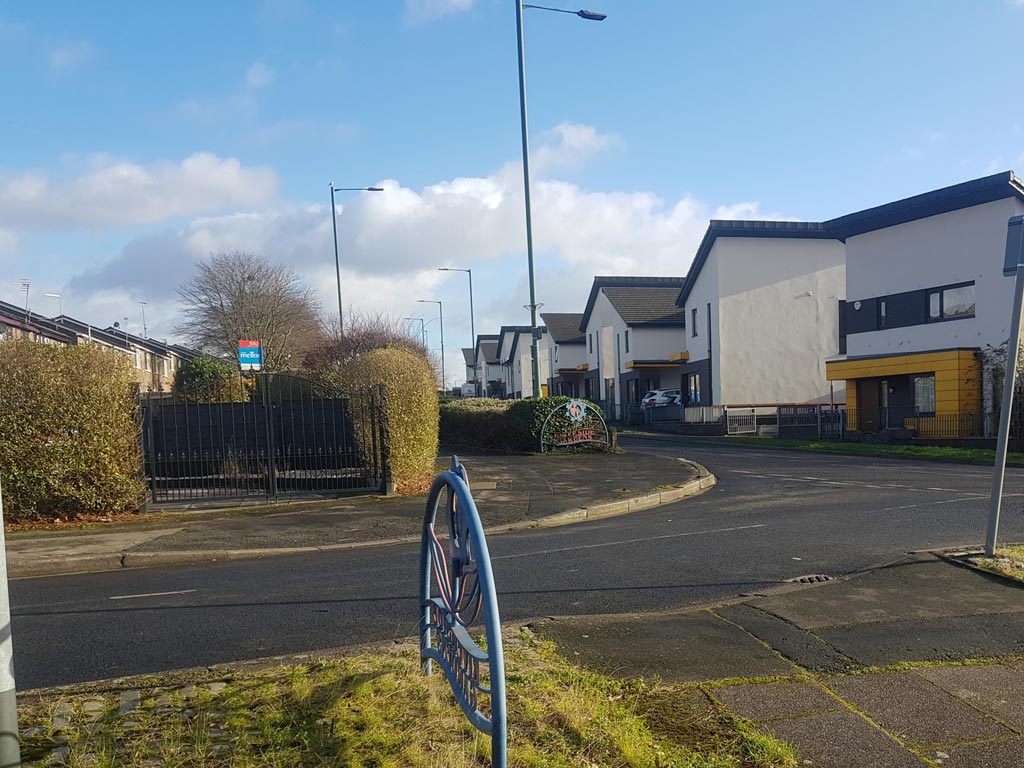
Looking across from Hillkirk St, that, Peter (1) says, has been renamed Purslow Close, to the new housing on the upper part of Palmerston St. (RL)
- Capture 8
- 29 Jan 2022
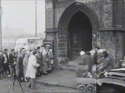
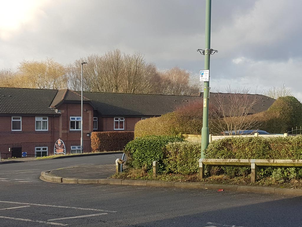
Peter's shot here provides a good explanation of the changes that have occurred. Looking back from the modern housing to Hillkirk St/Purslow Close reveals that St Mary's church is no more and that the 'Mary & Joseph House' now occupies the waste land. (RL)
- Capture 9
- 29 Jan 2022
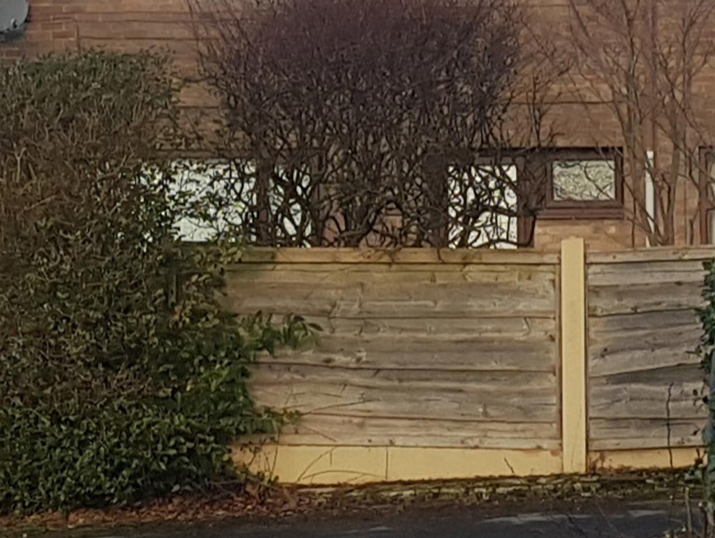
Sometimes, Peter (1) found, that the changes over the years provide a less photogenic subject. Here, a garden fence has replaced the archway of the church porch. (RL)
- Capture 10
- 29 Jan 2022
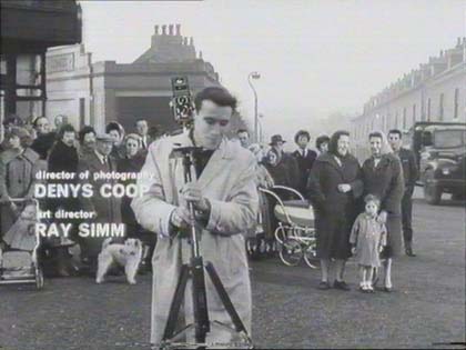
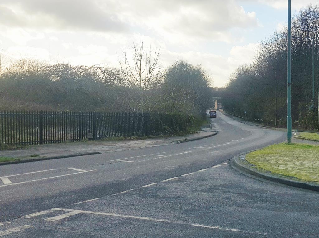
Looking south west down Palmerston St towards Manchester city centre, Peter (1) found that land once occupied by housing has reverted to nature. (RL)
- Capture 11
- 29 Jan 2022
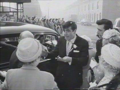
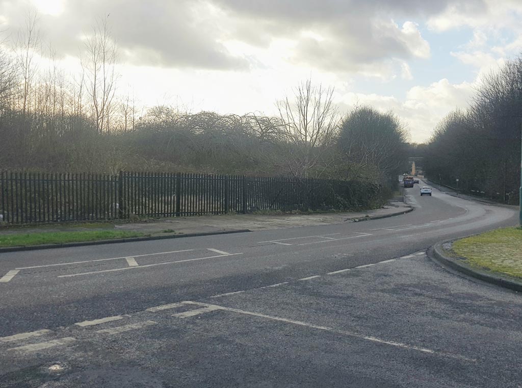
A similar shot to the previous capture from Peter (1) at the intersection of Palmerston St and Hillkirk St. North Ridge Recreation Area can now be found amongst the trees on the left. (RL)
- Capture 12
- 22 Jan 2022

The old Mullards factory, Phillips Park Road, Blackburn. Thanks to Andrew Ward.
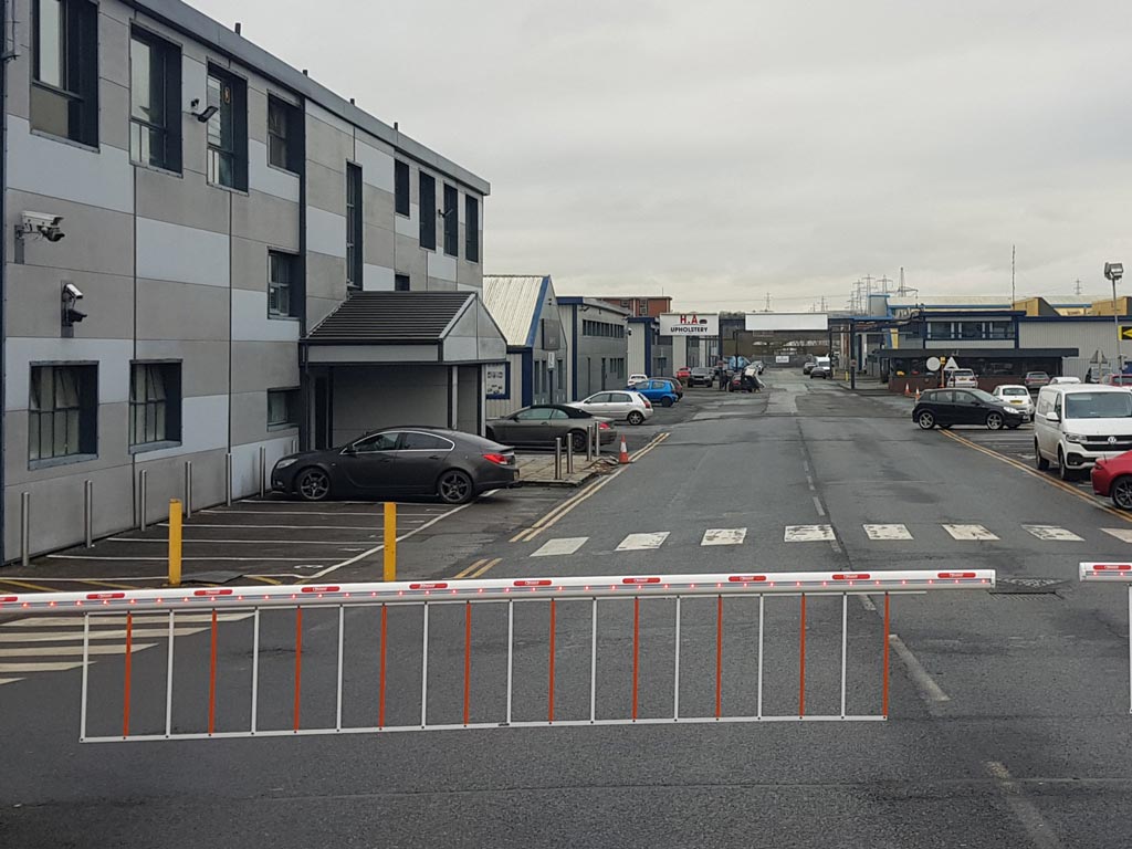
Peter Brown found that the main building on the left has had a re-clad but the overall shape of the business park is the same. Whitebirk Power Station in the background closed in 1976 and is now the site of a retail park. (RL)
- Capture 13
- 22 Jan 2022
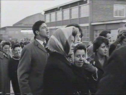
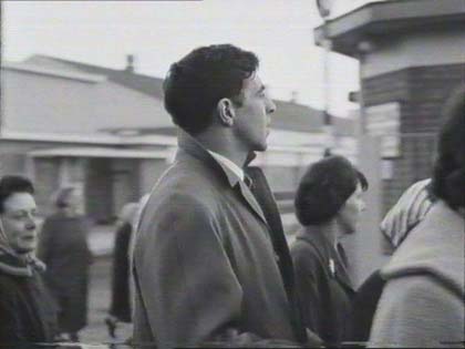
Stuart Garside advises that this is outside the Mullard Works on Philips Road in Blackburn, Lancashire.
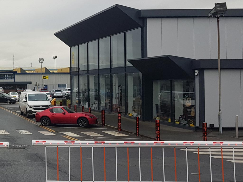
The 1950s style building on the right, which used to house Mullard's Personnel and Purchasing departments, has also had a fancy make-over and is now home to a musical instruments store. More changes noted by Peter. (RL)
- Capture 14
- 22 Jan 2022
Philips Road, Blackburn at what is now the junction of a road leading to the Glenfield Business Park. Located by Stuart Garside.
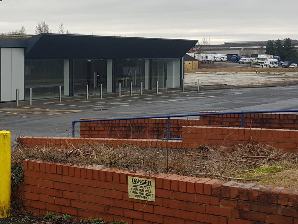
The guard house which used to control access to the Mullard site has been removed. The factory behind the Personnel building has disappeared. There always seem to be changes Peter. (RL)
- Capture 15
- Pre 2008
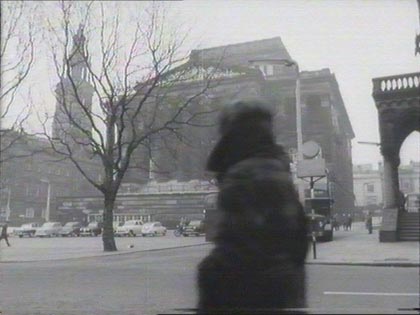
This was tagged as 'Bolton town hall' but is actually the Harris public library building in Preston according to Rick Parker.
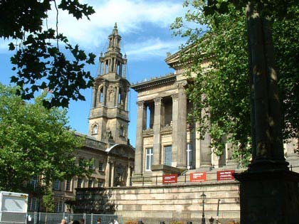
Now. The same Town Hall, snapped by Keith Livsedge.
- Capture 16
- 14 Jan 2022
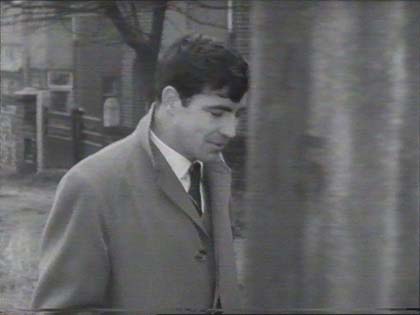
Moor Lane, Kersal, Salford, writes Ewan Lewis. I am a nerd! ( Join the club!). Using Google Earth and hours of persistence (we know the feeling) I have tracked down the scenes around Ingrid's mother's house to three roads in Kersal, near Pendlebury, Salford.
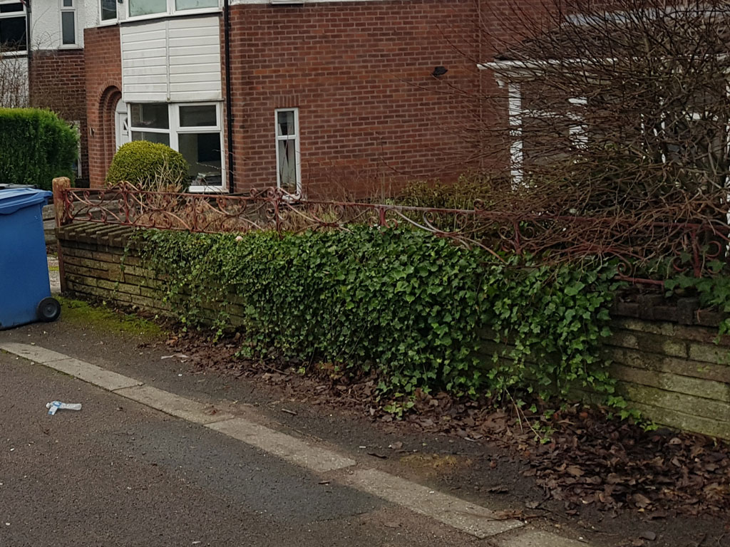
Peter Brown kindly spent some time in Kersal for us. The lamppost which partly obscures the original capture is no longer there, so we now have a clearer view of the houses on Moor Lane. Why is there always a bin?! Be grateful, it's smaller than a white van or scaffolding Peter. (RL)
- Capture 17
- 14 Jan 2022
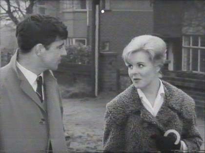
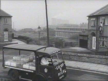
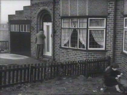
Moor Lane is the main road where the bus stops, and later where Vic hails a ride to the hospital and the actual house sits on the corner of Heathland Road, and what is now Kellbrook Crescent, a wasteland at the time of filming. Well sleuthed Ewan.
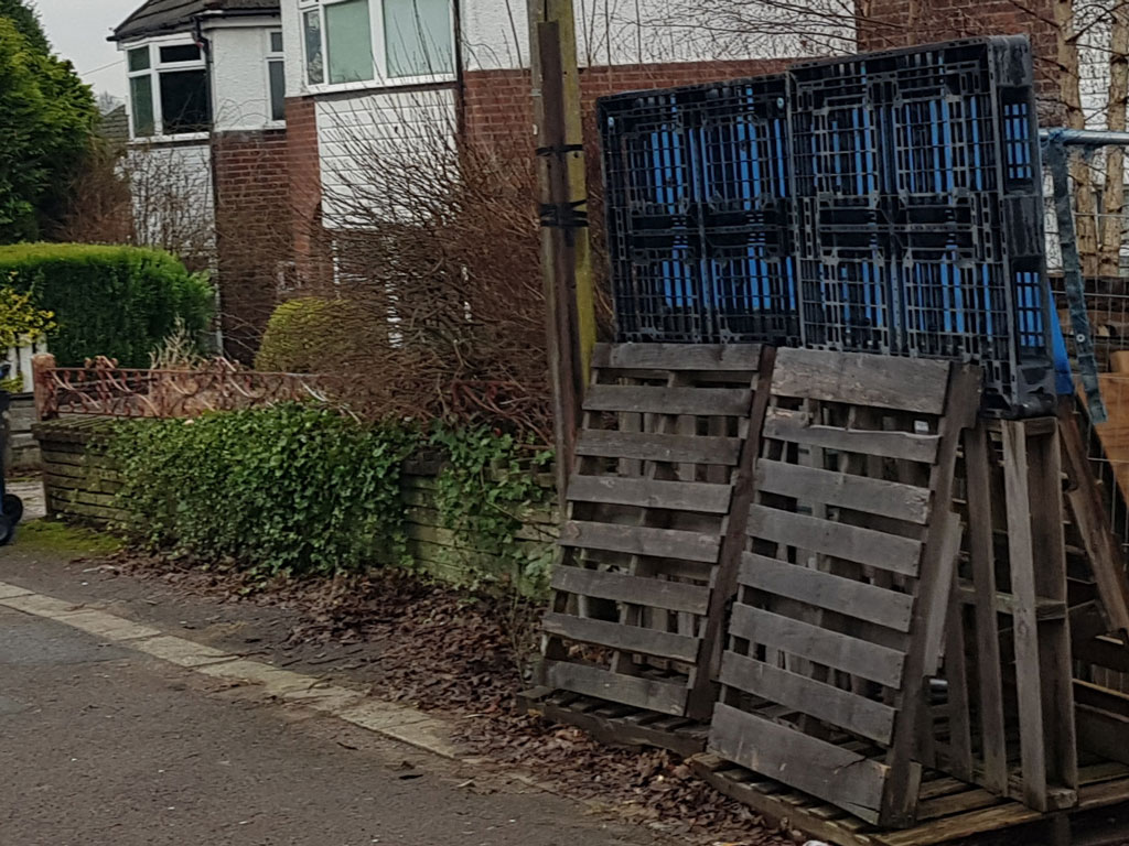
Peter used the telegraph pole as the reference point to find the exact spot, the pallets did't help at all! (RL)
- Capture 18
- 14 Jan 2022
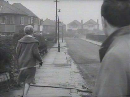
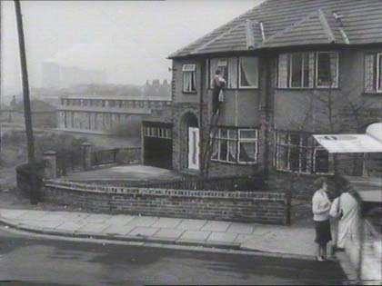
Heathland Road, Kersal, Salford. When Ingrid's house (no. 37 Heathland Road) was built, a space was created between that house and the next door neighbours house (no.39?) wide enough to become a roadway if necessary, with a view to further development. Found by Ewan Lewis.
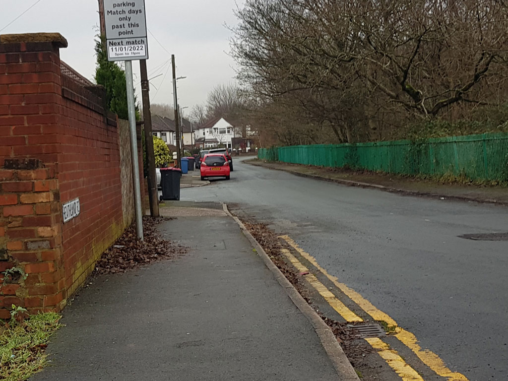
Peter found that the wall on the left prevents us from seeing the houses at the first entrance to Kellbrook Crescent, but the railings marking the boundary of Kersal Moor can still be seen on the right. (RL)
- Capture 19
- 14 Jan 2022
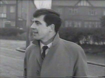
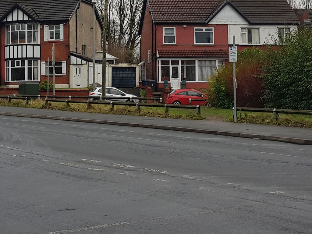
Peter looked back from Moor Lane to see the houses on Oaklands Road. (RL)
- Capture 20
- 14 Jan 2022
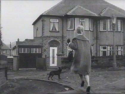
Kellbrook Crescent, Kersal, Salford. This now leads to a late-60s block of low-rise flats. Identified by Ewan Lewis.

Number 37 Heathland Road is found at the second entrance to Kellbrook Crescent, that, Peter points out, now comes with a Cordyline palm tree. (RL)
- Capture 21
- 20 Aug 2011
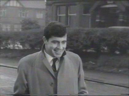
Kersal Hotel, Moor Lane, Salford. Says Ewan, (but can't see an hotel ourselves), but it is the building on the right. This was still here in 2004 when a planning application went in to replace it with modern apartment blocks. Don't know the outcome.
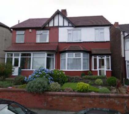
House in left background is property at 5/7 Oaklands Road. (see pic). The main building to the right is indeed Kersal Hotel, a Boddingtons pub, demolished to form part of the "Lever Court" modern low-rise apartment complex. Excellent bit of sleuthing from Loz Park.
- Capture 22
- 14 Jan 2022
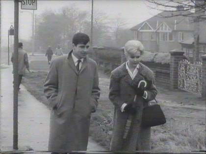
Margaret McHale identifies this as Moor Lane in Salford, Greater Manchester with the junctions of Wensley Road and Kersal Road in the left background.
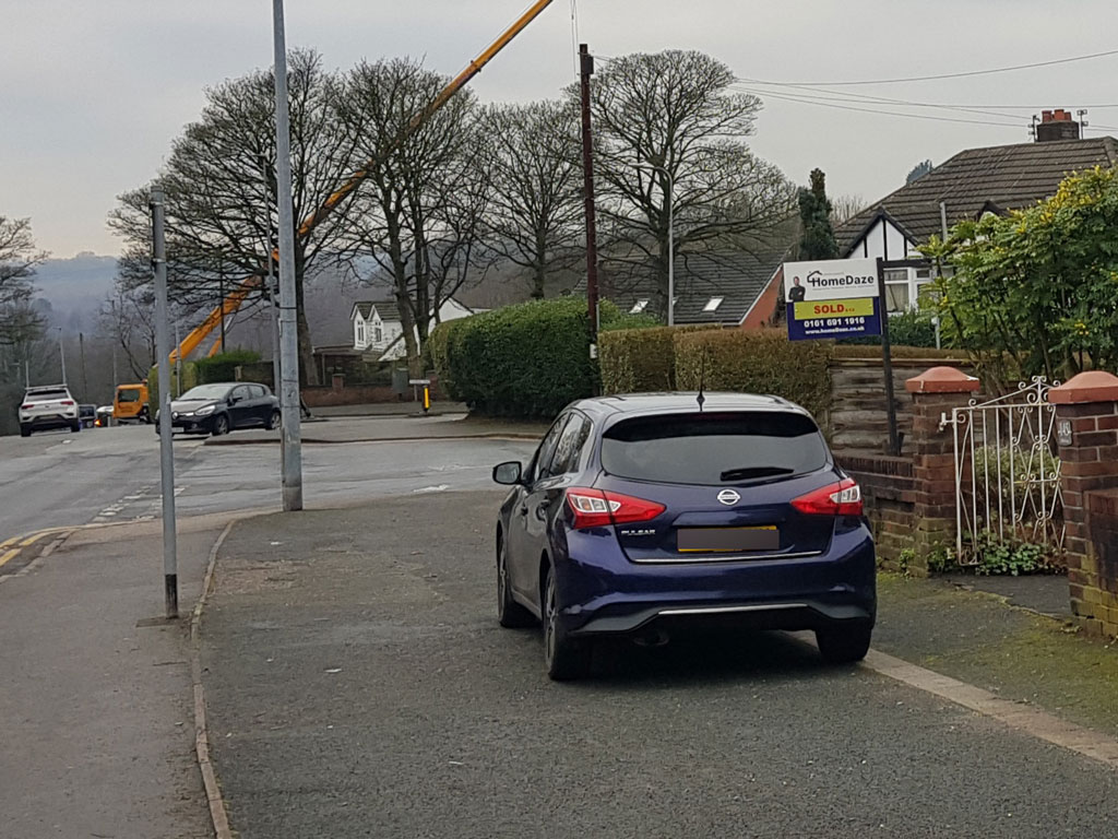
Peter notes that the bus stop is no longer present on Moor Lane, and the ever-present challenge of parked cars could not be avoided once again!
- Capture 23
- 05 Feb 2022
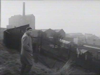
The old industrial North. Allotments on west side of Oldham Edge, above the centre of Oldham, with Oldham Brewery building in background. (Oldham Edge featured in the gambling scene and subsequent police chase in the Stanley Baker film 'Hell is a City'). Allotments and brewery building long gone and site now planted with trees. Neil Tomlinson.
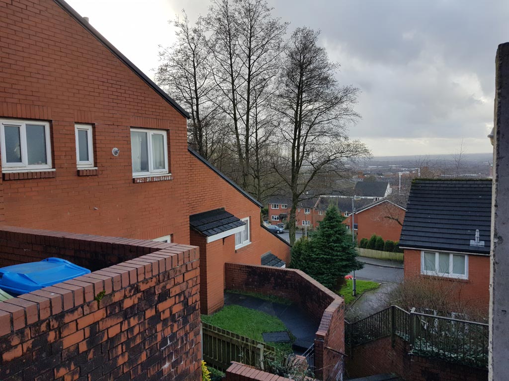
Peter Brown (1) found that the allotments have now been replaced by housing. The smaller buildings of the brewery and the retaining wall, however, are still present but are hidden behind the house on the left. (RL)
- Capture 24
- 05 Feb 2022
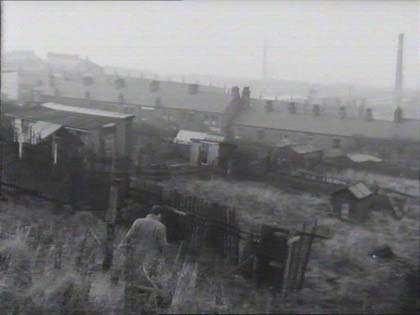
Descending down through these allotments towards rear of houses on Trinity Street, Oldham. Neil Tomlinson.
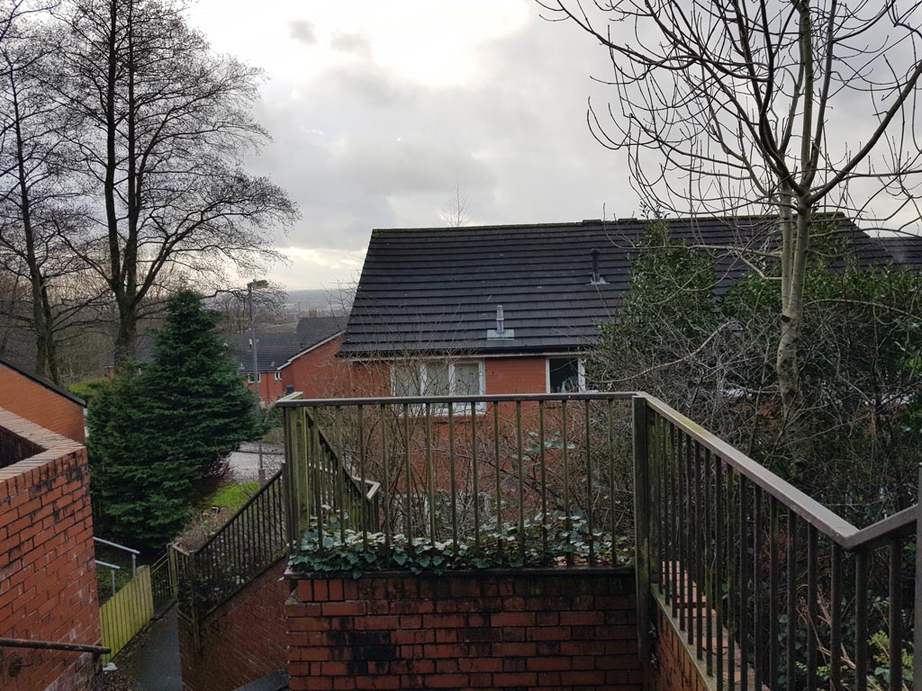
Moving down into what is now Lower Edge Ave, Peter Brown (1) found that the view of Trinity St is obscured by the new housing. (RL)
- Capture 25
- 05 Feb 2022
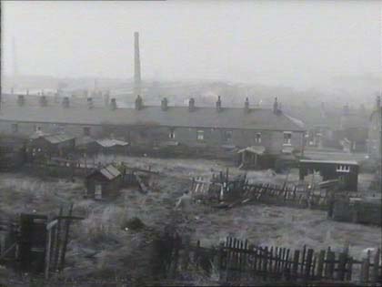
Descending further down through the allotments towards rear of houses on Trinity Street, Oldham. Neil Tomlinson.
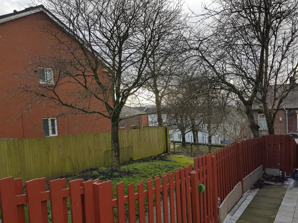
Peter Brown (1) was relieved to find that further down Lower Edge Avenue, the gap between the Victorian terraces of Trinity St is just about visible. (RL)
- Capture 26
- 05 Feb 2022
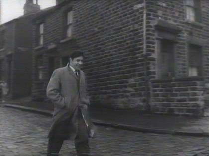
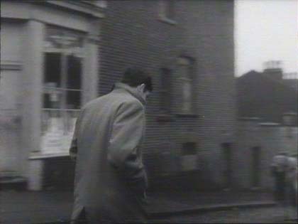
Where? Rock St, Oldham. This end of Rock St has been re-developed. Neil Tomlinson.
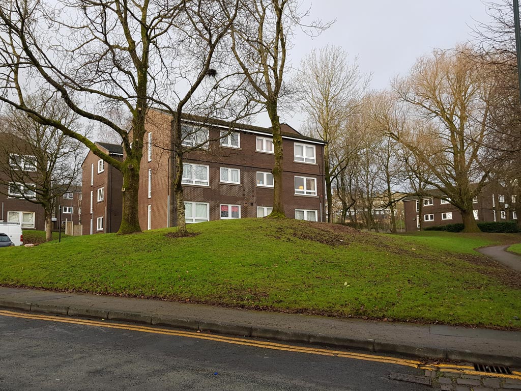
At the junction of Rock St and Beever St, Peter Brown (1) observed that flats now sit in landscaped grounds where once there was terraced housing. (RL)
- Capture 27
- 05 Feb 2022
Rock St, Oldham. This end of Rock St has been re-developed. Neil Tomlinson.
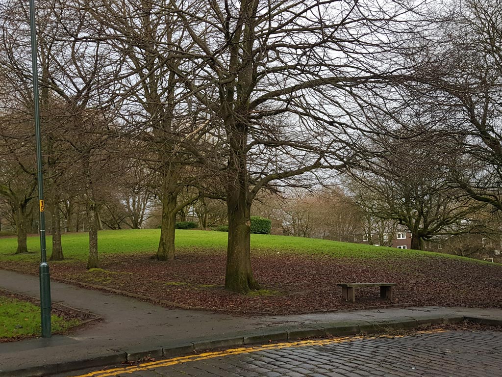
Peter Brown (1) panned his camera at the point at which Rock St starts its deep descent, to show that the corner shop has been replaced by landscaping. (RL)
- Capture 28
- 27 Aug 2016
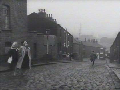
Rock Street, Oldham as was, now re-developed. Neil Tomlinson. Paul Bruffell adds that the Oldham bus garage mentioned earlier, has a rear wall that can be seen in the capture to the right of the end terrace house on Wallshaw Street. In addition, he says that Rock Street is also in 'Mrs Brown You Have a Lovely Daughter'. (RL)
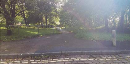
Paul sends this shot of the scene today, looking along what would have been Rock Street from Beever Street down to Wallshaw Street. (RL)
- Capture 29
- 05 Feb 2022
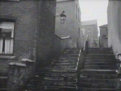
Neil Tomlinson identifies the site, Steps leading down to Wallshaw Street, Oldham, and can be seen in 'Hell is a City'.
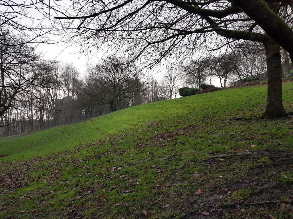
The location of the steps was particularly challenging for Peter Brown (1) as there are no identifiable features but he settled for "about here!" (RL)
- Capture 30
- 05 Feb 2022
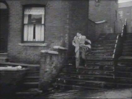
As above, from Neil.
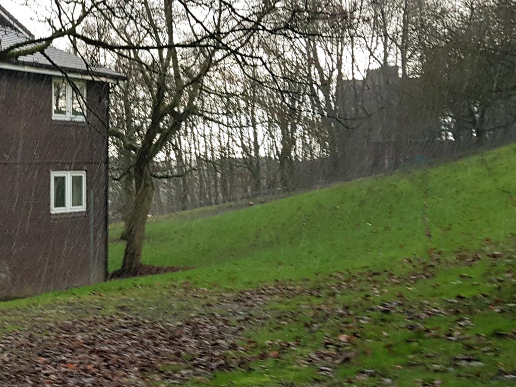
Peter Brown (1) tells us that the line of what was Wallshaw St is left to right through the building on the left. (RL)
- Capture 31
- 05 Feb 2022
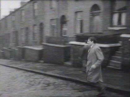
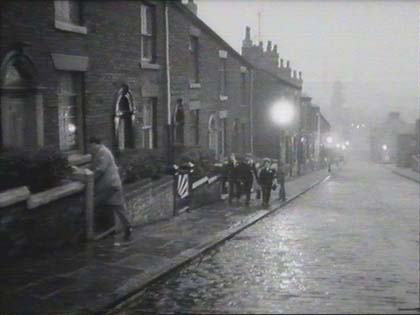
From Neil Tomlinson: Wallshaw St, Oldham. Not visible in this still, a daytime shot in the film (as Vic and his father leave the home together) shows the ornate tower of the Nat West bank at the bottom of the road and the wall of Oldham bus garage on the left at the bottom.
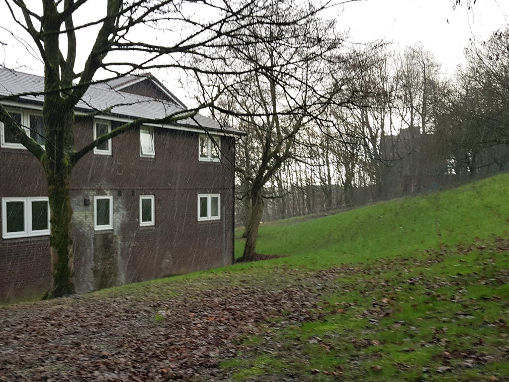
More of the building is revealed as Peter Brown (1)'s camera pans round. Wallshaw Street cut through the building roughly where the single windows are positioned. (RL)
- Capture 32
- 05 Feb 2022
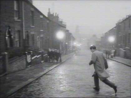
In the far distance are both the Greenbank and Commercial cotton mills on Glodwick Road. The top half of Wallshaw St, where these houses in the picture were, was built on in the 1970s and the road now only comes up as far as the rear of the bus garage. Neil Tomlinson.
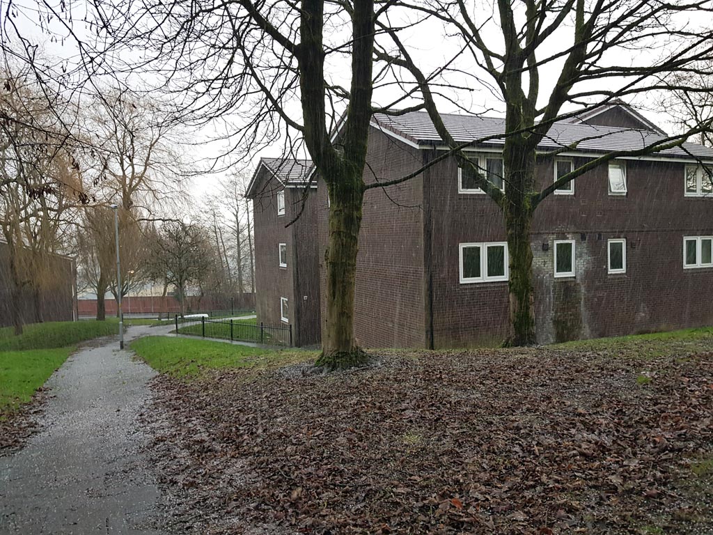
Much like the scene in the film itself, Peter Brown (1) found himself looking down Wallshaw St in a hailstorm! The view is obscured by the block of flats but the wall of the bus depot can still be seen in the background. Your attention to detail Peter is much appreciated. (RL)
- Capture 33
- 05 Feb 2022
Same street, same place, same demolition.
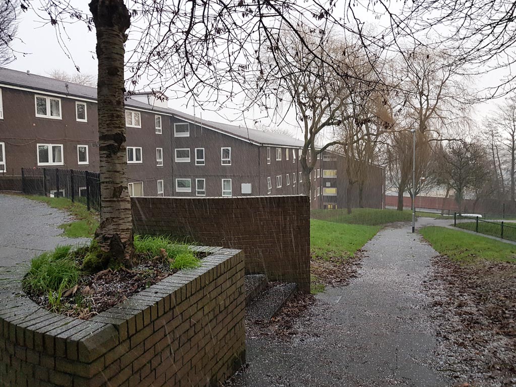
Still no view of the ornate Nat West Bank but it is still there at the bottom of Wallshaw St waiting to be redeveloped as part of the Prince's Gate scheme. That is what we call progress these days Peter. (RL)
- Capture 34
- 17 Aug 2011
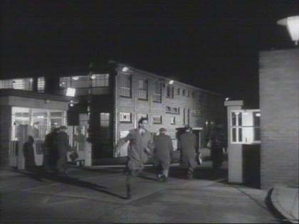
Mullards again.
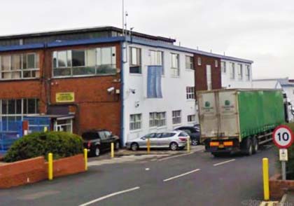
Loz Park says, Entrance to Philips Road Business Park, Microtech, who took over Mullards, having gone out of business in 2009.
- Capture 35
- 22 Jan 2022
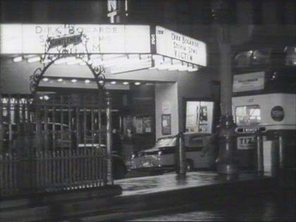
Not the Walpole in Ealing (as previously suggested) but actually in Preston directly across the road from Miller Arcade. The ornamental ironwork of the sinister underground 'Gents' is visible and is still in situ today, although the gents were bricked off some years ago. Rick Parker.
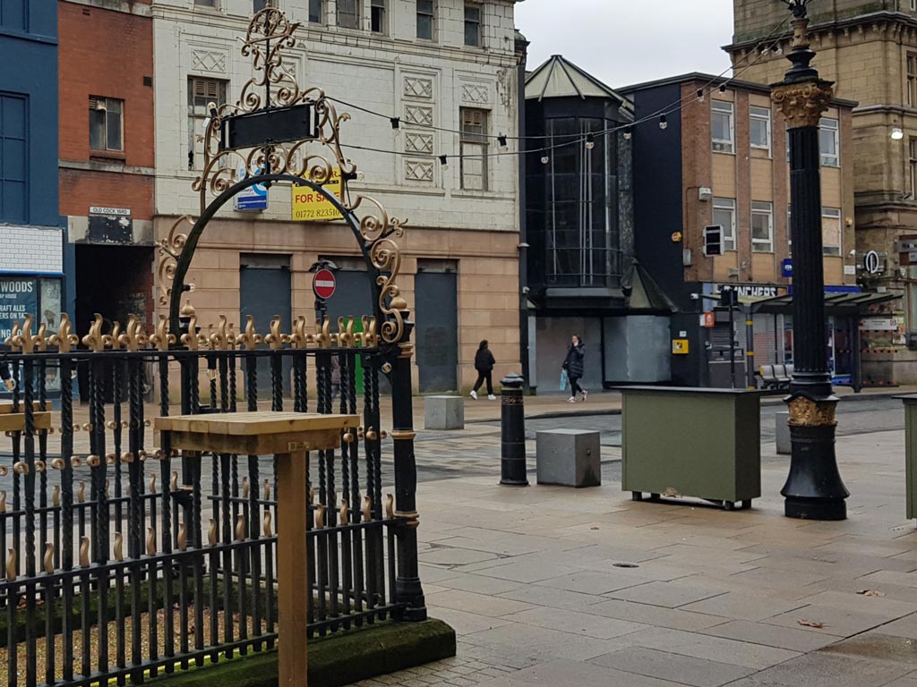
Peter found that changes have also taken place in Preston. The Gaumont cinema in Church St is seen in the original capture just before its conversion to an Odeon multiplex. The latter was eventually replaced by an out-of-town cinema and the building now awaits its fate. (RL)
- Capture 36
- Pre 2008
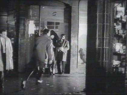
The Miller Arcade, Preston Lancs.
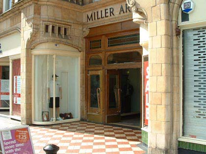
The Arcade now. Thanks to Jimmy Bron.
- Capture 37
- 22 Jan 2022
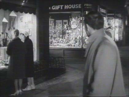
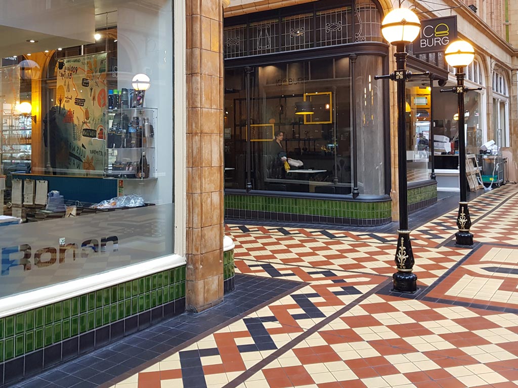
Peter has provided us with this shot of Miller Arcade to replace the previous shot that was from the wrong angle. The exit to the left is towards Jacson St (sic). (RL)
- Capture 38
- 22 Jan 2022
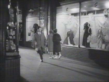
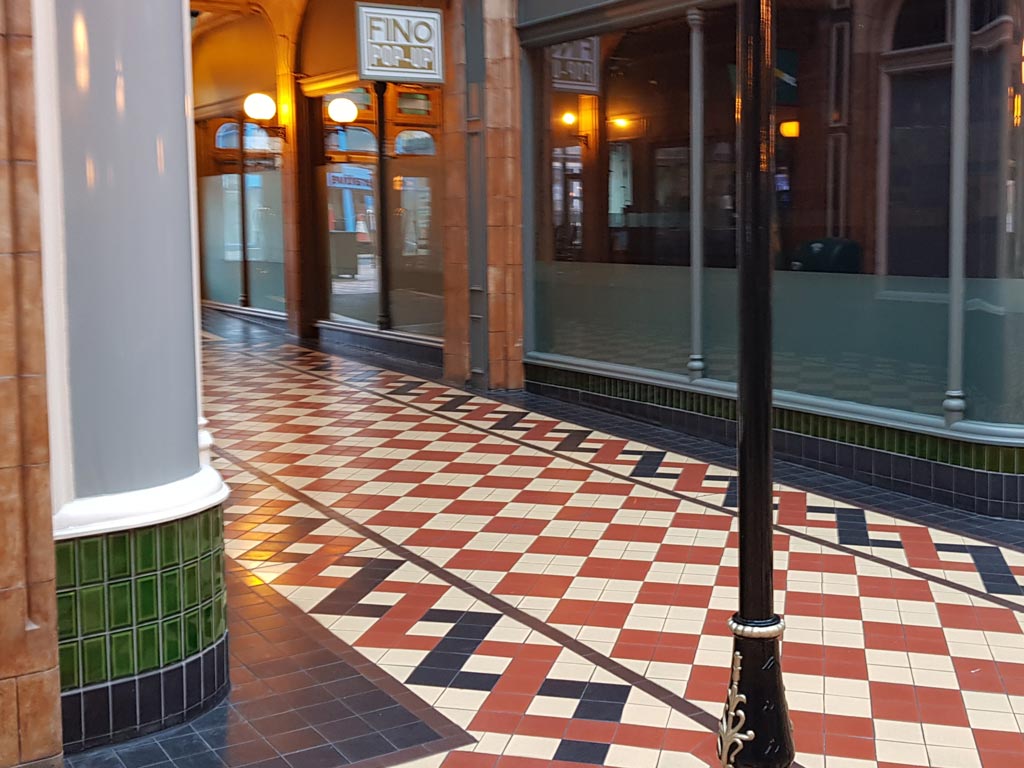
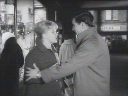
Peter provides another replacement for an incorrect "Now" photo. Vic is running into the arcade from the Church St entrance, shown here. (RL)
- Capture 39
- 22 Jan 2022
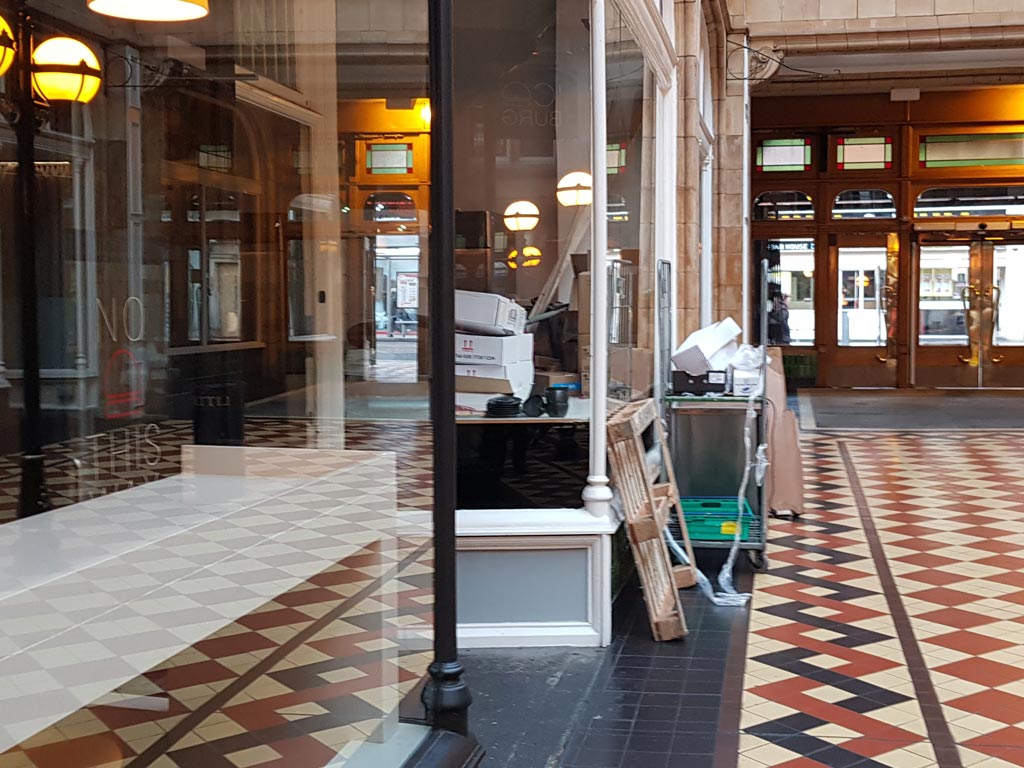
The Lancaster Rd exit is seen in the background. The shop is being prepared for its new tenant. Another from Peter. (RL)
- Capture 40
- 22 Jan 2022
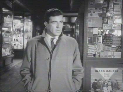
Henry Peacock confirms that the sweets kiosk here stood at the centre of the arcade. It is no longer there - seats have taken its place.
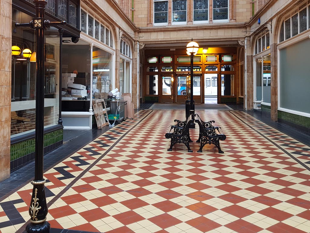
The kiosk was at the intersection of the four entrances/exits which form a cross, and would have been on the right foreground of this photo. The entrance behind the camera is Birley St. (RL)
- Capture 41
- 22 Jan 2022
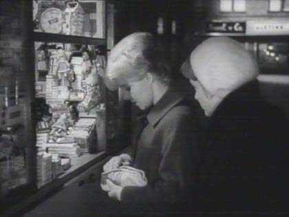
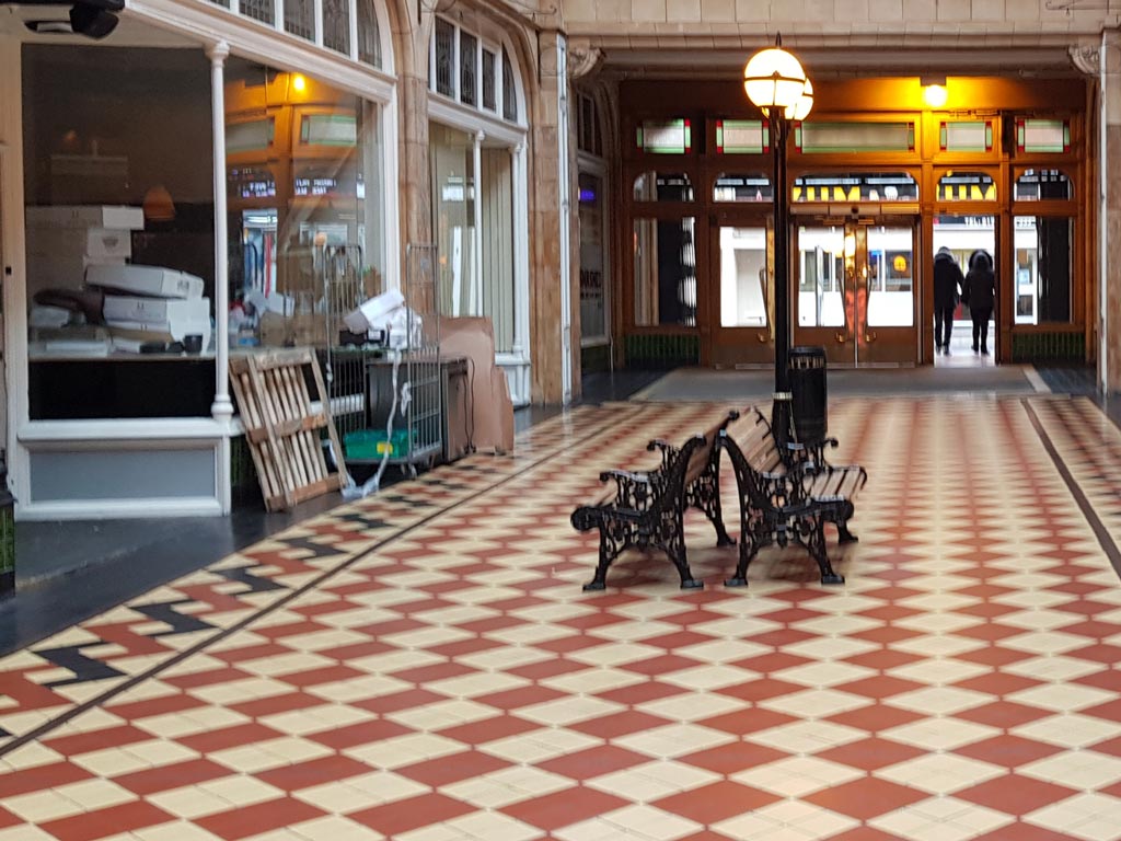
Peter says that the Lavell's kiosk would have dominated the left foreground in this photo. Once again, looking towards Lancaster Rd. (RL)
- Capture 42
- 29 Jan 2022
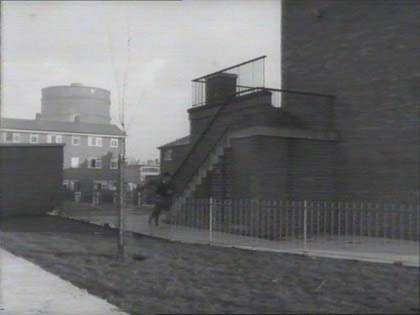
Nice gas holder in the left background, one of the "German" models, rather than the lattice work "English" style (JT). Bollington Road on the Ancoats, Miles Platting border advises Tony Hughes.
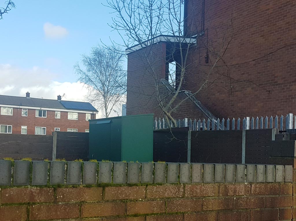
A large wall almost thwarted Peter (1) but not quite! The entrance at the top of the steps has gained a roof, and the gasometer was removed in the late 1990s to make way for the Commonwealth Games in 2002. (RL)
- Capture 43
- 16 Oct 2012
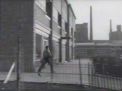
Is, or was, nearby, in the same pan. Bollington again, Tony Hughes informs us and Catherine Rogers confirms that the flats still stand.
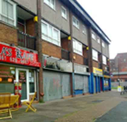
Picture from Tony Hughes.
- Capture 44
- Pre 2008
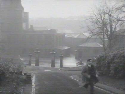
Coronation Park, Radcliffe, Manchester.
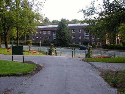
Today, excellent shot from Brian Leng, thanks.
- Capture 45
- 05 Feb 2022
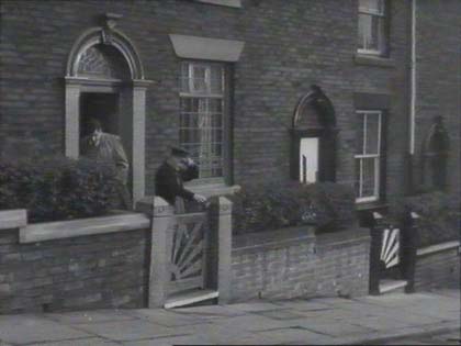
Same street seen earlier, lovely sunburst gates. Wallshaw St, Oldham. Keith Tomlinson.
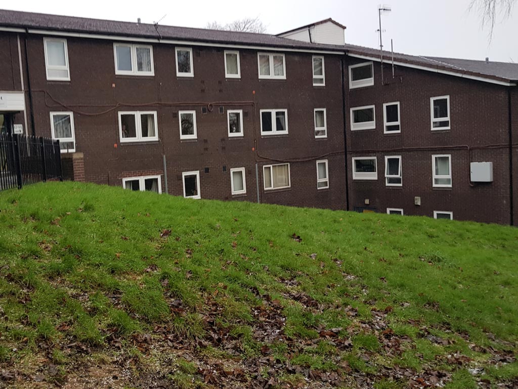
The sunburst gate has been replaced by a grassy mound. A rather dramatic change Peter (RL)
- Capture 46
- 05 Feb 2022
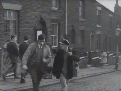
As above.
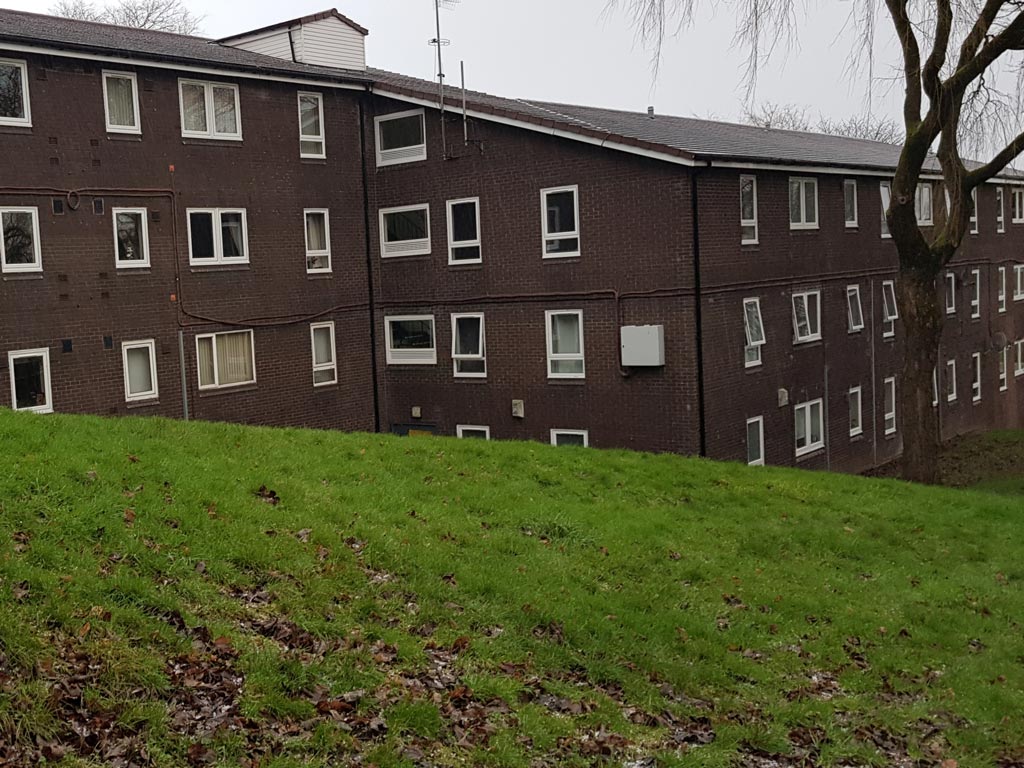
Peter Brown (1) also found that the cobbled street had been replaced by the same grassy mound. (RL)
- Capture 47
- 20 Aug 2018
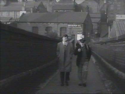
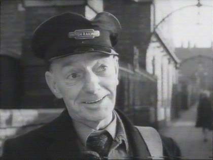
Said to be the Johnson Street Footbridge in Bolton, info from Andrew Ward. Peter Whittaker advises that the bridge here, and in later captures, is what was Gas Street Bridge that crossed the railway lines from Gas Street to Churchill Street East which is confirmed by Paul Wild who points out that other views of Oldham can be seen in "Hell is a City" as well as "The Whisperers".
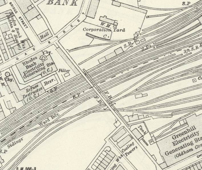
Peter Whittaker adds "I knew it very well because my father used to work as a carpenter in the Corporation Yard on Gas Street next to it and I often called in on him when walking home to Glodwick Road from Mumps Station after coming back from school in Manchester in the 1960's." In the capture can be seen a sign on the building behind Vic and his dad. Whilst a bit blurry it reads "CHRISTADELPHIAN HALL", as he remembers well, marked "Hall" on the map. Peter provides the map extract 'Reproduced with the permission of the National Library of Scotland' to support. (RL)
- Capture 48
- 05 Feb 2022
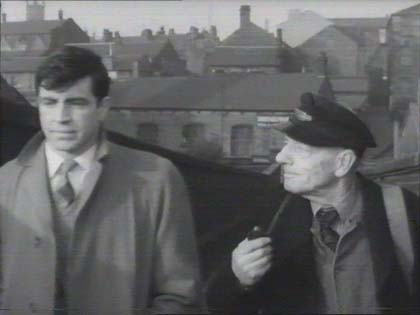
Susan Jones points out Oldham parish church in the background. (RL)
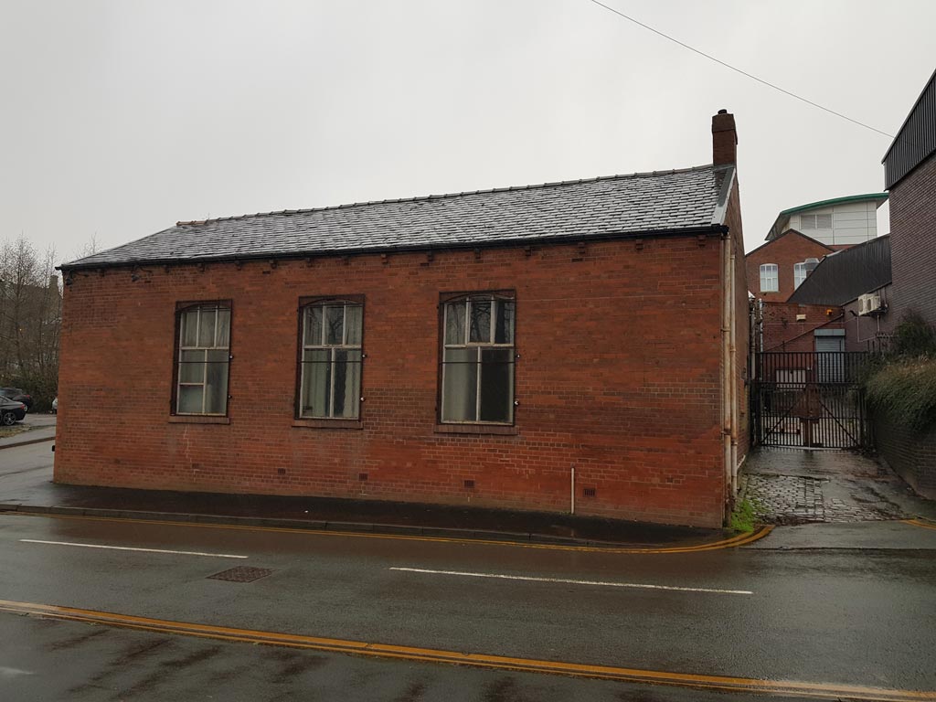
Although it is impossible to get the exact shot as the approach ramp to the bridge is severed by the A62 Oldham Way, the distinctive Christadelphian Hall and the building behind it do, nonetheless, confirm that this is Gas St (now called Rhodes Bank) in Oldham and not Johnson St in Bolton. (RL)
- Capture 49
- 05 Feb 2022
See Capture 47.
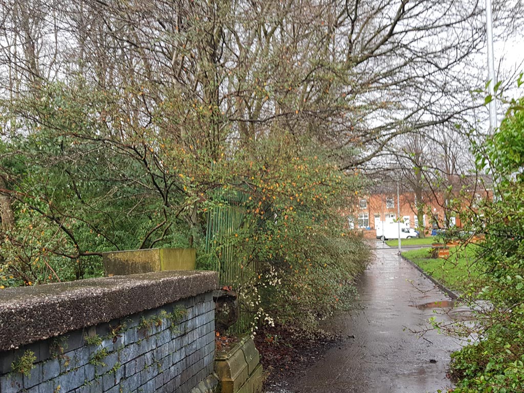
On the other side of the bridge, Peter Brown (1) took this shot looking towards the houses of Church St East with the site of the electricity station water tank on the left and the wrought iron railings marking the boundary of the electricity station are still there amongst the vegetation! (RL)
- Capture 50
- 30 Oct 2011
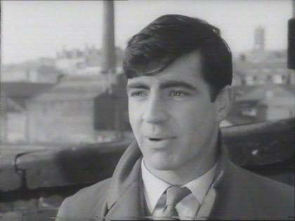
Jeremy M T Sutcliffe says; The footbridge is known as the Gas Street Bridge, Oldham, running from Gas Street to Churchill Street over the Oldham Manchester railway line and Mumps sidings.
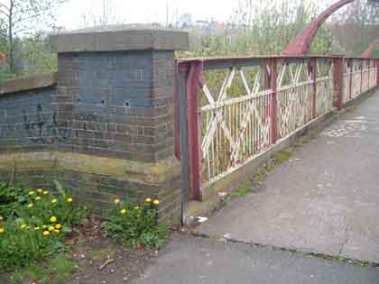
Nice bit of wall from Geoff Smith, Mumps bridge.Jim Weir has taken the time and trouble to clarify the name of the bridge. Whilst it might be referred to "Mumps Bridge" by some locals because it extended over Mumps sidings it is actually Gas St. Bridge as stated by Jeremy Sutcliffe. Gas Street Bridge, he says, originally ran from Churchill Street to Gas Street which no longer exists. Mumps Bridge was a railway bridge carrying trains from Oldham to Rochdale and was demolished in 2013 to make access for the tram (Metro Link) system.
- Capture 51
- 20 Apr 2011
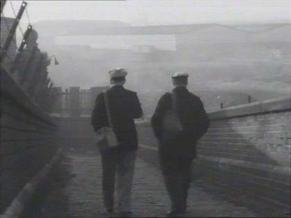
Mump's Bridge, says Geoff Smith.

Pathway to Mumps Bridge, proved with an excellent photo, by Geoff Smith.
- Capture 52
- 12 Feb 2013
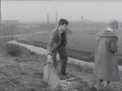
A canal and chimneys. The Irwell Valley, according to Brian Leng, but really no hard architectural evidence, so the jury is still out. However, S. Green says "I believe this is grassland at the side of Radcliffe New Road overlooking the River Irwell. In the film you can see part of Pioneer Mills and East Lancs Papermill, both of which were in Radcliffe. The River Irwell runs at the bottom of the grassed area and across the river is what was known as the Radcliffe Ees, now almost level with the grassed area having been used as a tip for many years!" Geoff Turner adds that this is an area known locally as Sailor Brows in Radcliffe above the River Irwell. Peter Brown grew up in Radcliffe, where this film is part of the town's folklore, and updates us that the grassland overlooking the river is now covered by trees and the river can no longer be seen while the chimney of Pioneer Mill is the only one that remains.
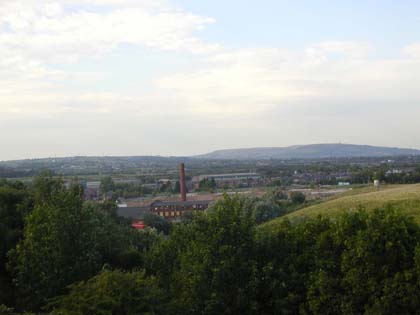
All four contributors agree that it's the Irwell Valley but is this the right location and angle?
- Capture 53
- 'Now' required
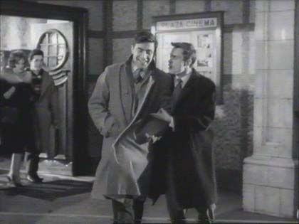
Or is this the Walpole Cinema in Ealing?
- Capture 54
- 05 Feb 2022
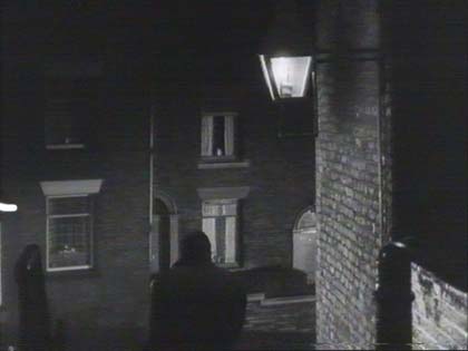
Seen earlier and identified by Neil Tomlinson.
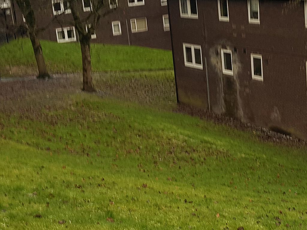
Risking life and limb in the hailstorm, Peter secured this daytime shot of the location of the steps. We are appreciative Peter, thank you. (RL)
- Capture 55
- 05 Feb 2022
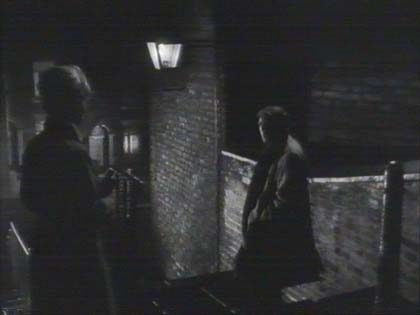
As above.
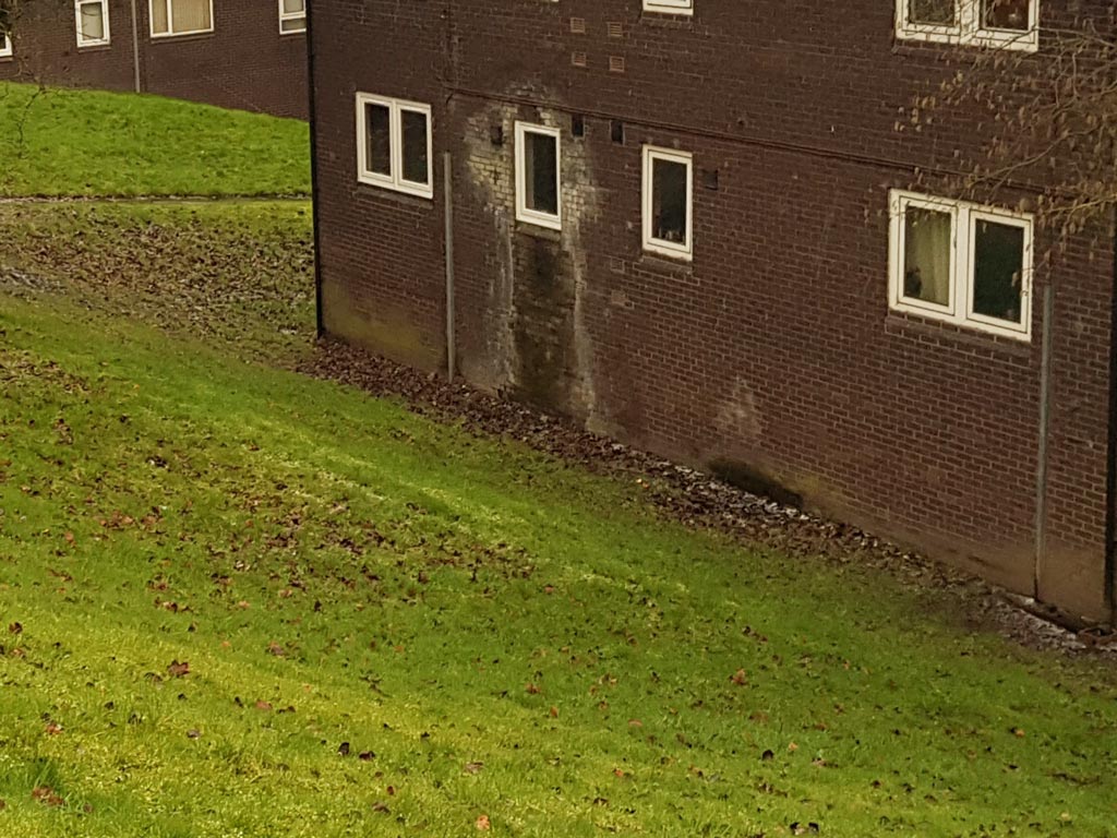
Peter was determined to find route of Wallshaw Street and took another daytime shot showing that it ran roughly along the line of the path at the back of this shot, and passed through this building approximately where the two single windows are positioned. (RL)
- Capture 56
- 'Now' required
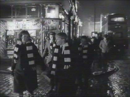
Imagine James Hartley's surprise when he came across ReelStreets to see himself featured in this capture. Recalling the moment, James tells us that this was filmed outside Frank Picks chemist on the corner of Cliviger Street at the junction of St. James's Street, Church Street and Yorkshire Street in Burnley, Lancashire and goes on to say "I remember that several friends and myself had been recruited from school to play extras in the film including scenes shot at the Mullard Factory where I was upset as, being a Burnley supporter, I was required to wear a Bolton scarf!" In the left background stands the still extant number 2 St. James's Street.
- Capture 57
- 22 Jan 2022
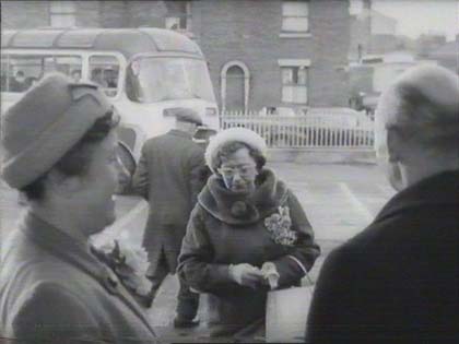
The Bus station shown is the old 'new' bus station in Preston Lancashire where the long distance coaches used to depart from. It was demolished in the mid 60s to make way for the, then, largest bus station in Europe, which opened in 1968. Good info from Tony Downing.
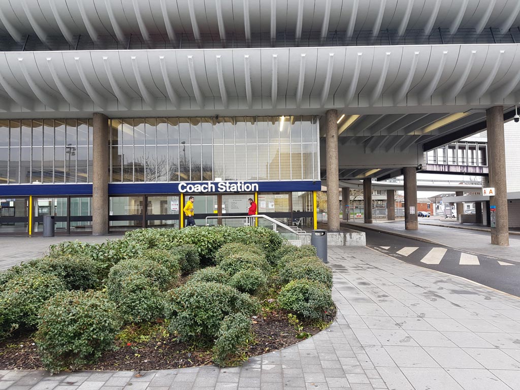
Peter took this shot of the once hated but now much loved 1968 bus station that sits on the site of the houses on North Rd. A public square has been built on the former concourses of the original Express Bus Station and the 1968 incarnation. (RL)
- Capture 58
- 22 Jan 2022
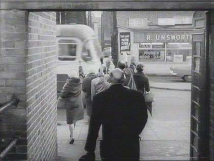
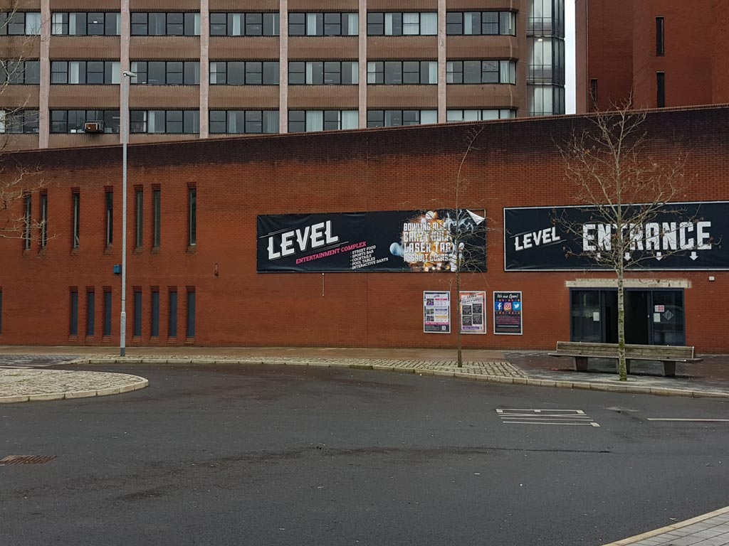
Peter informs us that Lord St ran at the side of the original bus station and has been renamed Lord's Walk. The shops were removed to make way for the rear of the Guild Hall complex. (RL)
- Capture 59
- Pre 2008
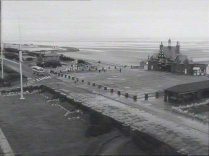
No actors, unless you include buses. Stew Riley recognised St. Anne’s pier in Lytham St. Annes, Lancashire adding that the pier is still in use and with little changed. Michael Klaw tells us "There was no one in sight because, as the 2nd Assistant Director and then 3rd Assistant on this film, I had in fact paid the pier master to lock everyone on the pier for a few minutes so as to get the shot As a result I was accused by the wife of a local bigwig, who was on the pier at the time, of 'unlawful arrest' and a policeman arrived later, while I was dining, to ask me to 'assist with his enquiries' because of event!!"
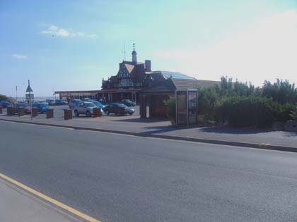
Brian Leng took this one, thanks Brian.
- Capture 60
- 23 May 2022
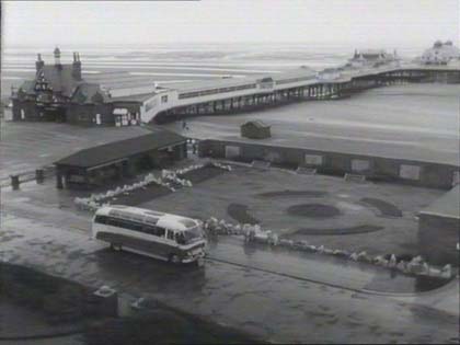
Looking onto St. Annes pier from the now demolished Hotel Majestic. Location confirmed by Stew Riley. The pier also features in 'Mrs. Lowry and Son'.
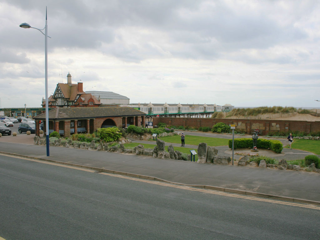
No being able to have the benefit of the said hotel bedroom Gregor Gillespie climbed a wall to get as much height as possible to take this shot for us. The man in the center of this shot is taking a picture of Gregor on the wall to prove the point, we have it on record as evidence! (RL)
- Capture 61
- 14 Jan 2022
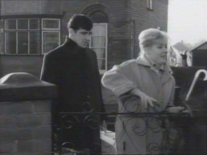
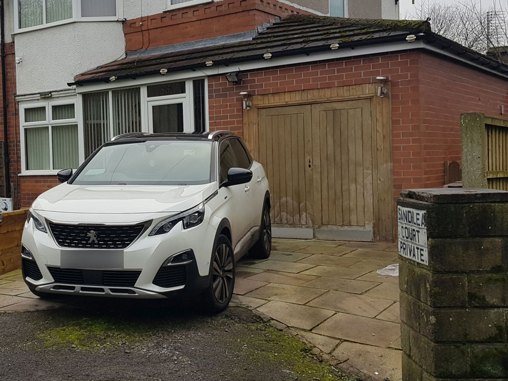
Looking back from Ingrid's house, Peter found number 22 Heathland Road with additions. (RL)
- Capture 62
- 14 Jan 2022
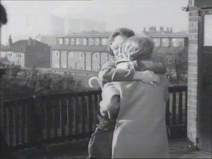
Cooling towers of Agecroft power station on the skyline behind Ingrid's mother's house on Heathfield Road, sadly, like much of our industrial heritage, it has been bulldozed. Sleuthed by Ewan, and our thanks to him.
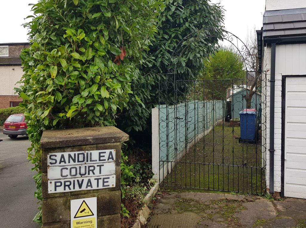
Peter found that there is no longer a view to Agecroft but the development of Kellbrook Crescent into Sandilea Court can just be made out on the left. (RL)
- Capture 63
- 14 Jan 2022
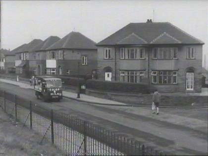
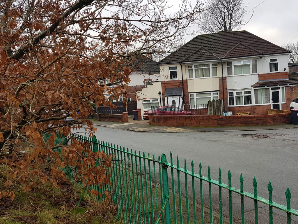
Peter provides a replacement comparative shot to that sent by 'redair' back in 2011, that, incorrectly was of Nos. 17 & 50 further down the road from Kellbrook Crescent. This correct shot is from the edge of Kersal Moor, looking across the railings to Nos. 11 & 22 (a strange numbering system). (RL)
- Capture 64
- 14 Jan 2022
The houses are angled inwards from Heathland Road, Kersal, so at the time of filming in the early 60s there was a patch of land with no development on it, right beside and behind the house; what exists on that land now is Kellbrook Crescent, built in the late 1960s when it was created for the Heath View development of low rise flats that stand on it now.
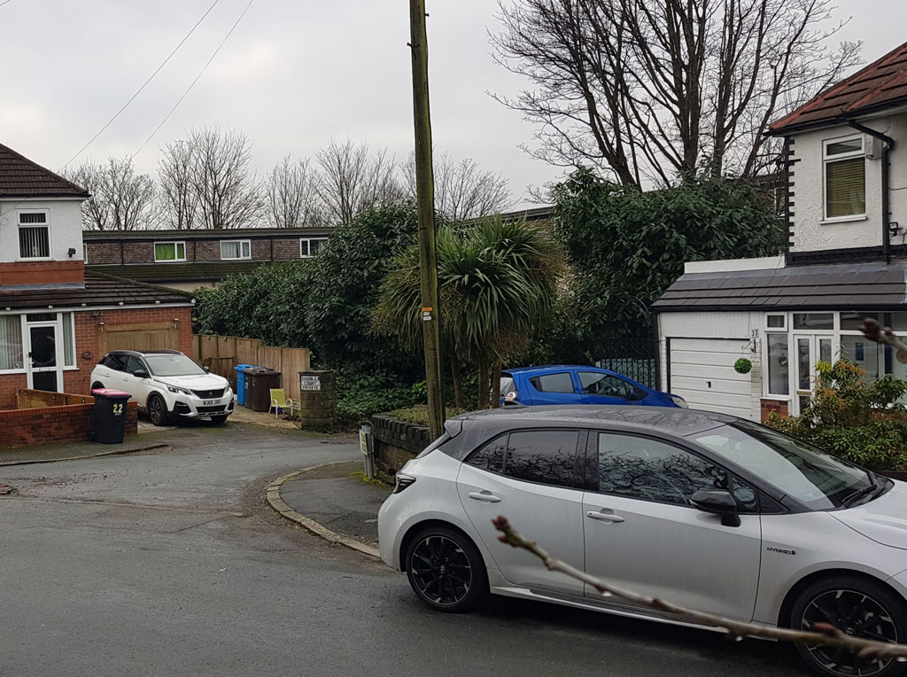
Peter provides this shot to replace a Google Earth View that has out stood since 2009, incorrectly attributing Ingrid's house to the first Kellbrook Crescent entrance instead of the second. He is nevertheless very grateful to other contributors though as he would have never found this location in a million years! This comparative shot of his shows how the gap between Nos. 22 & 37 was developed, with Sandilea Court appearing beyond the trees. (RL)
- Capture 65
- 14 Jan 2022
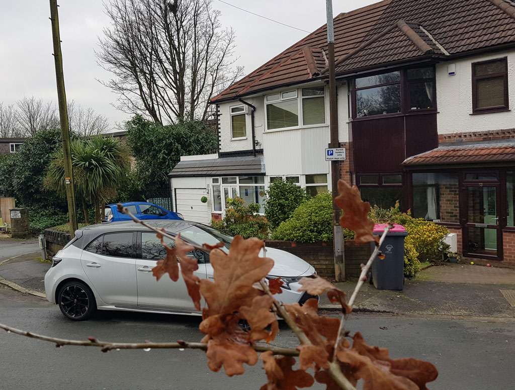
Annoyingly, the branch of an Oak tree sneaked its way into Peter's shot of number 37 Heathland Road. (RL)
- Capture 66
- 14 Jan 2022
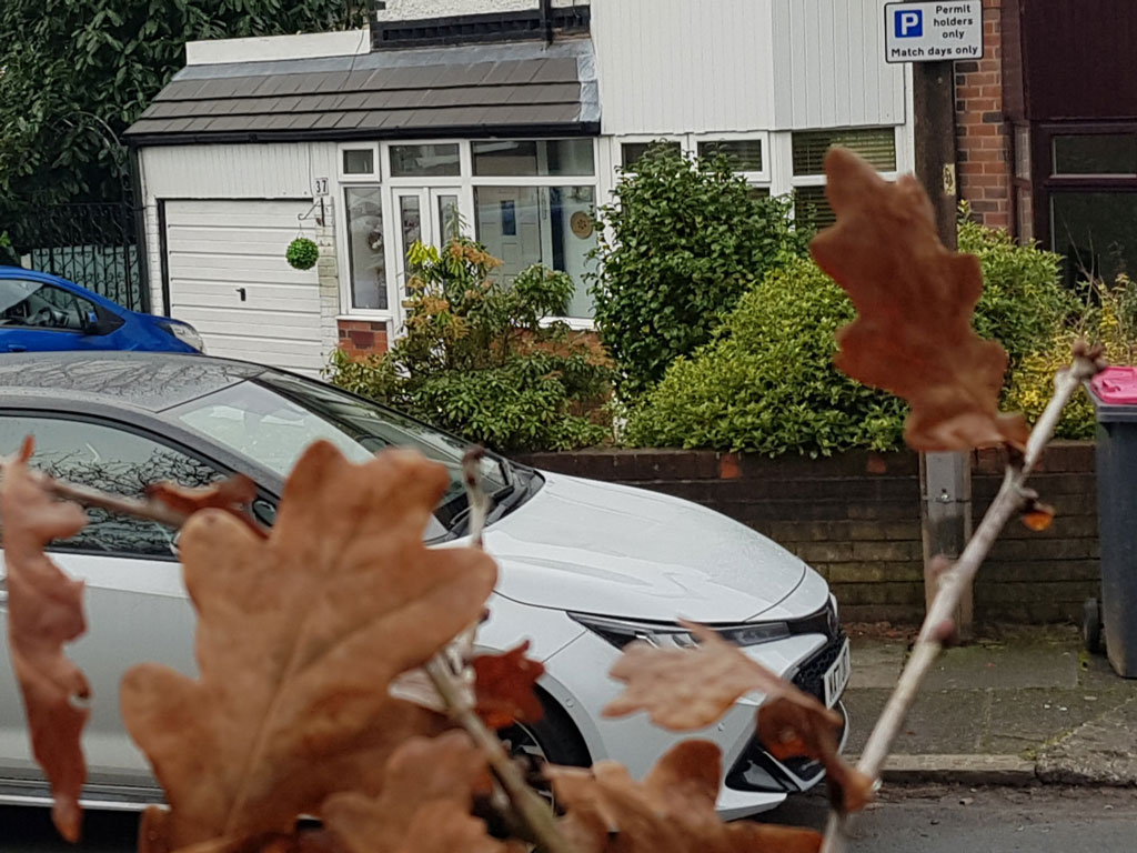
Peter apologises for a rather cluttered scene featuring the Oak tree and a parked car in this close up of house no. 37. You managed to capture a wheelie bin as well! (RL)
- Capture 67
- 14 Jan 2022
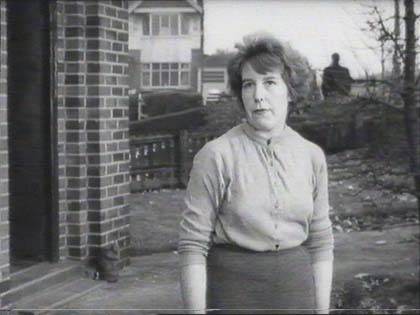
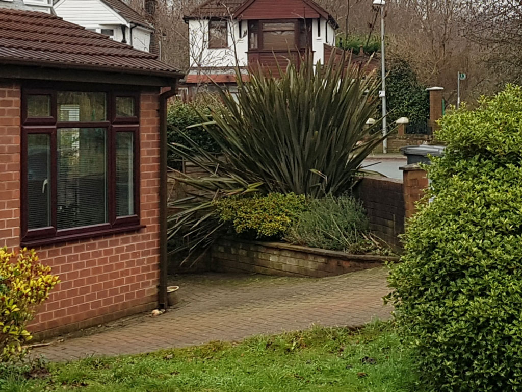
Looking from No. 37 Heathland Road, we see that the neighbouring No.13 (that numbering system again!) has had a porch extension, and a Phormium plant gives the garden a more exotic feel. Thank you Peter for the horticultural input once again. (RL)
- Capture 68
- 14 Jan 2022
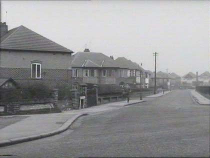
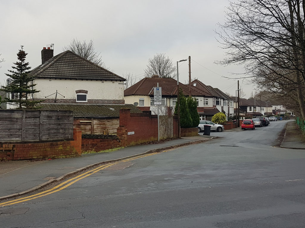
Peter returns to Moor Lane, to see that Heathland Road has retained its general shape. (RL)
- Capture 69
- 14 Jan 2022
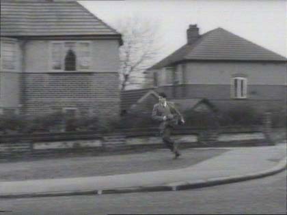
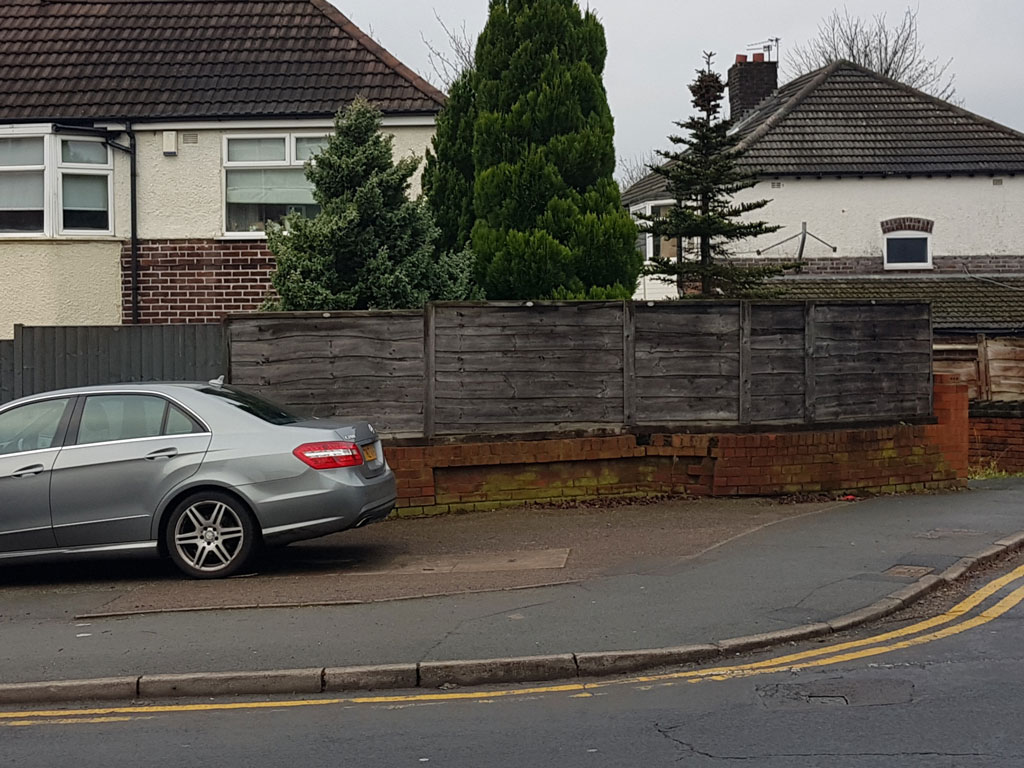
Peter found another parked car but it doesn't interfere too much with the view of the Moor Lane/Heathland Road junction. (RL)
- Capture 70
- 14 Jan 2022
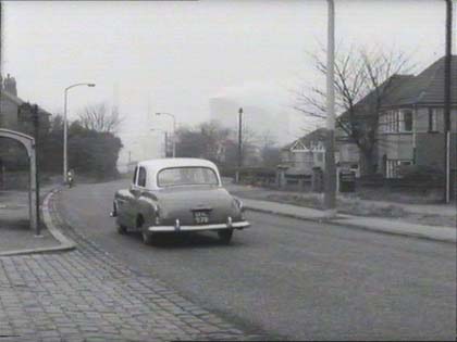
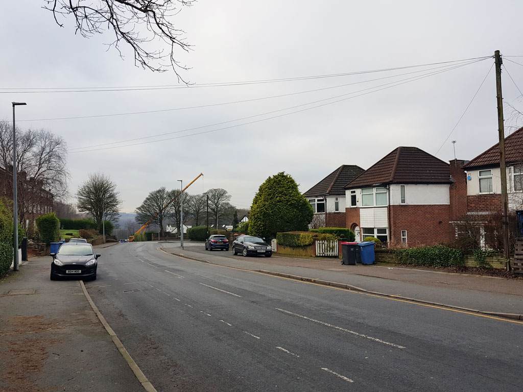
Looking down Moor Lane towards Agecroft, Peter notes that the smoke from the power station, the bus stops, and a lamppost have disappeared but the telegraph pole remains, along with the houses, of course. (RL)
- Capture 71
- 13 Jan 2022
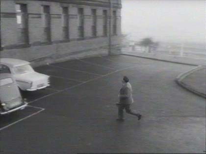
Blackburn Royal Infirmary, Bolton Road, Blackburn. Thanks to Jason Brewer.
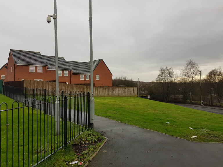
The site of the hospital and car park has now been redeveloped into housing. (PB)
- Capture 72
- 13 Jan 2022
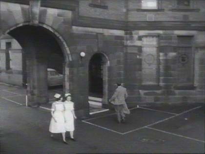
Blackburn Royal Infirmary again.
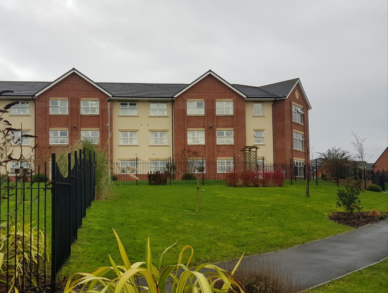
A care home now occupies the site of the main entrance to the hospital. (PB)
- Capture 73
- 07 Feb 2019
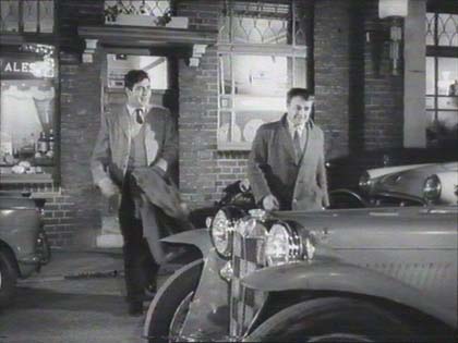
The Queen Victoria public house, but where? Antony Blair reckons that this Queen Victoria is now called The Grove and stands at the corner of Grove Road and Ealing Green in Ealing, Middlesex.
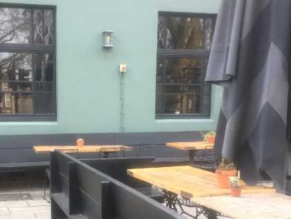
And here's Antony's proof.
- Capture 74
- 07 Feb 2019
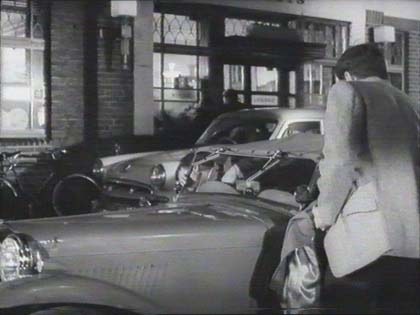
The Queen Victoria is now called The Grove in Ealing recognised by Antony.
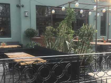
The right hand side of the front of the pub captured by Antony.
- Capture 75
- 07 Feb 2019
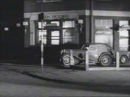
Antony Blair identifies this as the Queen Victoria in Ealing W5.
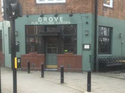
Antony took this modern view, just across the green from Ealing Studios.
- Capture 76
- 05 Feb 2022
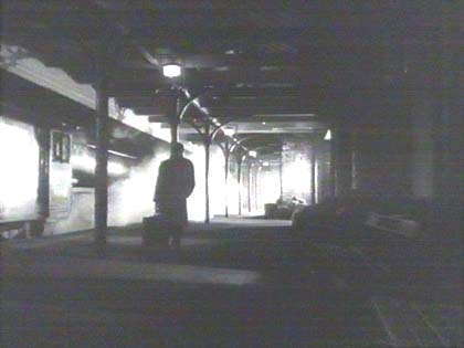
One suggestion is Brentford station but David Fox believes this to be Oldham Central station with the pattern of the cast iron canopy supports and the transverse roofing being distinctive. The station stood at the corner of Wellington Street and Clegg Street and closed in 1966.
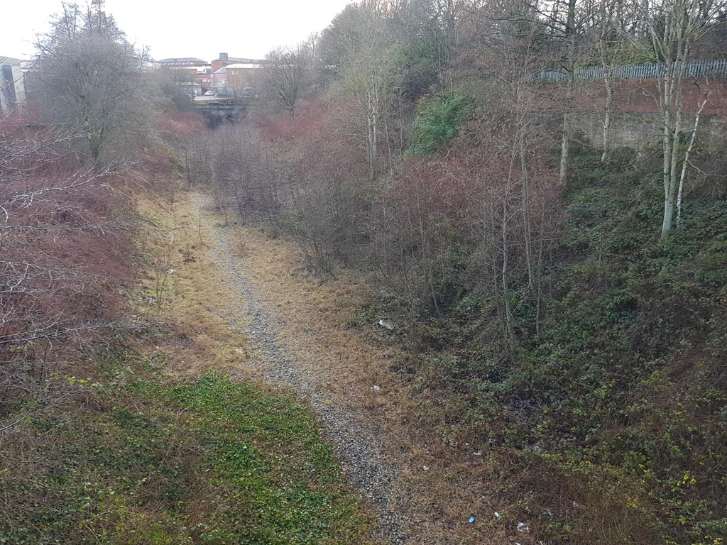
Peter provides this shot of what was the site of Oldham Central Station. The station was closed in 1966 but the line remained in use, latterly for Metrolink trams, and was finally closed in 2014 when the trams were moved to a different street-running route in the town centre. (RL)
- Capture 77
- 21 Aug 2014
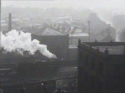
Is this, was this? Johnson Street footbridge in Bolton?
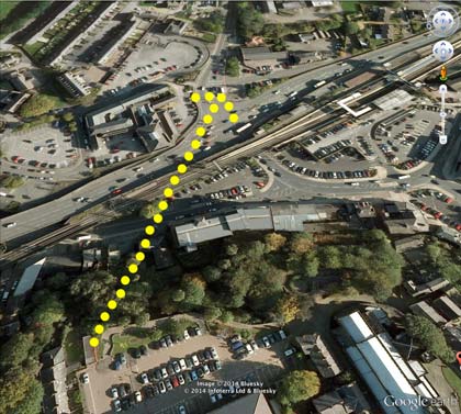
No, Paul Hibbert has identified this as the London to Manchester line (Stoke to Cheadle Hulme Branch). The still is taken from a vantage point known as Sparrows Park at the rear of the Parish Church of St. Michael, Macclesfield. More information and background from Paul can be read in the panel at the head of this page and this Google Image is given to support.(RL)
- Capture 78
- 22 Aug 2012
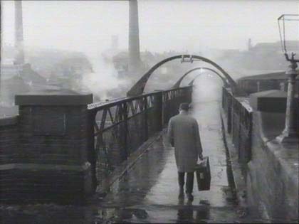
Susan Ravey suggests Mump's Bridge, which also appears in 'Little Malcolm and His Struggle Against the Eunuchs' adding "When Vic is walking to his sisters after the argument with Ingrid and her mother, it is the same bridge but the stone part of the bridge is now demolished it's the iron bridge that is still there and is still in use today. Peter Whittaker points out the two chimneys of the Greenbank Mills at the junction of Greengate Street and Glodwick Road. (RL)
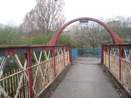
Geoff Smith, who took the pic, says that this is Mump's Bridge, and an excellent shot, wherever it is. Kevin Blomley fondly remembers; In 1962 my then girlfriend was an extra in this scene,blonde hair and pretty, 16 years old. Definitely Mumps bridge ! I used to walk her home daily from Oldham Art school across the railway bridge. Oldham church in horizon background.
- Capture 79
- 25 Oct 2012
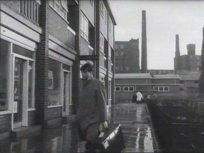
Bollington Road, Ancoats, built 1959/60. Tony Hughes.
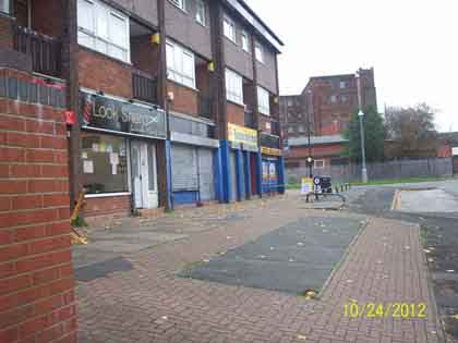
Pic by Tony Hughes.
- Capture 80
- 13 Jan 2022
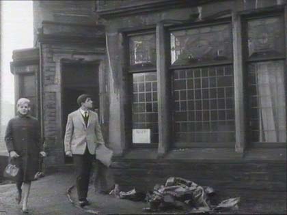
Gary Parker advises that this building stands on Ormerod Road, opposite Thompson Park, in Burnley.
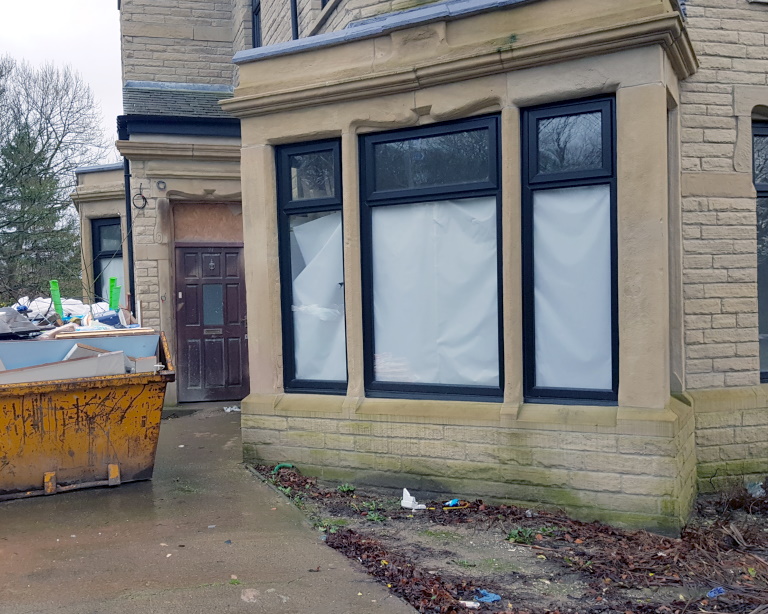
Over in Burnley, the builders are in at 97 Ormerod Road. This original from Peter Brown replaces Gary's Google image.
- Capture 81
- 17 Nov 2021
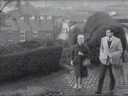
Could this be Coronation Park, Radcliffe? Geoff Turner agrees that it is adding "This is the Bowling Green in Coronation Park, Radcliffe. I lived close to these locations as a teenager and recall we used to rush home from school to watch filming. One of my mates was asked to run across the the park and was paid the princely sum of half a crown. Unfortunately, the scene ended up on the cutting room floor! The local fire brigade were called out to provide the 'rain' just outside the park."
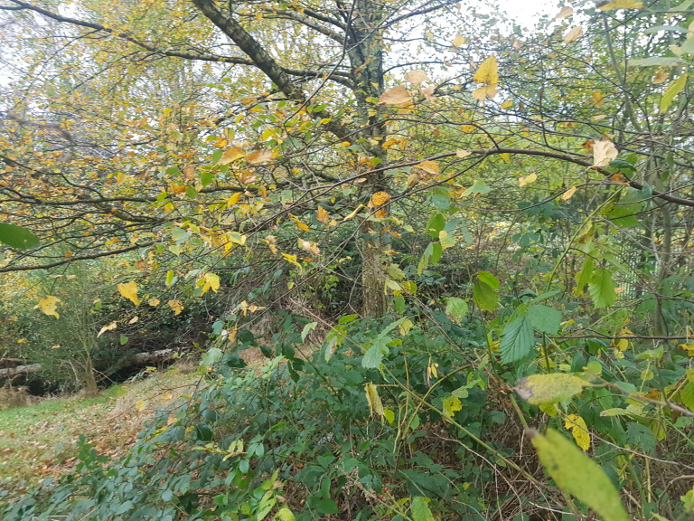
Peter Brown confirms that this is definitely Coronation Park where a transformed scene greeted him. The bowling green is still present to the right but is now secured behind fencing. The area has been allowed to become overgrown but the line of the sloping hedge from the centre of the photo to the left is just about visible. The houses on Irwell Street in the background can no longer be seen.